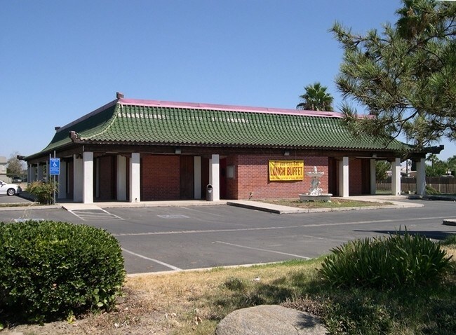
Property Record
2200 Girard St, Delano, CA 93215


NEARBY LISTINGS FOR SALE OR LEASE
Property Detail
2200 Girard St
Bakersfield, CA
Parcel Map 6102
410-070-10-00-9
PARCEL MAP 6102 , LOT 3
Servicestationmarket
Kern
X
California
06107C2300E
3
2024
1 AC
2025
North Outlying Kern County
004901
Bakersfield
4,095 SF
DEMOGRAPHICS near 2200 Girard St
1 Mile
3 Mile
5 Mile
2024 Total Population
12,942
44,041
46,744
2029 Population
12,887
43,784
46,479
Pop Growth 2024-2029
(0.42%)
(0.58%)
(0.57%)
Average Age
33
34
34
2024 Total Households
3,260
11,178
11,320
HH Growth 2024-2029
(0.46%)
(0.57%)
(0.59%)
Median Household Inc
$39,507
$47,651
$47,601
Avg Household Size
3.80
3.80
3.80
2024 Avg HH Vehicles
2.00
2.00
2.00
Median Home Value
$245,883
$259,316
$259,346
Median Year Built
1982
1986
1986
Nearby Places
Map Layers
Map Styles
 Street
 Aerial
- Restaurants
- Banks
- Shops
- Fitness
- Groceries
PUBLIC TRANSPORTATION
AIRPORT
Meadows Field
DRIVE
WALK
Distance
Meadows Field
39 min
30.1 mi
Freight Ports
The Port of Hueneme
DRIVE
WALK
Distance
The Port of Hueneme
187 min
154.8 mi
SALE & LEASE HISTORY
LISTING DATE
SALE/LEASE

Oct 07, 2019
For Sale
Jun 30, 2021
For Sale
Apr 20, 2023
For Sale
Nearby Properties
Address
Land Use
TOTAL SIZE
Lot Size
Zoning
Address
Land Use
TOTAL SIZE
Lot Size
Zoning
115,071 SF
46.83 AC
R-1
Address
Land Use
TOTAL SIZE
Lot Size
Zoning
13,558 SF
5.53 AC
GC
Address
Land Use
TOTAL SIZE
Lot Size
Zoning
233,028 SF
11.76 AC
G-C
Address
Land Use
TOTAL SIZE
Lot Size
Zoning
190,069 SF
18 AC
CRC
Address
Land Use
TOTAL SIZE
Lot Size
Zoning
89,941 SF
11.22 AC
CRC
Address
Land Use
TOTAL SIZE
Lot Size
Zoning
80,178 SF
4.65 AC
R-3
Address
Land Use
TOTAL SIZE
Lot Size
Zoning
68,994 SF
4.83 AC
R-2
Address
Land Use
TOTAL SIZE
Lot Size
Zoning
3,179 SF
5.45 AC
R-3
Address
Land Use
TOTAL SIZE
Lot Size
Zoning
68,077 SF
10 AC
GC
Address
Land Use
TOTAL SIZE
Lot Size
Zoning
67,645 SF
4.71 AC
Address
Land Use
TOTAL SIZE
Lot Size
Zoning
61,600 SF
4.49 AC
R-3
Address
Land Use
TOTAL SIZE
Lot Size
Zoning
1.77 AC
Address
Land Use
TOTAL SIZE
Lot Size
Zoning
1,800 SF
4.49 AC
C1
Address
Land Use
TOTAL SIZE
Lot Size
Zoning
1.35 AC
Address
Land Use
TOTAL SIZE
Lot Size
Zoning
18,538 SF
7.25 AC
R-1
Address
Land Use
TOTAL SIZE
Lot Size
Zoning
34,608 SF
1.59 AC
C1
Address
Land Use
TOTAL SIZE
Lot Size
Zoning
17,206 SF
2.27 AC
GC
Address
Land Use
TOTAL SIZE
Lot Size
Zoning
28,560 SF
9.51 AC
R-3
Address
Land Use
TOTAL SIZE
Lot Size
Zoning
34,064 SF
3.37 AC
GC
Address
Land Use
TOTAL SIZE
Lot Size
Zoning
84,767 SF
4.88 AC
Address
Land Use
TOTAL SIZE
Lot Size
Zoning
13,052 SF
1.77 AC
GC
Address
Land Use
TOTAL SIZE
Lot Size
Zoning
21,246 SF
0.54 AC
GC
Address
Land Use
TOTAL SIZE
Lot Size
Zoning
2.51 AC
Address
Land Use
TOTAL SIZE
Lot Size
Zoning
2.54 AC
Address
Land Use
TOTAL SIZE
Lot Size
Zoning
5.38 AC
GC
Address
Land Use
TOTAL SIZE
Lot Size
Zoning
18,167 SF
1.33 AC
GC
Address
Land Use
TOTAL SIZE
Lot Size
Zoning
2.46 AC
Address
Land Use
TOTAL SIZE
Lot Size
Zoning
1.73 AC
The World's #1 Commercial Real Estate Marketplace
Connect with us
© 2025 CoStar Group
The information above has been obtained from sources believed reliable. While we do not doubt its accuracy we have not verified it and make no guarantee, warranty or representation about it. It is your responsibility to independently confirm its accuracy and completeness. Any projections, opinions, assumptions, or estimates used are for example only and do not represent the current or future performance of the property. The value of this transaction to you depends on tax and other factors which should be evaluated by your tax, financial, and legal advisors. You and your advisors should conduct a careful, independent investigation of the property to determine to your satisfaction the suitability of the property for your needs.