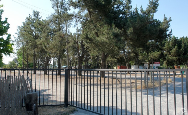
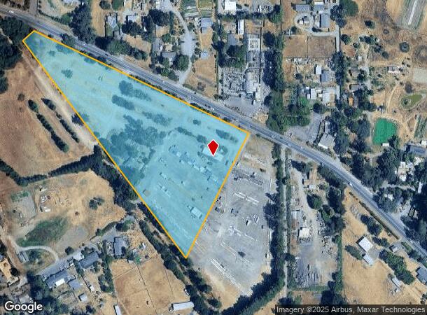
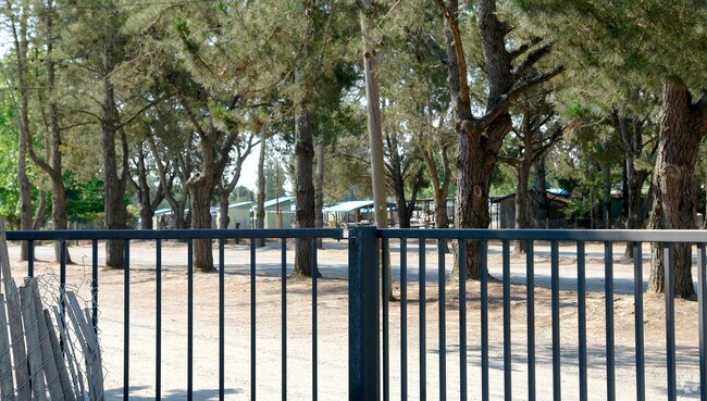
Property Record
2200 Gravenstein Hwy S, Sebastopol, CA 95472
NEARBY LISTINGS FOR SALE OR LEASE
Property Detail
2200 Gravenstein Hwy S
063-052-001
Blucher Rho
Retailwithmorethanonenonretailuse
Sonoma
X
California
06097C0718F
125
2024
9.12 AC
2025
Sebastopol/Bodega
153403
North Bay/Santa Rosa
4,312 SF
Santa Rosa, CA
DEMOGRAPHICS near 2200 Gravenstein Hwy S
1 Mile
3 Mile
5 Mile
2024 Total Population
1,616
16,238
65,573
2029 Population
1,525
15,547
63,948
Pop Growth 2024-2029
(5.63%)
(4.26%)
(2.48%)
Average Age
48
47
41
2024 Total Households
647
6,606
22,812
HH Growth 2024-2029
(5.72%)
(4.21%)
(2.66%)
Median Household Inc
$105,224
$105,802
$92,278
Avg Household Size
2.50
2.40
2.80
2024 Avg HH Vehicles
2.00
2.00
2.00
Median Home Value
$885,462
$894,766
$742,710
Median Year Built
1971
1971
1978
Nearby Places
- Restaurants
- Banks
- Shops
- Fitness
- Groceries
PUBLIC TRANSPORTATION
COMMUTER RAIL
Rohnert Park Smart (Main Line - Sonoma Marin Area Rail Transit)
DRIVE
WALK
Distance
Rohnert Park Smart (Main Line - Sonoma Marin Area Rail Transit)
13 min
8.0 mi
Santa Rosa Downtown Smart (Main Line - Sonoma Marin Area Rail Transit)
DRIVE
WALK
Distance
Santa Rosa Downtown Smart (Main Line - Sonoma Marin Area Rail Transit)
13 min
8.7 mi
AIRPORT
Charles M Schulz - Sonoma County
DRIVE
WALK
Distance
Charles M Schulz - Sonoma County
24 min
13.5 mi
Freight Ports
Port of Richmond
DRIVE
WALK
Distance
Port of Richmond
62 min
46.7 mi
Nearby Properties
Address
Land Use
TOTAL SIZE
Lot Size
Zoning
Address
Land Use
TOTAL SIZE
Lot Size
Zoning
53,766 SF
20 AC
Address
Land Use
TOTAL SIZE
Lot Size
Zoning
1,040 SF
2.32 AC
CITYSE
Address
Land Use
TOTAL SIZE
Lot Size
Zoning
17,064 SF
21.15 AC
Address
Land Use
TOTAL SIZE
Lot Size
Zoning
41,874 SF
2.46 AC
Address
Land Use
TOTAL SIZE
Lot Size
Zoning
46,649 SF
9.09 AC
AR5
Address
Land Use
TOTAL SIZE
Lot Size
Zoning
48,349 SF
0.40 AC
C3
Address
Land Use
TOTAL SIZE
Lot Size
Zoning
18,403 SF
0.68 AC
Address
Land Use
TOTAL SIZE
Lot Size
Zoning
51,837 SF
8.50 AC
Address
Land Use
TOTAL SIZE
Lot Size
Zoning
41,643 SF
1.77 AC
Address
Land Use
TOTAL SIZE
Lot Size
Zoning
20,473 SF
1.02 AC
CITYSE
Address
Land Use
TOTAL SIZE
Lot Size
Zoning
23,572 SF
1.74 AC
CITYSE
Address
Land Use
TOTAL SIZE
Lot Size
Zoning
21,096 SF
1.74 AC
CD
Address
Land Use
TOTAL SIZE
Lot Size
Zoning
57,564 SF
3.33 AC
M3
Address
Land Use
TOTAL SIZE
Lot Size
Zoning
33,150 SF
1 AC
MLPD
Address
Land Use
TOTAL SIZE
Lot Size
Zoning
43,858 SF
2.35 AC
Address
Land Use
TOTAL SIZE
Lot Size
Zoning
22,582 SF
71.18 AC
LEA100
Address
Land Use
TOTAL SIZE
Lot Size
Zoning
47.64 AC
DA20
Address
Land Use
TOTAL SIZE
Lot Size
Zoning
47,724 SF
3.33 AC
CITYSE
Address
Land Use
TOTAL SIZE
Lot Size
Zoning
2,048 SF
39 AC
DA20
Address
Land Use
TOTAL SIZE
Lot Size
Zoning
9,601 SF
9.77 AC
DA10
Address
Land Use
TOTAL SIZE
Lot Size
Zoning
24,823 SF
0.25 AC
CITYSE
Address
Land Use
TOTAL SIZE
Lot Size
Zoning
33,446 SF
0.86 AC
Address
Land Use
TOTAL SIZE
Lot Size
Zoning
20,138 SF
0.87 AC
CITYSE
Address
Land Use
TOTAL SIZE
Lot Size
Zoning
21,534 SF
1.23 AC
Address
Land Use
TOTAL SIZE
Lot Size
Zoning
16,404 SF
1.22 AC
Address
Land Use
TOTAL SIZE
Lot Size
Zoning
22,235 SF
1.04 AC
Address
Land Use
TOTAL SIZE
Lot Size
Zoning
41,261 SF
3.59 AC
CITYSE
Address
Land Use
TOTAL SIZE
Lot Size
Zoning
26,183 SF
0.34 AC
Address
Land Use
TOTAL SIZE
Lot Size
Zoning
19,200 SF
1.11 AC
CITYSE
Address
Land Use
TOTAL SIZE
Lot Size
Zoning
21,558 SF
1.14 AC
OSEB
The World's #1 Commercial Real Estate Marketplace
Connect with us
© 2025 CoStar Group
The information above has been obtained from sources believed reliable. While we do not doubt its accuracy we have not verified it and make no guarantee, warranty or representation about it. It is your responsibility to independently confirm its accuracy and completeness. Any projections, opinions, assumptions, or estimates used are for example only and do not represent the current or future performance of the property. The value of this transaction to you depends on tax and other factors which should be evaluated by your tax, financial, and legal advisors. You and your advisors should conduct a careful, independent investigation of the property to determine to your satisfaction the suitability of the property for your needs.