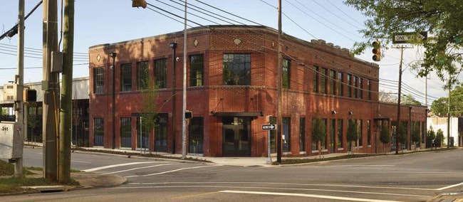
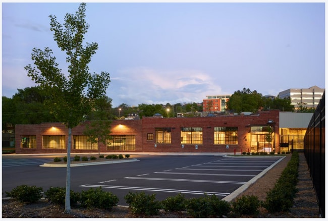
Property Record
2200 Magnolia Ave S, Birmingham, AL 35205
Current Lease Availabilities
NEARBY LISTINGS FOR SALE OR LEASE
Property Detail
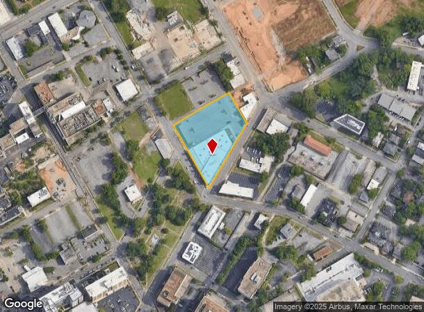
2200 Magnolia Ave S
Birmingham-Hoover, AL
Algernon Blair-Sri Llc Add To
28-00-06-2-013-003.000
LOT 1 ALGERNON BLAIR-SRI LLC ADDITION TO BIRMINGHAM PB 247 PG 73
Financialbuilding
Jefferson
X
Alabama
01073C0393G
1
2023
1.17 AC
2024
Southside
004502
Birmingham
27,934 SF
DEMOGRAPHICS near 2200 Magnolia Ave S
1 Mile
3 Mile
5 Mile
2024 Total Population
17,837
86,775
178,827
2029 Population
17,855
86,647
178,080
Pop Growth 2024-2029
+ 0.10%
(0.15%)
(0.42%)
Average Age
34
37
39
2024 Total Households
8,761
39,074
77,024
HH Growth 2024-2029
+ 0.66%
(0.04%)
(0.33%)
Median Household Inc
$47,049
$47,999
$49,699
Avg Household Size
1.50
1.90
2.10
2024 Avg HH Vehicles
1.00
1.00
2.00
Median Home Value
$369,726
$363,148
$302,733
Median Year Built
1971
1965
1966
Nearby Places
- Restaurants
- Banks
- Shops
- Fitness
- Groceries
PUBLIC TRANSPORTATION
AIRPORT
Birmingham-Shuttlesworth International
DRIVE
WALK
Distance
Birmingham-Shuttlesworth International
11 min
7.0 mi
Nearby Properties
Address
Land Use
TOTAL SIZE
Lot Size
Zoning
Address
Land Use
TOTAL SIZE
Lot Size
Zoning
296,284 SF
12 AC
OI
Address
Land Use
TOTAL SIZE
Lot Size
Zoning
305,826 SF
3.68 AC
B4
Address
Land Use
TOTAL SIZE
Lot Size
Zoning
189,447 SF
3.67 AC
B4
Address
Land Use
TOTAL SIZE
Lot Size
Zoning
224,049 SF
4.33 AC
M1
Address
Land Use
TOTAL SIZE
Lot Size
Zoning
978,879 SF
43.50 AC
I3
Address
Land Use
TOTAL SIZE
Lot Size
Zoning
239,334 SF
4.42 AC
B6
Address
Land Use
TOTAL SIZE
Lot Size
Zoning
203,878 SF
12.58 AC
B6
Address
Land Use
TOTAL SIZE
Lot Size
Zoning
230,441 SF
10.22 AC
M1
Address
Land Use
TOTAL SIZE
Lot Size
Zoning
261,311 SF
20.85 AC
C1
Address
Land Use
TOTAL SIZE
Lot Size
Zoning
183,862 SF
9.66 AC
B4
Address
Land Use
TOTAL SIZE
Lot Size
Zoning
334,463 SF
1.92 AC
B4
Address
Land Use
TOTAL SIZE
Lot Size
Zoning
94,958 SF
4.47 AC
M1
Address
Land Use
TOTAL SIZE
Lot Size
Zoning
106,144 SF
1.09 AC
B4
Address
Land Use
TOTAL SIZE
Lot Size
Zoning
57,066 SF
0.80 AC
B4
Address
Land Use
TOTAL SIZE
Lot Size
Zoning
31,980 SF
99.92 AC
I3/P
Address
Land Use
TOTAL SIZE
Lot Size
Zoning
154,474 SF
12.50 AC
R-D
Address
Land Use
TOTAL SIZE
Lot Size
Zoning
79,458 SF
1.37 AC
B4
Address
Land Use
TOTAL SIZE
Lot Size
Zoning
46,161 SF
1.38 AC
M1-B
Address
Land Use
TOTAL SIZE
Lot Size
Zoning
95,993 SF
3.67 AC
M1
Address
Land Use
TOTAL SIZE
Lot Size
Zoning
229,669 SF
2.75 AC
B4
Address
Land Use
TOTAL SIZE
Lot Size
Zoning
81,807 SF
6.30 AC
C1
Address
Land Use
TOTAL SIZE
Lot Size
Zoning
109,411 SF
2.77 AC
B4
Address
Land Use
TOTAL SIZE
Lot Size
Zoning
1.66 AC
M1-B
Address
Land Use
TOTAL SIZE
Lot Size
Zoning
1,666 SF
1.69 AC
M1
Address
Land Use
TOTAL SIZE
Lot Size
Zoning
1.54 AC
B4
Address
Land Use
TOTAL SIZE
Lot Size
Zoning
29,136 SF
1.58 AC
B4
Address
Land Use
TOTAL SIZE
Lot Size
Zoning
37,733 SF
0.84 AC
B-4
Address
Land Use
TOTAL SIZE
Lot Size
Zoning
51,699 SF
1.31 AC
PCD-
Address
Land Use
TOTAL SIZE
Lot Size
Zoning
109,819 SF
2.91 AC
M2
Address
Land Use
TOTAL SIZE
Lot Size
Zoning
37,640 SF
1.76 AC
B4
The World's #1 Commercial Real Estate Marketplace
Connect with us
© 2025 CoStar Group
The information above has been obtained from sources believed reliable. While we do not doubt its accuracy we have not verified it and make no guarantee, warranty or representation about it. It is your responsibility to independently confirm its accuracy and completeness. Any projections, opinions, assumptions, or estimates used are for example only and do not represent the current or future performance of the property. The value of this transaction to you depends on tax and other factors which should be evaluated by your tax, financial, and legal advisors. You and your advisors should conduct a careful, independent investigation of the property to determine to your satisfaction the suitability of the property for your needs.