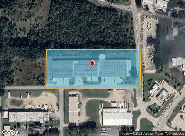
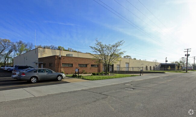
Property Record
2200 N Garvin St, Elkhart, IN 46514

NEARBY LISTINGS FOR SALE OR LEASE
Property Detail
2200 N Garvin St
20-01-36-426-002.000-006
PT NE COR SE1/4 SEC 36 7.326A
Lightindustrial
Elkhart
X
Indiana
18039C0109D
7.33 AC
2023
Outlying Elkhart County
2024
South Bend/Mishawaka
001501
Elkhart-Goshen, IN
129,921 SF
DEMOGRAPHICS near 2200 N Garvin St
1 Mile
3 Mile
5 Mile
2024 Total Population
3,598
46,383
102,813
2029 Population
3,606
46,690
102,824
Pop Growth 2024-2029
+ 0.22%
+ 0.66%
+ 0.01%
Average Age
35
37
38
2024 Total Households
1,254
17,484
38,643
HH Growth 2024-2029
+ 0.08%
+ 0.74%
+ 0.03%
Median Household Inc
$56,493
$48,738
$55,606
Avg Household Size
2.70
2.50
2.60
2024 Avg HH Vehicles
2.00
2.00
2.00
Median Home Value
$125,188
$130,394
$158,305
Median Year Built
1977
1967
1973
Nearby Places
Map Layers
Map Styles
 Street
 Aerial
- Restaurants
- Banks
- Shops
- Fitness
- Groceries
PUBLIC TRANSPORTATION
COMMUTER RAIL
DRIVE
WALK
Distance
6 min
2.9 mi
AIRPORT
South Bend International
DRIVE
WALK
Distance
South Bend International
41 min
20.1 mi
Nearby Properties
Address
Land Use
TOTAL SIZE
Lot Size
Zoning
Address
Land Use
TOTAL SIZE
Lot Size
Zoning
373,218 SF
14.58 AC
ZO01
Address
Land Use
TOTAL SIZE
Lot Size
Zoning
133,214 SF
0.30 AC
ZO01
Address
Land Use
TOTAL SIZE
Lot Size
Zoning
384,095 SF
64.77 AC
Address
Land Use
TOTAL SIZE
Lot Size
Zoning
243,442 SF
6.54 AC
ZO01
Address
Land Use
TOTAL SIZE
Lot Size
Zoning
347,814 SF
27.57 AC
ZO01
Address
Land Use
TOTAL SIZE
Lot Size
Zoning
334,473 SF
24.88 AC
ZO01
Address
Land Use
TOTAL SIZE
Lot Size
Zoning
333,124 SF
16.47 AC
ZO01
Address
Land Use
TOTAL SIZE
Lot Size
Zoning
300,000 SF
68.80 AC
ZO01
Address
Land Use
TOTAL SIZE
Lot Size
Zoning
158,688 SF
20.79 AC
ZO01
Address
Land Use
TOTAL SIZE
Lot Size
Zoning
278,692 SF
13.86 AC
ZO01
Address
Land Use
TOTAL SIZE
Lot Size
Zoning
184,212 SF
23.71 AC
ZO01
Address
Land Use
TOTAL SIZE
Lot Size
Zoning
203,685 SF
17.74 AC
ZO01
Address
Land Use
TOTAL SIZE
Lot Size
Zoning
129,147 SF
3.23 AC
Address
Land Use
TOTAL SIZE
Lot Size
Zoning
316,658 SF
27.46 AC
Address
Land Use
TOTAL SIZE
Lot Size
Zoning
78,006 SF
8.10 AC
ZO01
Address
Land Use
TOTAL SIZE
Lot Size
Zoning
196,080 SF
17.99 AC
ZO01
Address
Land Use
TOTAL SIZE
Lot Size
Zoning
53,109 SF
45.11 AC
ZO01
Address
Land Use
TOTAL SIZE
Lot Size
Zoning
203,942 SF
32.52 AC
ZO01
Address
Land Use
TOTAL SIZE
Lot Size
Zoning
81,452 SF
33.51 AC
ZO01
Address
Land Use
TOTAL SIZE
Lot Size
Zoning
47,936 SF
0.92 AC
ZO01
Address
Land Use
TOTAL SIZE
Lot Size
Zoning
139,274 SF
14.03 AC
ZO01
Address
Land Use
TOTAL SIZE
Lot Size
Zoning
144,550 SF
30.99 AC
ZO01
Address
Land Use
TOTAL SIZE
Lot Size
Zoning
144,000 SF
18.31 AC
ZO01
Address
Land Use
TOTAL SIZE
Lot Size
Zoning
65,387 SF
7.72 AC
ZO01
Address
Land Use
TOTAL SIZE
Lot Size
Zoning
155,600 SF
10.53 AC
ZO01
Address
Land Use
TOTAL SIZE
Lot Size
Zoning
129,039 SF
12.56 AC
ZO01
Address
Land Use
TOTAL SIZE
Lot Size
Zoning
142,932 SF
7.40 AC
ZO01
Address
Land Use
TOTAL SIZE
Lot Size
Zoning
153,910 SF
15.14 AC
Address
Land Use
TOTAL SIZE
Lot Size
Zoning
188,176 SF
13.90 AC
ZO01
Address
Land Use
TOTAL SIZE
Lot Size
Zoning
86,252 SF
9.13 AC
ZO01
The World's #1 Commercial Real Estate Marketplace
Connect with us
© 2025 CoStar Group
The information above has been obtained from sources believed reliable. While we do not doubt its accuracy we have not verified it and make no guarantee, warranty or representation about it. It is your responsibility to independently confirm its accuracy and completeness. Any projections, opinions, assumptions, or estimates used are for example only and do not represent the current or future performance of the property. The value of this transaction to you depends on tax and other factors which should be evaluated by your tax, financial, and legal advisors. You and your advisors should conduct a careful, independent investigation of the property to determine to your satisfaction the suitability of the property for your needs.