Property Record
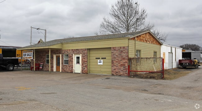
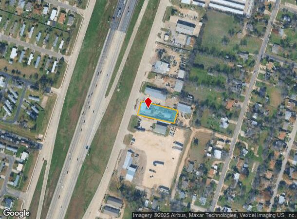
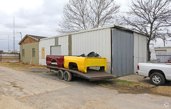
2200 S Highway Blvd, Belton, TX 76513
NEARBY LISTINGS FOR SALE OR LEASE
Property Detail
2200 S Highway Blvd
63709
M F Connell
Commercialnec
A0006BC M F CONNELL, AKA BURTON OB, ACRES .515
X
Bell
48027C0340E
Texas
2024
0.52 AC
2025
Outlying Bell County
021602
Killeen/Temple/Fort Hood
3,960 SF
Killeen-Temple, TX
DEMOGRAPHICS near 2200 S Highway Blvd
1 Mile
3 Mile
5 Mile
2024 Total Population
5,107
23,431
40,655
2029 Population
5,737
26,444
45,816
Pop Growth 2024-2029
+ 12.34%
+ 12.86%
+ 12.69%
Average Age
35
34
37
2024 Total Households
1,776
7,744
14,264
HH Growth 2024-2029
+ 12.56%
+ 13.29%
+ 13.01%
Median Household Inc
$57,142
$51,520
$68,436
Avg Household Size
2.80
2.60
2.60
2024 Avg HH Vehicles
2.00
2.00
2.00
Median Home Value
$202,417
$214,993
$246,663
Median Year Built
1992
1996
2001
Nearby Places
Map Layers
Map Styles
 Street
 Aerial
- Restaurants
- Banks
- Shops
- Fitness
- Groceries
PUBLIC TRANSPORTATION
COMMUTER RAIL
Temple (Texas Eagle - Amtrak)
DRIVE
WALK
Distance
Temple (Texas Eagle - Amtrak)
12 min
9.3 mi
AIRPORT
Killeen Municipal
DRIVE
WALK
Distance
Killeen Municipal
20 min
15.3 mi
Robert Gray AAF
DRIVE
WALK
Distance
Robert Gray AAF
39 min
29.2 mi
Freight Ports
Port of Houston
DRIVE
WALK
Distance
Port of Houston
238 min
185.9 mi
Nearby Properties
Address
Land Use
TOTAL SIZE
Lot Size
Zoning
Address
Land Use
TOTAL SIZE
Lot Size
Zoning
523,244 SF
74.89 AC
Address
Land Use
TOTAL SIZE
Lot Size
Zoning
1 SF
15.99 AC
Address
Land Use
TOTAL SIZE
Lot Size
Zoning
39.79 AC
Address
Land Use
TOTAL SIZE
Lot Size
Zoning
148,268 SF
30.02 AC
Address
Land Use
TOTAL SIZE
Lot Size
Zoning
42,313 SF
1.38 AC
Address
Land Use
TOTAL SIZE
Lot Size
Zoning
85,530 SF
101.80 AC
Address
Land Use
TOTAL SIZE
Lot Size
Zoning
205,244 SF
12.51 AC
Address
Land Use
TOTAL SIZE
Lot Size
Zoning
174,116 SF
75.93 AC
Address
Land Use
TOTAL SIZE
Lot Size
Zoning
87,881 SF
15.69 AC
Address
Land Use
TOTAL SIZE
Lot Size
Zoning
138,476 SF
8.23 AC
Address
Land Use
TOTAL SIZE
Lot Size
Zoning
118,382 SF
7.50 AC
Address
Land Use
TOTAL SIZE
Lot Size
Zoning
138,424 SF
9.87 AC
Address
Land Use
TOTAL SIZE
Lot Size
Zoning
126,176 SF
6.05 AC
Address
Land Use
TOTAL SIZE
Lot Size
Zoning
89,187 SF
10.23 AC
Address
Land Use
TOTAL SIZE
Lot Size
Zoning
115,426 SF
11.27 AC
Address
Land Use
TOTAL SIZE
Lot Size
Zoning
79,179 SF
15.38 AC
Address
Land Use
TOTAL SIZE
Lot Size
Zoning
82,750 SF
4.52 AC
Address
Land Use
TOTAL SIZE
Lot Size
Zoning
72,616 SF
4.19 AC
Address
Land Use
TOTAL SIZE
Lot Size
Zoning
180,530 SF
31.89 AC
Address
Land Use
TOTAL SIZE
Lot Size
Zoning
49,855 SF
4.80 AC
Address
Land Use
TOTAL SIZE
Lot Size
Zoning
87,768 SF
6.42 AC
Address
Land Use
TOTAL SIZE
Lot Size
Zoning
161,200 SF
47.14 AC
Address
Land Use
TOTAL SIZE
Lot Size
Zoning
85,446 SF
25.88 AC
Address
Land Use
TOTAL SIZE
Lot Size
Zoning
51,060 SF
Address
Land Use
TOTAL SIZE
Lot Size
Zoning
60,678 SF
14.84 AC
Address
Land Use
TOTAL SIZE
Lot Size
Zoning
120,610 SF
3 AC
Address
Land Use
TOTAL SIZE
Lot Size
Zoning
133,640 SF
8.37 AC
Address
Land Use
TOTAL SIZE
Lot Size
Zoning
40,089 SF
1.97 AC
Address
Land Use
TOTAL SIZE
Lot Size
Zoning
107,487 SF
0.28 AC
Address
Land Use
TOTAL SIZE
Lot Size
Zoning
39,880 SF
19.78 AC
The World's #1 Commercial Real Estate Marketplace
Connect with us
© 2025 CoStar Group
The information above has been obtained from sources believed reliable. While we do not doubt its accuracy we have not verified it and make no guarantee, warranty or representation about it. It is your responsibility to independently confirm its accuracy and completeness. Any projections, opinions, assumptions, or estimates used are for example only and do not represent the current or future performance of the property. The value of this transaction to you depends on tax and other factors which should be evaluated by your tax, financial, and legal advisors. You and your advisors should conduct a careful, independent investigation of the property to determine to your satisfaction the suitability of the property for your needs.