Property Record
2200 S Watney Way, Fairfield, CA 94533


NEARBY LISTINGS FOR SALE OR LEASE
Property Detail
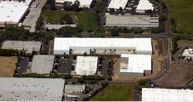
2200 S Watney Way
0028-781-030
BK-BG 00-00
Warehouse
Solano
AO
California
06095C0452F
7.91 AC
2024
Fairfield
2025
North Bay/Santa Rosa
252402
Vallejo-Fairfield, CA
142,232 SF
DEMOGRAPHICS near 2200 S Watney Way
1 Mile
3 Mile
5 Mile
2024 Total Population
2,961
46,512
122,540
2029 Population
2,907
45,955
120,886
Pop Growth 2024-2029
(1.82%)
(1.20%)
(1.35%)
Average Age
39
38
39
2024 Total Households
893
15,423
40,629
HH Growth 2024-2029
(1.79%)
(1.20%)
(1.40%)
Median Household Inc
$88,490
$74,503
$89,012
Avg Household Size
3.10
2.90
2.90
2024 Avg HH Vehicles
3.00
2.00
2.00
Median Home Value
$444,974
$465,850
$507,694
Median Year Built
1982
1975
1981
Nearby Places
Map Layers
Map Styles
 Street
 Aerial
- Restaurants
- Banks
- Shops
- Fitness
- Groceries
PUBLIC TRANSPORTATION
COMMUTER RAIL
Suisun-Fairfield (Capitol Corridor - Capitol Corridor Joint Powers Authority)
DRIVE
WALK
Distance
Suisun-Fairfield (Capitol Corridor - Capitol Corridor Joint Powers Authority)
5 min
2.4 mi
Fairfield-Vacaville (Capitol Corridor - Amtrak)
DRIVE
WALK
Distance
Fairfield-Vacaville (Capitol Corridor - Amtrak)
15 min
8.8 mi
Freight Ports
Port of Richmond
DRIVE
WALK
Distance
Port of Richmond
47 min
34.6 mi
Nearby Properties
Address
Land Use
TOTAL SIZE
Lot Size
Zoning
Address
Land Use
TOTAL SIZE
Lot Size
Zoning
75.45 AC
Address
Land Use
TOTAL SIZE
Lot Size
Zoning
Address
Land Use
TOTAL SIZE
Lot Size
Zoning
317,493 SF
21.54 AC
Address
Land Use
TOTAL SIZE
Lot Size
Zoning
9,945 SF
51.21 AC
Address
Land Use
TOTAL SIZE
Lot Size
Zoning
Address
Land Use
TOTAL SIZE
Lot Size
Zoning
527,279 SF
33.29 AC
Address
Land Use
TOTAL SIZE
Lot Size
Zoning
22.49 AC
Address
Land Use
TOTAL SIZE
Lot Size
Zoning
430,500 SF
20.85 AC
Address
Land Use
TOTAL SIZE
Lot Size
Zoning
430,500 SF
15.70 AC
Address
Land Use
TOTAL SIZE
Lot Size
Zoning
290,560 SF
12.73 AC
Address
Land Use
TOTAL SIZE
Lot Size
Zoning
473,135 SF
24.25 AC
Address
Land Use
TOTAL SIZE
Lot Size
Zoning
69,580 SF
12.67 AC
Address
Land Use
TOTAL SIZE
Lot Size
Zoning
219,672 SF
10 AC
IND
Address
Land Use
TOTAL SIZE
Lot Size
Zoning
76,195 SF
8.43 AC
Address
Land Use
TOTAL SIZE
Lot Size
Zoning
74,406 SF
3.21 AC
Address
Land Use
TOTAL SIZE
Lot Size
Zoning
102,528 SF
4.87 AC
Address
Land Use
TOTAL SIZE
Lot Size
Zoning
318,402 SF
18.73 AC
Address
Land Use
TOTAL SIZE
Lot Size
Zoning
53,960 SF
8.22 AC
Address
Land Use
TOTAL SIZE
Lot Size
Zoning
191,132 SF
9.01 AC
Address
Land Use
TOTAL SIZE
Lot Size
Zoning
59,427 SF
2.90 AC
Address
Land Use
TOTAL SIZE
Lot Size
Zoning
3.41 AC
Address
Land Use
TOTAL SIZE
Lot Size
Zoning
95,800 SF
8.95 AC
Address
Land Use
TOTAL SIZE
Lot Size
Zoning
348,271 SF
16.05 AC
Address
Land Use
TOTAL SIZE
Lot Size
Zoning
129,624 SF
9.80 AC
Address
Land Use
TOTAL SIZE
Lot Size
Zoning
39,170 SF
4.33 AC
LT IND/COM
Address
Land Use
TOTAL SIZE
Lot Size
Zoning
167,051 SF
11.97 AC
Address
Land Use
TOTAL SIZE
Lot Size
Zoning
64,863 SF
2.08 AC
COMML/MOT
Address
Land Use
TOTAL SIZE
Lot Size
Zoning
201,973 SF
11.83 AC
LT IND
Address
Land Use
TOTAL SIZE
Lot Size
Zoning
159,990 SF
11.93 AC
Address
Land Use
TOTAL SIZE
Lot Size
Zoning
0.66 AC
The World's #1 Commercial Real Estate Marketplace
Connect with us
© 2026 CoStar Group
The information above has been obtained from sources believed reliable. While we do not doubt its accuracy we have not verified it and make no guarantee, warranty or representation about it. It is your responsibility to independently confirm its accuracy and completeness. Any projections, opinions, assumptions, or estimates used are for example only and do not represent the current or future performance of the property. The value of this transaction to you depends on tax and other factors which should be evaluated by your tax, financial, and legal advisors. You and your advisors should conduct a careful, independent investigation of the property to determine to your satisfaction the suitability of the property for your needs.