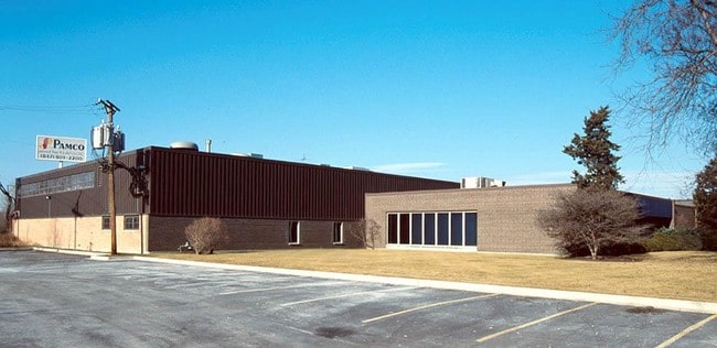
Property Record
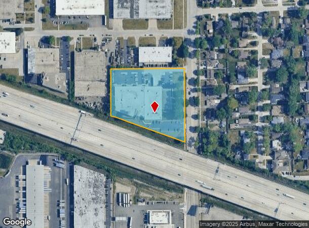
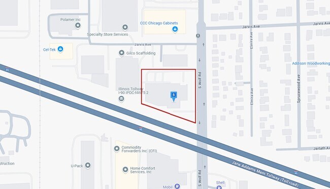
2200 S Wolf Rd, Des Plaines, IL 60018
NEARBY LISTINGS FOR SALE OR LEASE
Property Detail
2200 S Wolf Rd
Chicago-Naperville-Elgin, IL-IN-WI
Andersons Wolf Toll
09-30-400-024-0000
J EMIL(ANDERSONS)(WOLF)(TOLL) ROAD SUB PT OF WH SE SEC 30-41-12
Industrialgeneral
Cook
X
Illinois
17031C0218J
1,2
2023
3.39 AC
2024
O'Hare
770602
Chicago
54,925 SF
DEMOGRAPHICS near 2200 S Wolf Rd
1 Mile
3 Mile
5 Mile
2024 Total Population
4,945
77,675
282,195
2029 Population
4,860
75,327
274,071
Pop Growth 2024-2029
(1.72%)
(3.02%)
(2.88%)
Average Age
41
42
42
2024 Total Households
1,640
30,245
107,915
HH Growth 2024-2029
(1.95%)
(3.26%)
(3.17%)
Median Household Inc
$73,644
$73,556
$79,937
Avg Household Size
2.90
2.50
2.50
2024 Avg HH Vehicles
2.00
2.00
2.00
Median Home Value
$283,333
$288,227
$323,728
Median Year Built
1971
1969
1967
Nearby Places
Map Layers
Map Styles
 Street
 Aerial
- Restaurants
- Banks
- Shops
- Fitness
- Groceries
PUBLIC TRANSPORTATION
COMMUTER RAIL
O'hare Transfer Station (North Central Service - Northeast Illinois Regional Commuter Railroad (Metra))
DRIVE
WALK
Distance
O'hare Transfer Station (North Central Service - Northeast Illinois Regional Commuter Railroad (Metra))
5 min
2.5 mi
Des Plaines Station (Union Pacific Northwest Line - Northeast Illinois Regional Commuter Railroad (Metra))
DRIVE
WALK
Distance
Des Plaines Station (Union Pacific Northwest Line - Northeast Illinois Regional Commuter Railroad (Metra))
6 min
3.4 mi
AIRPORT
Chicago O'Hare International
DRIVE
WALK
Distance
Chicago O'Hare International
9 min
5.0 mi
Chicago Midway International
DRIVE
WALK
Distance
Chicago Midway International
39 min
23.7 mi
Freight Ports
Port Milwaukee
DRIVE
WALK
Distance
Port Milwaukee
92 min
75.6 mi
Nearby Properties
Address
Land Use
TOTAL SIZE
Lot Size
Zoning
Address
Land Use
TOTAL SIZE
Lot Size
Zoning
108,216 SF
7.87 AC
Address
Land Use
TOTAL SIZE
Lot Size
Zoning
1,127,595 SF
Address
Land Use
TOTAL SIZE
Lot Size
Zoning
Address
Land Use
TOTAL SIZE
Lot Size
Zoning
310,751 SF
15.04 AC
Address
Land Use
TOTAL SIZE
Lot Size
Zoning
179,780 SF
8.12 AC
I
Address
Land Use
TOTAL SIZE
Lot Size
Zoning
380,895 SF
5.36 AC
Address
Land Use
TOTAL SIZE
Lot Size
Zoning
Address
Land Use
TOTAL SIZE
Lot Size
Zoning
Address
Land Use
TOTAL SIZE
Lot Size
Zoning
410,822 SF
14.26 AC
Address
Land Use
TOTAL SIZE
Lot Size
Zoning
208,000 SF
10.35 AC
Address
Land Use
TOTAL SIZE
Lot Size
Zoning
132,699 SF
6.74 AC
Address
Land Use
TOTAL SIZE
Lot Size
Zoning
413,338 SF
23.92 AC
Address
Land Use
TOTAL SIZE
Lot Size
Zoning
688,900 SF
20.91 AC
Address
Land Use
TOTAL SIZE
Lot Size
Zoning
Address
Land Use
TOTAL SIZE
Lot Size
Zoning
533,629 SF
24.19 AC
Address
Land Use
TOTAL SIZE
Lot Size
Zoning
508,246 SF
32.81 AC
Address
Land Use
TOTAL SIZE
Lot Size
Zoning
1.23 AC
Address
Land Use
TOTAL SIZE
Lot Size
Zoning
270,512 SF
2.26 AC
Address
Land Use
TOTAL SIZE
Lot Size
Zoning
160,000 SF
2.14 AC
Address
Land Use
TOTAL SIZE
Lot Size
Zoning
378,525 SF
0.11 AC
Address
Land Use
TOTAL SIZE
Lot Size
Zoning
298,747 SF
5.11 AC
Address
Land Use
TOTAL SIZE
Lot Size
Zoning
206,400 SF
9.73 AC
I
Address
Land Use
TOTAL SIZE
Lot Size
Zoning
667,821 SF
20.55 AC
Address
Land Use
TOTAL SIZE
Lot Size
Zoning
53,760 SF
5.36 AC
Address
Land Use
TOTAL SIZE
Lot Size
Zoning
214,652 SF
7.62 AC
I
Address
Land Use
TOTAL SIZE
Lot Size
Zoning
279,103 SF
7.09 AC
Address
Land Use
TOTAL SIZE
Lot Size
Zoning
207,560 SF
4.42 AC
Address
Land Use
TOTAL SIZE
Lot Size
Zoning
6.28 AC
Address
Land Use
TOTAL SIZE
Lot Size
Zoning
845,318 SF
7.09 AC
Address
Land Use
TOTAL SIZE
Lot Size
Zoning
134,590 SF
9.92 AC
I
The World's #1 Commercial Real Estate Marketplace
Connect with us
© 2025 CoStar Group
The information above has been obtained from sources believed reliable. While we do not doubt its accuracy we have not verified it and make no guarantee, warranty or representation about it. It is your responsibility to independently confirm its accuracy and completeness. Any projections, opinions, assumptions, or estimates used are for example only and do not represent the current or future performance of the property. The value of this transaction to you depends on tax and other factors which should be evaluated by your tax, financial, and legal advisors. You and your advisors should conduct a careful, independent investigation of the property to determine to your satisfaction the suitability of the property for your needs.