Property Record
2200 Shell Rd, Georgetown, TX 78628

Property Detail
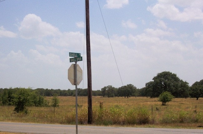
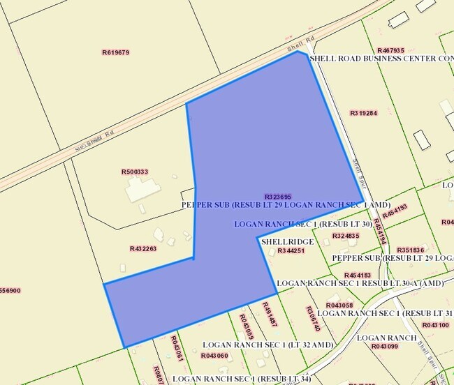
2200 Shell Rd
Austin-Round Rock-San Marcos, TX
AW0524 AW0524 - ROBERTS, WM. SUR., ACRES 36.19
R323695
WILLIAMSON
Agriculturalland
Texas
B and X Area of moderate flood hazard, usually the area between the limits of the 100-year and 500-year floods.
36.19 AC
2024
Georgetown
2025
Austin
020115
NEARBY LISTINGS FOR SALE OR LEASE
DEMOGRAPHICS near 2200 Shell Rd
1 mile
3 mile
5 mile
2024 Total Population
3,072
35,229
68,676
2029 Population
3,471
40,045
79,093
Pop Growth 2024-2029
+ 12.99%
+ 13.67%
+ 15.17%
Average Age
52
54
50
2024 Total Households
1,265
16,410
30,323
HH Growth 2024-2029
+ 13.36%
+ 14.03%
+ 15.57%
Median Household Inc
$138,288
$102,221
$99,863
Avg Household Size
2.40
2.10
2.20
2024 Avg HH Vehicles
2.00
2.00
2.00
Median Home Value
$595,930
$476,473
$481,311
Median Year Built
1999
2005
2007
Nearby Places
Map Layers
Map Styles
 Street
 Aerial
Transit
 Traffic
 Biking
Places
Listings with unknown addresses are not visible on the map
- Restaurants
- Banks
- Shops
- Fitness
- Groceries
PUBLIC TRANSPORTATION
AIRPORT
Killeen Municipal
Drive
Walk
Distance
Killeen Municipal
49 min
36.6 mi
Robert Gray AAF
Drive
Walk
Distance
Robert Gray AAF
53 min
37.4 mi
Freight Ports
Calhoun Port
Drive
Walk
Distance
Calhoun Port
219 min
191.4 mi
Nearby Properties
Address
Land Use
TOTAL SIZE
Lot Size
Zoning
Address
Land Use
TOTAL SIZE
Lot Size
Zoning
389,888 SF
30 AC
1-MF
Address
Land Use
TOTAL SIZE
Lot Size
Zoning
200,200 SF
34.02 AC
Address
Land Use
TOTAL SIZE
Lot Size
Zoning
310,849 SF
13.15 AC
Address
Land Use
TOTAL SIZE
Lot Size
Zoning
326,646 SF
19.33 AC
Address
Land Use
TOTAL SIZE
Lot Size
Zoning
425,144 SF
32.97 AC
Address
Land Use
TOTAL SIZE
Lot Size
Zoning
439,044 SF
32.68 AC
Address
Land Use
TOTAL SIZE
Lot Size
Zoning
233,173 SF
9.89 AC
Address
Land Use
TOTAL SIZE
Lot Size
Zoning
495,945 SF
56.14 AC
Address
Land Use
TOTAL SIZE
Lot Size
Zoning
520,121 SF
56.73 AC
Address
Land Use
TOTAL SIZE
Lot Size
Zoning
120,653 SF
12.83 AC
Address
Land Use
TOTAL SIZE
Lot Size
Zoning
193,985 SF
38.17 AC
Address
Land Use
TOTAL SIZE
Lot Size
Zoning
298,302 SF
20.96 AC
Address
Land Use
TOTAL SIZE
Lot Size
Zoning
241,857 SF
26.60 AC
Address
Land Use
TOTAL SIZE
Lot Size
Zoning
200,746 SF
17.52 AC
Address
Land Use
TOTAL SIZE
Lot Size
Zoning
592 SF
42.32 AC
Address
Land Use
TOTAL SIZE
Lot Size
Zoning
154,603 SF
20.04 AC
Address
Land Use
TOTAL SIZE
Lot Size
Zoning
172,657 SF
8.84 AC
Address
Land Use
TOTAL SIZE
Lot Size
Zoning
174,955 SF
9.28 AC
Address
Land Use
TOTAL SIZE
Lot Size
Zoning
162,236 SF
8.99 AC
Address
Land Use
TOTAL SIZE
Lot Size
Zoning
90,821 SF
41.97 AC
Address
Land Use
TOTAL SIZE
Lot Size
Zoning
176,065 SF
19.48 AC
Address
Land Use
TOTAL SIZE
Lot Size
Zoning
160,042 SF
10.15 AC
Address
Land Use
TOTAL SIZE
Lot Size
Zoning
184,242 SF
11 AC
Address
Land Use
TOTAL SIZE
Lot Size
Zoning
129,281 SF
17.68 AC
Address
Land Use
TOTAL SIZE
Lot Size
Zoning
123,984 SF
6.89 AC
Address
Land Use
TOTAL SIZE
Lot Size
Zoning
50,543 SF
10.49 AC
Address
Land Use
TOTAL SIZE
Lot Size
Zoning
209,508 SF
13.25 AC
Address
Land Use
TOTAL SIZE
Lot Size
Zoning
188,408 SF
9.62 AC
Address
Land Use
TOTAL SIZE
Lot Size
Zoning
192.21 AC
Address
Land Use
TOTAL SIZE
Lot Size
Zoning
219,839 SF
24.74 AC
The World's #1 Commercial Real Estate Marketplace
Connect with us
© 2026 CoStar Group
The information above has been obtained from sources believed reliable. While we do not doubt its accuracy we have not verified it and make no guarantee, warranty or representation about it. It is your responsibility to independently confirm its accuracy and completeness. Any projections, opinions, assumptions, or estimates used are for example only and do not represent the current or future performance of the property. The value of this transaction to you depends on tax and other factors which should be evaluated by your tax, financial, and legal advisors. You and your advisors should conduct a careful, independent investigation of the property to determine to your satisfaction the suitability of the property for your needs.