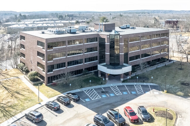
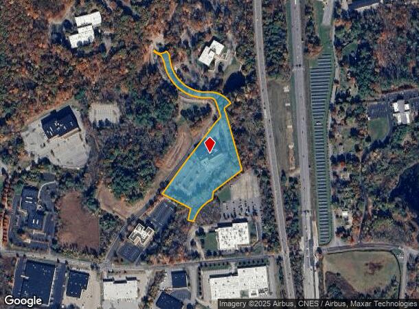
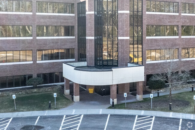
Property Record
2200 W Park Dr, Westborough, MA 01581

Current Lease Availabilities
NEARBY LISTINGS FOR SALE OR LEASE
Property Detail
2200 W Park Dr
Officebuilding
Worcester
X
Massachusetts
25027C0664F
7.34 AC
2025
The Boroughs
2025
Boston
761200
Worcester, MA-CT
74,992 SF
WBOR-000030-000003
DEMOGRAPHICS near 2200 W Park Dr
1 Mile
3 Mile
5 Mile
2024 Total Population
148
21,741
79,232
2029 Population
147
21,682
78,917
Pop Growth 2024-2029
(0.68%)
(0.27%)
(0.40%)
Average Age
38
40
40
2024 Total Households
60
8,059
29,354
HH Growth 2024-2029
(1.67%)
(0.25%)
(0.44%)
Median Household Inc
$73,124
$125,738
$129,878
Avg Household Size
2.30
2.60
2.60
2024 Avg HH Vehicles
2.00
2.00
2.00
Median Home Value
$666,666
$628,069
$615,390
Median Year Built
1985
1978
1979
Nearby Places
Map Layers
Map Styles
 Street
 Aerial
- Restaurants
- Banks
- Shops
- Fitness
- Groceries
PUBLIC TRANSPORTATION
COMMUTER RAIL
Southborough (Framingham/Worcester Line - Massachusetts Bay Transportation Authority Commuter Rail (Purple Line))
DRIVE
WALK
Distance
Southborough (Framingham/Worcester Line - Massachusetts Bay Transportation Authority Commuter Rail (Purple Line))
13 min
6.0 mi
Westborough (Framingham/Worcester Line - Massachusetts Bay Transportation Authority Commuter Rail (Purple Line))
DRIVE
WALK
Distance
Westborough (Framingham/Worcester Line - Massachusetts Bay Transportation Authority Commuter Rail (Purple Line))
15 min
6.7 mi
AIRPORT
General Edward Lawrence Logan International
DRIVE
WALK
Distance
General Edward Lawrence Logan International
45 min
34.1 mi
Nearby Properties
Address
Land Use
TOTAL SIZE
Lot Size
Zoning
Address
Land Use
TOTAL SIZE
Lot Size
Zoning
274,000 SF
32 AC
M-1
Address
Land Use
TOTAL SIZE
Lot Size
Zoning
367,779 SF
59.22 AC
IB
Address
Land Use
TOTAL SIZE
Lot Size
Zoning
263,979 SF
0.12 AC
EROD
Address
Land Use
TOTAL SIZE
Lot Size
Zoning
7,383 SF
80.70 AC
RA
Address
Land Use
TOTAL SIZE
Lot Size
Zoning
237,337 SF
16.65 AC
IB
Address
Land Use
TOTAL SIZE
Lot Size
Zoning
8,160 SF
11 AC
RA
Address
Land Use
TOTAL SIZE
Lot Size
Zoning
19.07 AC
IP
Address
Land Use
TOTAL SIZE
Lot Size
Zoning
320,540 SF
20.02 AC
BA
Address
Land Use
TOTAL SIZE
Lot Size
Zoning
578,873 SF
94.26 AC
IB
Address
Land Use
TOTAL SIZE
Lot Size
Zoning
347,607 SF
51.50 AC
IP
Address
Land Use
TOTAL SIZE
Lot Size
Zoning
15.20 AC
BA
Address
Land Use
TOTAL SIZE
Lot Size
Zoning
677,238 SF
92.81 AC
IB
Address
Land Use
TOTAL SIZE
Lot Size
Zoning
204,205 SF
14.59 AC
IP
Address
Land Use
TOTAL SIZE
Lot Size
Zoning
1,976 SF
81.69 AC
RA
Address
Land Use
TOTAL SIZE
Lot Size
Zoning
386,463 SF
23.80 AC
I
Address
Land Use
TOTAL SIZE
Lot Size
Zoning
32.51 AC
IB
Address
Land Use
TOTAL SIZE
Lot Size
Zoning
281,079 SF
11.81 AC
Address
Land Use
TOTAL SIZE
Lot Size
Zoning
296,330 SF
24.88 AC
IB
Address
Land Use
TOTAL SIZE
Lot Size
Zoning
82,554 SF
11.15 AC
RB
Address
Land Use
TOTAL SIZE
Lot Size
Zoning
67,760 SF
11.65 AC
RB
Address
Land Use
TOTAL SIZE
Lot Size
Zoning
6,420 SF
28 AC
IP
Address
Land Use
TOTAL SIZE
Lot Size
Zoning
27,836 SF
4.22 AC
RB
Address
Land Use
TOTAL SIZE
Lot Size
Zoning
216,518 SF
6.64 AC
R
Address
Land Use
TOTAL SIZE
Lot Size
Zoning
97,171 SF
27.77 AC
M-1
Address
Land Use
TOTAL SIZE
Lot Size
Zoning
7,387 SF
109.70 AC
M-1
Address
Land Use
TOTAL SIZE
Lot Size
Zoning
50.07 AC
BB
Address
Land Use
TOTAL SIZE
Lot Size
Zoning
173,107 SF
17.10 AC
I
Address
Land Use
TOTAL SIZE
Lot Size
Zoning
112,981 SF
10.50 AC
R
Address
Land Use
TOTAL SIZE
Lot Size
Zoning
160,993 SF
14.28 AC
IP
Address
Land Use
TOTAL SIZE
Lot Size
Zoning
11.83 AC
MUD
The World's #1 Commercial Real Estate Marketplace
Connect with us
© 2025 CoStar Group
The information above has been obtained from sources believed reliable. While we do not doubt its accuracy we have not verified it and make no guarantee, warranty or representation about it. It is your responsibility to independently confirm its accuracy and completeness. Any projections, opinions, assumptions, or estimates used are for example only and do not represent the current or future performance of the property. The value of this transaction to you depends on tax and other factors which should be evaluated by your tax, financial, and legal advisors. You and your advisors should conduct a careful, independent investigation of the property to determine to your satisfaction the suitability of the property for your needs.