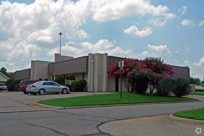
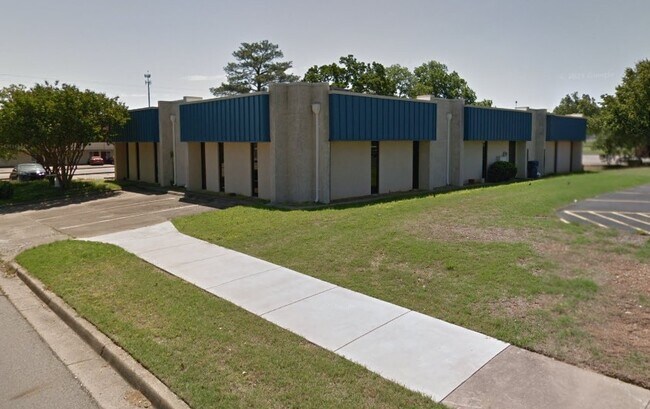
Property Record
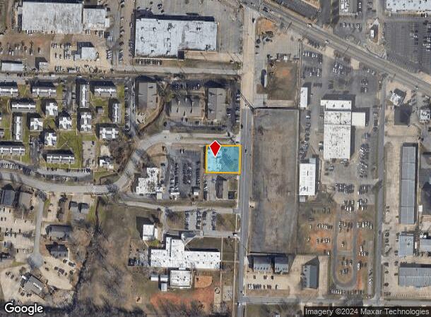
2200 S Waldron Rd, Fort Smith, AR 72903
NEARBY LISTINGS FOR SALE OR LEASE
Property Detail
2200 S Waldron Rd
Fort Smith, AR-OK
23-08-32
18883-0000-01104-00
PART NW SE 124.20 X 155
Officebuilding
Sebastian
X
Arkansas
05131C0130F
4
2025
0.44 AC
2025
Greater Ft Smith
001101
Fort Smith
5,976 SF
DEMOGRAPHICS near 2200 S Waldron Rd
1 Mile
3 Mile
5 Mile
2024 Total Population
5,978
52,067
92,270
2029 Population
6,069
53,152
94,388
Pop Growth 2024-2029
+ 1.52%
+ 2.08%
+ 2.30%
Average Age
41
40
39
2024 Total Households
2,763
22,030
37,572
HH Growth 2024-2029
+ 1.56%
+ 2.07%
+ 2.29%
Median Household Inc
$57,981
$44,979
$44,031
Avg Household Size
2.10
2.20
2.30
2024 Avg HH Vehicles
2.00
2.00
2.00
Median Home Value
$190,039
$152,738
$141,364
Median Year Built
1976
1972
1975
Nearby Places
Map Layers
Map Styles
 Street
 Aerial
- Restaurants
- Banks
- Shops
- Fitness
- Groceries
PUBLIC TRANSPORTATION
AIRPORT
Fort Smith Regional
DRIVE
WALK
Distance
Fort Smith Regional
9 min
2.5 mi
SALE & LEASE HISTORY
LISTING DATE
SALE/LEASE

Nov 16, 2021
For Lease
Nearby Properties
Address
Land Use
TOTAL SIZE
Lot Size
Zoning
Address
Land Use
TOTAL SIZE
Lot Size
Zoning
34,852 SF
17.68 AC
Address
Land Use
TOTAL SIZE
Lot Size
Zoning
276,870 SF
36.85 AC
Address
Land Use
TOTAL SIZE
Lot Size
Zoning
138,906 SF
9.52 AC
Address
Land Use
TOTAL SIZE
Lot Size
Zoning
97,396 SF
Address
Land Use
TOTAL SIZE
Lot Size
Zoning
847,154 SF
66.34 AC
Address
Land Use
TOTAL SIZE
Lot Size
Zoning
154,417 SF
8.08 AC
Address
Land Use
TOTAL SIZE
Lot Size
Zoning
21,556 SF
47 AC
Address
Land Use
TOTAL SIZE
Lot Size
Zoning
198,302 SF
42.39 AC
Address
Land Use
TOTAL SIZE
Lot Size
Zoning
3,675 SF
21.98 AC
Address
Land Use
TOTAL SIZE
Lot Size
Zoning
8,323 SF
20.41 AC
Address
Land Use
TOTAL SIZE
Lot Size
Zoning
202,092 SF
16.25 AC
Address
Land Use
TOTAL SIZE
Lot Size
Zoning
67,084 SF
0.62 AC
Address
Land Use
TOTAL SIZE
Lot Size
Zoning
237,553 SF
15.38 AC
Address
Land Use
TOTAL SIZE
Lot Size
Zoning
59,096 SF
21.97 AC
Address
Land Use
TOTAL SIZE
Lot Size
Zoning
76,575 SF
3 AC
Address
Land Use
TOTAL SIZE
Lot Size
Zoning
936,618 SF
53.06 AC
Address
Land Use
TOTAL SIZE
Lot Size
Zoning
125,968 SF
9.46 AC
Address
Land Use
TOTAL SIZE
Lot Size
Zoning
90,380 SF
9.29 AC
Address
Land Use
TOTAL SIZE
Lot Size
Zoning
108,519 SF
13.38 AC
Address
Land Use
TOTAL SIZE
Lot Size
Zoning
72,895 SF
2.34 AC
Address
Land Use
TOTAL SIZE
Lot Size
Zoning
54,697 SF
7.87 AC
Address
Land Use
TOTAL SIZE
Lot Size
Zoning
165,245 SF
15.39 AC
Address
Land Use
TOTAL SIZE
Lot Size
Zoning
9,161 SF
13.45 AC
Address
Land Use
TOTAL SIZE
Lot Size
Zoning
18,492 SF
2.03 AC
Address
Land Use
TOTAL SIZE
Lot Size
Zoning
29,522 SF
25 AC
Address
Land Use
TOTAL SIZE
Lot Size
Zoning
85,735 SF
2.28 AC
Address
Land Use
TOTAL SIZE
Lot Size
Zoning
128,006 SF
13.02 AC
Address
Land Use
TOTAL SIZE
Lot Size
Zoning
6,643 SF
0.96 AC
Address
Land Use
TOTAL SIZE
Lot Size
Zoning
100,126 SF
4.70 AC
Address
Land Use
TOTAL SIZE
Lot Size
Zoning
119,666 SF
6.90 AC
The World's #1 Commercial Real Estate Marketplace
Connect with us
© 2025 CoStar Group
The information above has been obtained from sources believed reliable. While we do not doubt its accuracy we have not verified it and make no guarantee, warranty or representation about it. It is your responsibility to independently confirm its accuracy and completeness. Any projections, opinions, assumptions, or estimates used are for example only and do not represent the current or future performance of the property. The value of this transaction to you depends on tax and other factors which should be evaluated by your tax, financial, and legal advisors. You and your advisors should conduct a careful, independent investigation of the property to determine to your satisfaction the suitability of the property for your needs.