Property Record
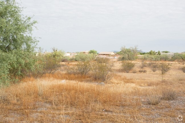
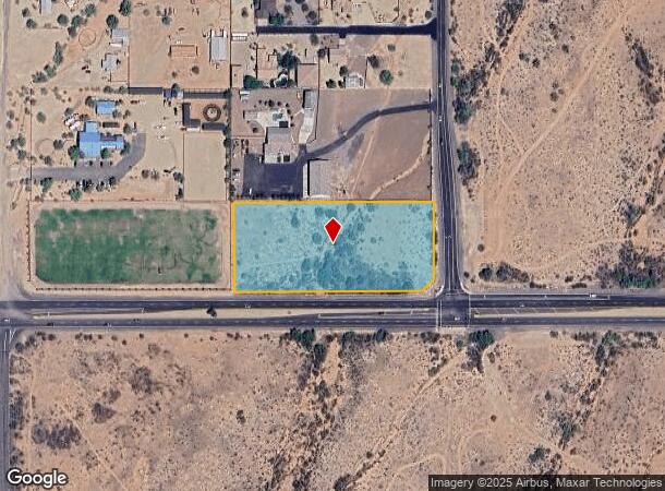
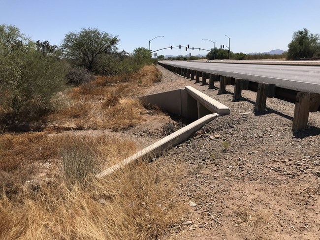
22001 N Scottsdale Rd, Phoenix, AZ 85086

NEARBY LISTINGS FOR SALE OR LEASE
-
-
View all Phoenix listings for sale on LoopNet.com
Property Detail
22001 N Scottsdale Rd
Phoenix-Mesa-Scottsdale, AZ
Scottsdale Ridge #2
211-52-072
S2 SE4 SE4 SE4 SEC 4 EX S 65F RD & EX E 60F RD & EX TRI IN SE COR FOR RD RD P/F 97-0204393
Residentialacreage
Maricopa
AE
Arizona
04013C0866M
3.64 AC
2025
N Phoenix/Cave Creek
2025
Phoenix
610500
DEMOGRAPHICS near 22001 N Scottsdale Rd
1 Mile
3 Mile
5 Mile
2024 Total Population
1,021
8,063
51,200
2029 Population
1,107
8,774
55,541
Pop Growth 2024-2029
+ 8.42%
+ 8.82%
+ 8.48%
Average Age
46
45
42
2024 Total Households
383
3,063
19,399
HH Growth 2024-2029
+ 8.36%
+ 8.98%
+ 8.49%
Median Household Inc
$130,000
$127,399
$119,825
Avg Household Size
2.70
2.60
2.60
2024 Avg HH Vehicles
3.00
3.00
2.00
Median Home Value
$577,114
$539,993
$489,981
Median Year Built
1998
2001
2004
Nearby Places
Map Layers
Map Styles
 Street
 Aerial
- Restaurants
- Banks
- Shops
- Fitness
- Groceries
PUBLIC TRANSPORTATION
AIRPORT
Phoenix Sky Harbor International
DRIVE
WALK
Distance
Phoenix Sky Harbor International
51 min
36.8 mi
Freight Ports
Port of San Diego
DRIVE
WALK
Distance
Port of San Diego
422 min
375.3 mi
SALE & LEASE HISTORY
LISTING DATE
SALE/LEASE

Aug 19, 2019
For Sale
Nearby Properties
Address
Land Use
TOTAL SIZE
Lot Size
Zoning
Address
Land Use
TOTAL SIZE
Lot Size
Zoning
113,123 SF
62.17 AC
R-43
Address
Land Use
TOTAL SIZE
Lot Size
Zoning
67,261 SF
22.86 AC
RU43
Address
Land Use
TOTAL SIZE
Lot Size
Zoning
254 SF
527.88 AC
R-35
Address
Land Use
TOTAL SIZE
Lot Size
Zoning
69,514 SF
5.82 AC
C-C
Address
Land Use
TOTAL SIZE
Lot Size
Zoning
1,010.34 AC
R-35
Address
Land Use
TOTAL SIZE
Lot Size
Zoning
132,593 SF
6.69 AC
Address
Land Use
TOTAL SIZE
Lot Size
Zoning
315.05 AC
R-43
Address
Land Use
TOTAL SIZE
Lot Size
Zoning
38,585 SF
6.84 AC
RU43
Address
Land Use
TOTAL SIZE
Lot Size
Zoning
22,818 SF
4.47 AC
C-C
Address
Land Use
TOTAL SIZE
Lot Size
Zoning
248 SF
343.16 AC
R-43AG
Address
Land Use
TOTAL SIZE
Lot Size
Zoning
6,781 SF
2.26 AC
C-C
Address
Land Use
TOTAL SIZE
Lot Size
Zoning
6,744 SF
4.51 AC
C-C
Address
Land Use
TOTAL SIZE
Lot Size
Zoning
9,230 SF
2.80 AC
C-N
Address
Land Use
TOTAL SIZE
Lot Size
Zoning
7,434 SF
1.02 AC
C-C
Address
Land Use
TOTAL SIZE
Lot Size
Zoning
27,044 SF
14.82 AC
R-43
Address
Land Use
TOTAL SIZE
Lot Size
Zoning
1.47 AC
Address
Land Use
TOTAL SIZE
Lot Size
Zoning
1.17 AC
Address
Land Use
TOTAL SIZE
Lot Size
Zoning
1.17 AC
Address
Land Use
TOTAL SIZE
Lot Size
Zoning
1.23 AC
Address
Land Use
TOTAL SIZE
Lot Size
Zoning
1,261 SF
1.18 AC
R-43
Address
Land Use
TOTAL SIZE
Lot Size
Zoning
1.21 AC
Address
Land Use
TOTAL SIZE
Lot Size
Zoning
1.21 AC
Address
Land Use
TOTAL SIZE
Lot Size
Zoning
23,368 SF
2.30 AC
C-C
Address
Land Use
TOTAL SIZE
Lot Size
Zoning
1.14 AC
Address
Land Use
TOTAL SIZE
Lot Size
Zoning
15,224 SF
4.31 AC
Address
Land Use
TOTAL SIZE
Lot Size
Zoning
1.18 AC
Address
Land Use
TOTAL SIZE
Lot Size
Zoning
The World's #1 Commercial Real Estate Marketplace
Connect with us
© 2025 CoStar Group
The information above has been obtained from sources believed reliable. While we do not doubt its accuracy we have not verified it and make no guarantee, warranty or representation about it. It is your responsibility to independently confirm its accuracy and completeness. Any projections, opinions, assumptions, or estimates used are for example only and do not represent the current or future performance of the property. The value of this transaction to you depends on tax and other factors which should be evaluated by your tax, financial, and legal advisors. You and your advisors should conduct a careful, independent investigation of the property to determine to your satisfaction the suitability of the property for your needs.