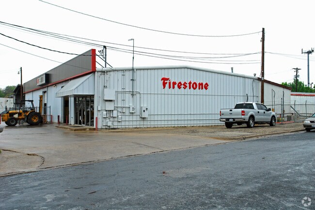
Property Record
2201 Airport Blvd, Austin, TX 78722


NEARBY LISTINGS FOR SALE OR LEASE
Property Detail
2201 Airport Blvd
Austin-Round Rock-San Marcos, TX
Airport & Manor Rd Subd No 3
204464
LOT 4-9 OLT 50 DIV B AIRPORT & MANOR RD SUBD NO 3
Vacantlandnec
Travis
X
Texas
48453C0465K
4-9
2024
1.33 AC
2025
East
002109
Austin
15,958 SF
DEMOGRAPHICS near 2201 Airport Blvd
1 mile
3 mile
5 mile
2024 Total Population
22,362
170,997
377,436
2029 Population
24,815
187,550
413,083
Pop Growth 2024-2029
+ 10.97%
+ 9.68%
+ 9.44%
Average Age
37
35
35
2024 Total Households
10,064
75,617
167,499
HH Growth 2024-2029
+ 11.83%
+ 10.94%
+ 10.39%
Median Household Inc
$89,489
$71,016
$72,153
Avg Household Size
2.10
2.00
2.10
2024 Avg HH Vehicles
1.00
1.00
2.00
Median Home Value
$673,471
$560,798
$604,849
Median Year Built
2008
1999
1991
Nearby Places
Map Layers
Map Styles
 Street
 Aerial
Transit
 Traffic
 Biking
Places
Listings with unknown addresses are not visible on the map
- Restaurants
- Banks
- Shops
- Fitness
- Groceries
PUBLIC TRANSPORTATION
COMMUTER RAIL
Drive
Walk
Distance
10 min
4.3 mi
AIRPORT
Austin-Bergstrom International
Drive
Walk
Distance
Austin-Bergstrom International
21 min
10.6 mi
SALE & LEASE HISTORY
LISTING DATE
SALE/LEASE

Sep 14, 2022
For Sale
Nearby Properties
Address
Land Use
TOTAL SIZE
Lot Size
Zoning
Address
Land Use
TOTAL SIZE
Lot Size
Zoning
9,768 SF
386.80 AC
Address
Land Use
TOTAL SIZE
Lot Size
Zoning
1,008,789 SF
17.50 AC
Address
Land Use
TOTAL SIZE
Lot Size
Zoning
20,550 SF
14.15 AC
Address
Land Use
TOTAL SIZE
Lot Size
Zoning
28.39 AC
Address
Land Use
TOTAL SIZE
Lot Size
Zoning
Address
Land Use
TOTAL SIZE
Lot Size
Zoning
28.62 AC
Address
Land Use
TOTAL SIZE
Lot Size
Zoning
1,156,135 SF
1.74 AC
Address
Land Use
TOTAL SIZE
Lot Size
Zoning
1,003,475 SF
1.84 AC
Address
Land Use
TOTAL SIZE
Lot Size
Zoning
27.17 AC
Address
Land Use
TOTAL SIZE
Lot Size
Zoning
136,900 SF
19.32 AC
Address
Land Use
TOTAL SIZE
Lot Size
Zoning
24.50 AC
Address
Land Use
TOTAL SIZE
Lot Size
Zoning
9,034 SF
28.69 AC
Address
Land Use
TOTAL SIZE
Lot Size
Zoning
30.96 AC
Address
Land Use
TOTAL SIZE
Lot Size
Zoning
709,300 SF
0.94 AC
Address
Land Use
TOTAL SIZE
Lot Size
Zoning
18.52 AC
Address
Land Use
TOTAL SIZE
Lot Size
Zoning
74.69 AC
Address
Land Use
TOTAL SIZE
Lot Size
Zoning
1,400,000 SF
3.07 AC
Address
Land Use
TOTAL SIZE
Lot Size
Zoning
789,220 SF
14.34 AC
Address
Land Use
TOTAL SIZE
Lot Size
Zoning
548,399 SF
23.82 AC
Address
Land Use
TOTAL SIZE
Lot Size
Zoning
623,000 SF
11.78 AC
Address
Land Use
TOTAL SIZE
Lot Size
Zoning
21 AC
Address
Land Use
TOTAL SIZE
Lot Size
Zoning
614,532 SF
66.07 AC
Address
Land Use
TOTAL SIZE
Lot Size
Zoning
609,613 SF
1.31 AC
Address
Land Use
TOTAL SIZE
Lot Size
Zoning
826,478 SF
1.75 AC
Address
Land Use
TOTAL SIZE
Lot Size
Zoning
341,096 SF
0.31 AC
Address
Land Use
TOTAL SIZE
Lot Size
Zoning
546,000 SF
1.27 AC
Address
Land Use
TOTAL SIZE
Lot Size
Zoning
533,917 SF
0.81 AC
Address
Land Use
TOTAL SIZE
Lot Size
Zoning
597,500 SF
0.99 AC
Address
Land Use
TOTAL SIZE
Lot Size
Zoning
552,000 SF
1.21 AC
The World's #1 Commercial Real Estate Marketplace
Connect with us
© 2026 CoStar Group
The information above has been obtained from sources believed reliable. While we do not doubt its accuracy we have not verified it and make no guarantee, warranty or representation about it. It is your responsibility to independently confirm its accuracy and completeness. Any projections, opinions, assumptions, or estimates used are for example only and do not represent the current or future performance of the property. The value of this transaction to you depends on tax and other factors which should be evaluated by your tax, financial, and legal advisors. You and your advisors should conduct a careful, independent investigation of the property to determine to your satisfaction the suitability of the property for your needs.