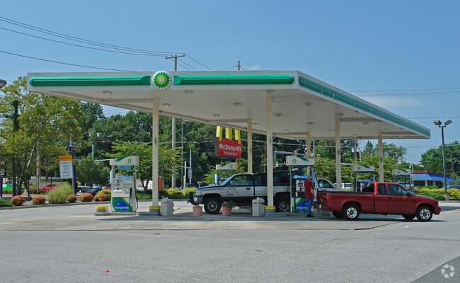
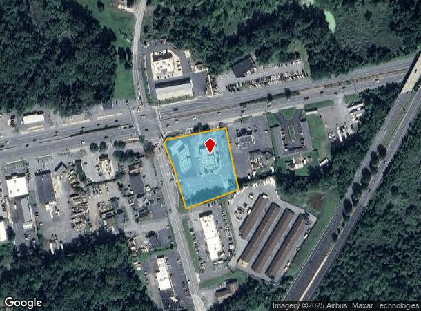
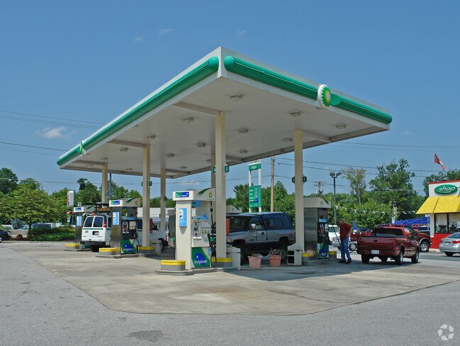
Property Record
2201 Pulaski Hwy, Edgewood, MD 21040
NEARBY LISTINGS FOR SALE OR LEASE
Property Detail
2201 Pulaski Hwy
Baltimore-Columbia-Towson, MD
Mcdonalds Edge
01-061518
LOT 1 77021 SF 2201 PULASKI HIGHWAY MCDONALD'S @ EDGE P97/10
Restaurantdrivein
Harford
X
Maryland
24025C0266E
1
2025
2 AC
2025
Outlying Harford County
301302
Baltimore
5,556 SF
DEMOGRAPHICS near 2201 Pulaski Hwy
1 Mile
3 Mile
5 Mile
2024 Total Population
9,887
50,064
95,748
2029 Population
10,169
51,408
98,306
Pop Growth 2024-2029
+ 2.85%
+ 2.68%
+ 2.67%
Average Age
37
38
39
2024 Total Households
3,614
18,759
35,903
HH Growth 2024-2029
+ 2.88%
+ 2.70%
+ 2.69%
Median Household Inc
$61,352
$82,571
$90,132
Avg Household Size
2.60
2.60
2.60
2024 Avg HH Vehicles
1.00
2.00
2.00
Median Home Value
$172,991
$243,678
$278,407
Median Year Built
1981
1987
1988
Nearby Places
Map Layers
Map Styles
 Street
 Aerial
- Restaurants
- Banks
- Shops
- Fitness
- Groceries
PUBLIC TRANSPORTATION
COMMUTER RAIL
Edgewood (Penn Line - Maryland Area Regional Commuter Trains (The MARC))
DRIVE
WALK
Distance
Edgewood (Penn Line - Maryland Area Regional Commuter Trains (The MARC))
9 min
2.8 mi
AIRPORT
Baltimore/Washington International Thurgood Marshall
DRIVE
WALK
Distance
Baltimore/Washington International Thurgood Marshall
43 min
35.2 mi
Nearby Properties
Address
Land Use
TOTAL SIZE
Lot Size
Zoning
Address
Land Use
TOTAL SIZE
Lot Size
Zoning
5,501.68 AC
R1
Address
Land Use
TOTAL SIZE
Lot Size
Zoning
97,619 SF
99.88 AC
R2
Address
Land Use
TOTAL SIZE
Lot Size
Zoning
15,250 SF
17.86 AC
CI
Address
Land Use
TOTAL SIZE
Lot Size
Zoning
266,913 SF
28.35 AC
R4
Address
Land Use
TOTAL SIZE
Lot Size
Zoning
253,842 SF
69.33 AC
R2
Address
Land Use
TOTAL SIZE
Lot Size
Zoning
44,475 SF
86.10 AC
R2
Address
Land Use
TOTAL SIZE
Lot Size
Zoning
822,410 SF
44.24 AC
GI
Address
Land Use
TOTAL SIZE
Lot Size
Zoning
996,030 SF
70.22 AC
GI
Address
Land Use
TOTAL SIZE
Lot Size
Zoning
59,724 SF
20.79 AC
C1
Address
Land Use
TOTAL SIZE
Lot Size
Zoning
212,760 SF
27.85 AC
GI
Address
Land Use
TOTAL SIZE
Lot Size
Zoning
246,560 SF
14.57 AC
LI
Address
Land Use
TOTAL SIZE
Lot Size
Zoning
61,350 SF
20 AC
B2
Address
Land Use
TOTAL SIZE
Lot Size
Zoning
124,268 SF
10.85 AC
R3
Address
Land Use
TOTAL SIZE
Lot Size
Zoning
1,690 SF
76.45 AC
R4
Address
Land Use
TOTAL SIZE
Lot Size
Zoning
116,822 SF
13.42 AC
CI
Address
Land Use
TOTAL SIZE
Lot Size
Zoning
109,398 SF
11.36 AC
CI
Address
Land Use
TOTAL SIZE
Lot Size
Zoning
200 AC
R4
Address
Land Use
TOTAL SIZE
Lot Size
Zoning
97,985 SF
12.12 AC
CI
Address
Land Use
TOTAL SIZE
Lot Size
Zoning
134,875 SF
40.88 AC
CI
Address
Land Use
TOTAL SIZE
Lot Size
Zoning
113,173 SF
17.04 AC
CI
Address
Land Use
TOTAL SIZE
Lot Size
Zoning
94,312 SF
14.40 AC
LI
Address
Land Use
TOTAL SIZE
Lot Size
Zoning
18.51 AC
R3
Address
Land Use
TOTAL SIZE
Lot Size
Zoning
255,464 SF
19.15 AC
GI
Address
Land Use
TOTAL SIZE
Lot Size
Zoning
35,400 SF
28.02 AC
R1
Address
Land Use
TOTAL SIZE
Lot Size
Zoning
191 AC
R4
Address
Land Use
TOTAL SIZE
Lot Size
Zoning
49,131 SF
14.39 AC
CI
Address
Land Use
TOTAL SIZE
Lot Size
Zoning
51,449 SF
32.85 AC
R4
Address
Land Use
TOTAL SIZE
Lot Size
Zoning
142,311 SF
24.28 AC
GI
Address
Land Use
TOTAL SIZE
Lot Size
Zoning
116,650 SF
47.59 AC
B3
Address
Land Use
TOTAL SIZE
Lot Size
Zoning
97,454 SF
14.72 AC
L1
The World's #1 Commercial Real Estate Marketplace
Connect with us
© 2025 CoStar Group
The information above has been obtained from sources believed reliable. While we do not doubt its accuracy we have not verified it and make no guarantee, warranty or representation about it. It is your responsibility to independently confirm its accuracy and completeness. Any projections, opinions, assumptions, or estimates used are for example only and do not represent the current or future performance of the property. The value of this transaction to you depends on tax and other factors which should be evaluated by your tax, financial, and legal advisors. You and your advisors should conduct a careful, independent investigation of the property to determine to your satisfaction the suitability of the property for your needs.