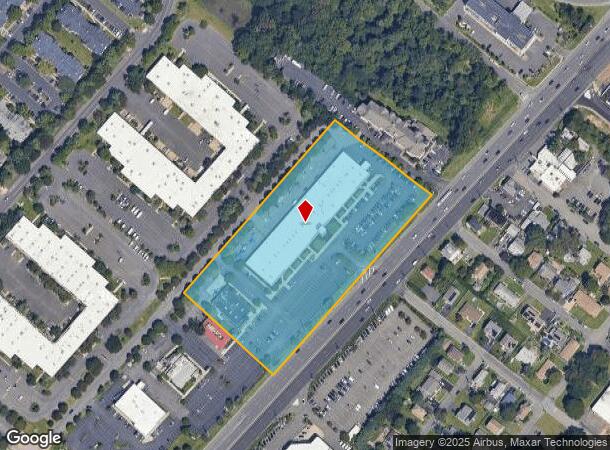
Property Record
2201 Route 1, North Brunswick, NJ 08902

NEARBY LISTINGS FOR SALE OR LEASE
Property Detail
2201 Route 1
New York-Jersey City-White Plains, NY-NJ
5.83 AC
14-00004-45-00004
Middlesex
Regionalshoppingcenterormallwithanchorstore
New Jersey
X
4
34023C0128F
5.83 AC
2024
Brunswick
2025
Northern New Jersey
006207
DEMOGRAPHICS near 2201 Route 1
1 Mile
3 Mile
5 Mile
2024 Total Population
12,999
72,270
210,212
2029 Population
12,923
71,998
209,177
Pop Growth 2024-2029
(0.58%)
(0.38%)
(0.49%)
Average Age
39
39
38
2024 Total Households
4,682
25,382
70,369
HH Growth 2024-2029
(0.64%)
(0.42%)
(0.35%)
Median Household Inc
$121,481
$104,283
$100,019
Avg Household Size
2.70
2.80
2.80
2024 Avg HH Vehicles
2.00
2.00
2.00
Median Home Value
$419,523
$402,302
$410,139
Median Year Built
1985
1982
1980
Nearby Places
Map Layers
Map Styles
 Street
 Aerial
- Restaurants
- Banks
- Shops
- Fitness
- Groceries
PUBLIC TRANSPORTATION
COMMUTER RAIL
Jersey Avenue (Northeast Corridor Line - NJ Transit Commuter Rail (NJ Transit))
DRIVE
WALK
Distance
Jersey Avenue (Northeast Corridor Line - NJ Transit Commuter Rail (NJ Transit))
10 min
3.3 mi
New Brunswick (Northeast Corridor Line - NJ Transit Commuter Rail (NJ Transit))
DRIVE
WALK
Distance
New Brunswick (Northeast Corridor Line - NJ Transit Commuter Rail (NJ Transit))
15 min
5.3 mi
AIRPORT
Newark Liberty International
DRIVE
WALK
Distance
Newark Liberty International
40 min
31.4 mi
Nearby Properties
Address
Land Use
TOTAL SIZE
Lot Size
Zoning
Address
Land Use
TOTAL SIZE
Lot Size
Zoning
25.77 AC
C-6
Address
Land Use
TOTAL SIZE
Lot Size
Zoning
99.79 AC
B-I
Address
Land Use
TOTAL SIZE
Lot Size
Zoning
31.07 AC
ERR
Address
Land Use
TOTAL SIZE
Lot Size
Zoning
543,945 SF
48.46 AC
B-I
Address
Land Use
TOTAL SIZE
Lot Size
Zoning
34.75 AC
CR
Address
Land Use
TOTAL SIZE
Lot Size
Zoning
27.23 AC
CR
Address
Land Use
TOTAL SIZE
Lot Size
Zoning
103.93 AC
ERR
Address
Land Use
TOTAL SIZE
Lot Size
Zoning
8,430 SF
10.51 AC
I-2
Address
Land Use
TOTAL SIZE
Lot Size
Zoning
46.85 AC
ERR
Address
Land Use
TOTAL SIZE
Lot Size
Zoning
283,080 SF
34.62 AC
CR
Address
Land Use
TOTAL SIZE
Lot Size
Zoning
419,094 SF
49.17 AC
CR
Address
Land Use
TOTAL SIZE
Lot Size
Zoning
18.50 AC
I-2
Address
Land Use
TOTAL SIZE
Lot Size
Zoning
27.88 AC
C2
Address
Land Use
TOTAL SIZE
Lot Size
Zoning
2.65 AC
R-6
Address
Land Use
TOTAL SIZE
Lot Size
Zoning
5.19 AC
I-2
Address
Land Use
TOTAL SIZE
Lot Size
Zoning
6.80 AC
R-6
Address
Land Use
TOTAL SIZE
Lot Size
Zoning
95,064 SF
14.41 AC
CR
Address
Land Use
TOTAL SIZE
Lot Size
Zoning
42.66 AC
PUD2
Address
Land Use
TOTAL SIZE
Lot Size
Zoning
1,071 SF
5.17 AC
CI
Address
Land Use
TOTAL SIZE
Lot Size
Zoning
192,072 SF
19.83 AC
CR
Address
Land Use
TOTAL SIZE
Lot Size
Zoning
30,000 SF
74.57 AC
R15
Address
Land Use
TOTAL SIZE
Lot Size
Zoning
23.39 AC
PUD2
Address
Land Use
TOTAL SIZE
Lot Size
Zoning
54,886 SF
5.21 AC
C-6
Address
Land Use
TOTAL SIZE
Lot Size
Zoning
800 SF
9.14 AC
B-I
Address
Land Use
TOTAL SIZE
Lot Size
Zoning
4,066 SF
30.42 AC
CR
Address
Land Use
TOTAL SIZE
Lot Size
Zoning
10.55 AC
B-I
Address
Land Use
TOTAL SIZE
Lot Size
Zoning
10 AC
I-2
Address
Land Use
TOTAL SIZE
Lot Size
Zoning
13,580 SF
10.39 AC
B-I
Address
Land Use
TOTAL SIZE
Lot Size
Zoning
27.47 AC
R5
Address
Land Use
TOTAL SIZE
Lot Size
Zoning
9,100 SF
9.54 AC
B-I
The World's #1 Commercial Real Estate Marketplace
Connect with us
© 2025 CoStar Group
The information above has been obtained from sources believed reliable. While we do not doubt its accuracy we have not verified it and make no guarantee, warranty or representation about it. It is your responsibility to independently confirm its accuracy and completeness. Any projections, opinions, assumptions, or estimates used are for example only and do not represent the current or future performance of the property. The value of this transaction to you depends on tax and other factors which should be evaluated by your tax, financial, and legal advisors. You and your advisors should conduct a careful, independent investigation of the property to determine to your satisfaction the suitability of the property for your needs.