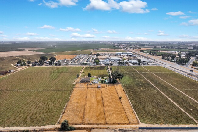
Property Record
2201 S Daubenberger Rd, Turlock, CA 95380


NEARBY LISTINGS FOR SALE OR LEASE
Property Detail
2201 S Daubenberger Rd
044-36-06
Rued Colony
Industrialgeneral
Stanislaus
X
California
06047C0175G
5&6
2025
37.93 AC
2025
Turlock/SW Stanislaus
003607
Stockton/Modesto
1,674 SF
Modesto, CA
DEMOGRAPHICS near 2201 S Daubenberger Rd
1 Mile
3 Mile
5 Mile
2024 Total Population
2,490
39,341
96,954
2029 Population
2,480
39,427
98,052
Pop Growth 2024-2029
(0.40%)
+ 0.22%
+ 1.13%
Average Age
36
37
37
2024 Total Households
705
12,893
31,554
HH Growth 2024-2029
(0.43%)
+ 0.30%
+ 1.07%
Median Household Inc
$74,071
$64,284
$71,777
Avg Household Size
3.40
2.90
3.00
2024 Avg HH Vehicles
2.00
2.00
2.00
Median Home Value
$368,518
$402,183
$396,837
Median Year Built
1977
1974
1983
Nearby Places
Map Layers
Map Styles
 Street
 Aerial
- Restaurants
- Banks
- Shops
- Fitness
- Groceries
PUBLIC TRANSPORTATION
COMMUTER RAIL
Turlock-Denair (San Joaquins - Amtrak)
DRIVE
WALK
Distance
Turlock-Denair (San Joaquins - Amtrak)
13 min
7.7 mi
Freight Ports
Port of Stockton
DRIVE
WALK
Distance
Port of Stockton
62 min
49.6 mi
SALE & LEASE HISTORY
LISTING DATE
SALE/LEASE

Jan 13, 2022
For Sale
Dec 06, 2024
For Lease
Nearby Properties
Address
Land Use
TOTAL SIZE
Lot Size
Zoning
Address
Land Use
TOTAL SIZE
Lot Size
Zoning
281,904 SF
17.84 AC
Address
Land Use
TOTAL SIZE
Lot Size
Zoning
128,000 SF
6.48 AC
Address
Land Use
TOTAL SIZE
Lot Size
Zoning
144,510 SF
12.04 AC
Address
Land Use
TOTAL SIZE
Lot Size
Zoning
81,953 SF
5 AC
M2
Address
Land Use
TOTAL SIZE
Lot Size
Zoning
149,310 SF
8.45 AC
Address
Land Use
TOTAL SIZE
Lot Size
Zoning
103,011 SF
7.90 AC
Address
Land Use
TOTAL SIZE
Lot Size
Zoning
112,779 SF
7.35 AC
TURCC
Address
Land Use
TOTAL SIZE
Lot Size
Zoning
68,015 SF
4.45 AC
CO
Address
Land Use
TOTAL SIZE
Lot Size
Zoning
44,860 SF
2.93 AC
Address
Land Use
TOTAL SIZE
Lot Size
Zoning
57,788 SF
1.08 AC
TURPD
Address
Land Use
TOTAL SIZE
Lot Size
Zoning
69,842 SF
2.54 AC
TURRH
Address
Land Use
TOTAL SIZE
Lot Size
Zoning
78.67 AC
Address
Land Use
TOTAL SIZE
Lot Size
Zoning
49,250 SF
2.77 AC
Address
Land Use
TOTAL SIZE
Lot Size
Zoning
42,096 SF
3.17 AC
Address
Land Use
TOTAL SIZE
Lot Size
Zoning
160,603 SF
11.17 AC
Address
Land Use
TOTAL SIZE
Lot Size
Zoning
57,674 SF
4 AC
Address
Land Use
TOTAL SIZE
Lot Size
Zoning
47,197 SF
1.59 AC
TURPD
Address
Land Use
TOTAL SIZE
Lot Size
Zoning
48,612 SF
2.53 AC
Address
Land Use
TOTAL SIZE
Lot Size
Zoning
93,664 SF
4.57 AC
Address
Land Use
TOTAL SIZE
Lot Size
Zoning
38,600 SF
3.29 AC
Address
Land Use
TOTAL SIZE
Lot Size
Zoning
34,156 SF
6.25 AC
Address
Land Use
TOTAL SIZE
Lot Size
Zoning
143.68 AC
A1
Address
Land Use
TOTAL SIZE
Lot Size
Zoning
28,254 SF
2.15 AC
Address
Land Use
TOTAL SIZE
Lot Size
Zoning
23,388 SF
9.44 AC
Address
Land Use
TOTAL SIZE
Lot Size
Zoning
8.69 AC
A240
Address
Land Use
TOTAL SIZE
Lot Size
Zoning
19.58 AC
Address
Land Use
TOTAL SIZE
Lot Size
Zoning
32,500 SF
2.31 AC
Address
Land Use
TOTAL SIZE
Lot Size
Zoning
48,664 SF
4.13 AC
Address
Land Use
TOTAL SIZE
Lot Size
Zoning
1,086 SF
51.80 AC
A1
Address
Land Use
TOTAL SIZE
Lot Size
Zoning
1,440 SF
82.20 AC
A1
The World's #1 Commercial Real Estate Marketplace
Connect with us
© 2026 CoStar Group
The information above has been obtained from sources believed reliable. While we do not doubt its accuracy we have not verified it and make no guarantee, warranty or representation about it. It is your responsibility to independently confirm its accuracy and completeness. Any projections, opinions, assumptions, or estimates used are for example only and do not represent the current or future performance of the property. The value of this transaction to you depends on tax and other factors which should be evaluated by your tax, financial, and legal advisors. You and your advisors should conduct a careful, independent investigation of the property to determine to your satisfaction the suitability of the property for your needs.