Property Record
22019 State Route 62, Alliance, OH 44601


NEARBY LISTINGS FOR SALE OR LEASE
Property Detail
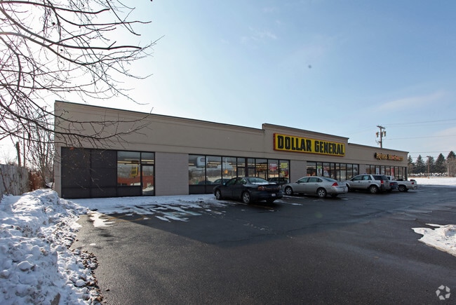
22019 State Route 62
3300048000
5 17 6 NW COR NW 1/4 2.027A
Storebuilding
Columbiana
X
Ohio
39029C0025E
2.03 AC
2024
Ohio North Area
2024
Other Market Areas
950900
Salem, OH
14,200 SF
DEMOGRAPHICS near 22019 State Route 62
1 Mile
3 Mile
5 Mile
2024 Total Population
5,121
26,754
38,275
2029 Population
5,122
26,699
38,064
Pop Growth 2024-2029
+ 0.02%
(0.21%)
(0.55%)
Average Age
41
40
42
2024 Total Households
2,173
10,737
15,721
HH Growth 2024-2029
0.00%
(0.20%)
(0.52%)
Median Household Inc
$46,699
$50,717
$50,731
Avg Household Size
2.20
2.30
2.30
2024 Avg HH Vehicles
2.00
2.00
2.00
Median Home Value
$70,596
$114,384
$125,286
Median Year Built
1948
1951
1954
Nearby Places
Map Layers
Map Styles
 Street
 Aerial
- Restaurants
- Banks
- Shops
- Fitness
- Groceries
PUBLIC TRANSPORTATION
COMMUTER RAIL
DRIVE
WALK
Distance
4 min
1.7 mi
AIRPORT
Akron-Canton Regional
DRIVE
WALK
Distance
Akron-Canton Regional
36 min
20.3 mi
SALE & LEASE HISTORY
LISTING DATE
SALE/LEASE

May 23, 2019
For Lease
Nearby Properties
Address
Land Use
TOTAL SIZE
Lot Size
Zoning
Address
Land Use
TOTAL SIZE
Lot Size
Zoning
1,015,253 SF
83.25 AC
Address
Land Use
TOTAL SIZE
Lot Size
Zoning
294,532 SF
7.73 AC
Address
Land Use
TOTAL SIZE
Lot Size
Zoning
121,669 SF
27.80 AC
Address
Land Use
TOTAL SIZE
Lot Size
Zoning
275,422 SF
10 AC
Address
Land Use
TOTAL SIZE
Lot Size
Zoning
402,113 SF
25.10 AC
Address
Land Use
TOTAL SIZE
Lot Size
Zoning
93,477 SF
8.21 AC
Address
Land Use
TOTAL SIZE
Lot Size
Zoning
79,700 SF
1.80 AC
Address
Land Use
TOTAL SIZE
Lot Size
Zoning
120,552 SF
10.37 AC
Address
Land Use
TOTAL SIZE
Lot Size
Zoning
69,467 SF
18.25 AC
Address
Land Use
TOTAL SIZE
Lot Size
Zoning
60,037 SF
6.38 AC
Address
Land Use
TOTAL SIZE
Lot Size
Zoning
398,637 SF
60.59 AC
Address
Land Use
TOTAL SIZE
Lot Size
Zoning
73,853 SF
3.83 AC
Address
Land Use
TOTAL SIZE
Lot Size
Zoning
75,318 SF
4.59 AC
Address
Land Use
TOTAL SIZE
Lot Size
Zoning
56,112 SF
6.37 AC
Address
Land Use
TOTAL SIZE
Lot Size
Zoning
134,368 SF
10.30 AC
Address
Land Use
TOTAL SIZE
Lot Size
Zoning
73,764 SF
1.52 AC
Address
Land Use
TOTAL SIZE
Lot Size
Zoning
29,455 SF
8 AC
Address
Land Use
TOTAL SIZE
Lot Size
Zoning
62,767 SF
2.85 AC
Address
Land Use
TOTAL SIZE
Lot Size
Zoning
130,339 SF
10.28 AC
Address
Land Use
TOTAL SIZE
Lot Size
Zoning
53,959 SF
3.58 AC
Address
Land Use
TOTAL SIZE
Lot Size
Zoning
49,226 SF
10.57 AC
Address
Land Use
TOTAL SIZE
Lot Size
Zoning
52,644 SF
1.03 AC
Address
Land Use
TOTAL SIZE
Lot Size
Zoning
34,078 SF
28.41 AC
Address
Land Use
TOTAL SIZE
Lot Size
Zoning
10,800 SF
6.60 AC
Address
Land Use
TOTAL SIZE
Lot Size
Zoning
56,474 SF
9.80 AC
Address
Land Use
TOTAL SIZE
Lot Size
Zoning
80,552 SF
68.27 AC
Address
Land Use
TOTAL SIZE
Lot Size
Zoning
29,283 SF
1.53 AC
Address
Land Use
TOTAL SIZE
Lot Size
Zoning
154,537 SF
14.37 AC
Address
Land Use
TOTAL SIZE
Lot Size
Zoning
93,477 SF
9.34 AC
Address
Land Use
TOTAL SIZE
Lot Size
Zoning
90,156 SF
8.20 AC
The World's #1 Commercial Real Estate Marketplace
Connect with us
© 2026 CoStar Group
The information above has been obtained from sources believed reliable. While we do not doubt its accuracy we have not verified it and make no guarantee, warranty or representation about it. It is your responsibility to independently confirm its accuracy and completeness. Any projections, opinions, assumptions, or estimates used are for example only and do not represent the current or future performance of the property. The value of this transaction to you depends on tax and other factors which should be evaluated by your tax, financial, and legal advisors. You and your advisors should conduct a careful, independent investigation of the property to determine to your satisfaction the suitability of the property for your needs.