Property Record
2202 E Scyene Rd, Mesquite, TX 75181


NEARBY LISTINGS FOR SALE OR LEASE
Property Detail
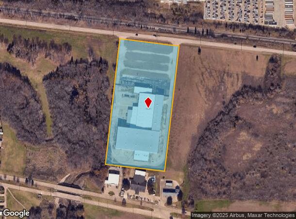
2202 E Scyene Rd
Dallas-Fort Worth-Arlington, TX
Paragon Park
38153500011RA0000
PARAGON PARK BLK 1 LT 1RA ACS 7.8876 INT201100110082 DD04292011 CO-DC 153500011RA00 3CM15350001
Warehouse
Dallas
AE
Texas
48257C0025E
1
2024
7.89 AC
2025
East Dallas/Mesquite
017307
Dallas/Ft Worth
97,420 SF
DEMOGRAPHICS near 2202 E Scyene Rd
1 mile
3 mile
5 mile
2024 Total Population
8,470
59,762
157,641
2029 Population
8,280
58,735
157,232
Pop Growth 2024-2029
(2.24%)
(1.72%)
(0.26%)
Average Age
37
36
35
2024 Total Households
2,641
18,919
48,840
HH Growth 2024-2029
(2.54%)
(2.06%)
(0.50%)
Median Household Inc
$77,146
$71,671
$63,061
Avg Household Size
3.10
3.10
3.10
2024 Avg HH Vehicles
2.00
2.00
2.00
Median Home Value
$224,174
$216,340
$199,509
Median Year Built
1989
1987
1986
Nearby Places
Map Layers
Map Styles
 Street
 Aerial
Transit
 Traffic
 Biking
Places
Listings with unknown addresses are not visible on the map
- Restaurants
- Banks
- Shops
- Fitness
- Groceries
PUBLIC TRANSPORTATION
AIRPORT
Dallas Love Field
Drive
Walk
Distance
Dallas Love Field
36 min
22.0 mi
Dallas-Fort Worth International
Drive
Walk
Distance
Dallas-Fort Worth International
50 min
39.4 mi
Nearby Properties
Address
Land Use
TOTAL SIZE
Lot Size
Zoning
Address
Land Use
TOTAL SIZE
Lot Size
Zoning
263,360 SF
42.98 AC
Z237
Address
Land Use
TOTAL SIZE
Lot Size
Zoning
441,799 SF
64.72 AC
Z05
Address
Land Use
TOTAL SIZE
Lot Size
Zoning
256,600 SF
80.73 AC
Z265
Address
Land Use
TOTAL SIZE
Lot Size
Zoning
877,230 SF
102.36 AC
Z05
Address
Land Use
TOTAL SIZE
Lot Size
Zoning
649,398 SF
42.19 AC
Address
Land Use
TOTAL SIZE
Lot Size
Zoning
592,958 SF
32.34 AC
Address
Land Use
TOTAL SIZE
Lot Size
Zoning
643,200 SF
30.02 AC
Z109
Address
Land Use
TOTAL SIZE
Lot Size
Zoning
144,858 SF
9.69 AC
Z206
Address
Land Use
TOTAL SIZE
Lot Size
Zoning
255,008 SF
30.39 AC
Z250
Address
Land Use
TOTAL SIZE
Lot Size
Zoning
100 SF
0.01 AC
Z268
Address
Land Use
TOTAL SIZE
Lot Size
Zoning
193,000 SF
34.42 AC
Z05
Address
Land Use
TOTAL SIZE
Lot Size
Zoning
1,229,138 SF
115.08 AC
Z117
Address
Land Use
TOTAL SIZE
Lot Size
Zoning
622,615 SF
35 AC
Z104
Address
Land Use
TOTAL SIZE
Lot Size
Zoning
223,216 SF
17.17 AC
Z31
Address
Land Use
TOTAL SIZE
Lot Size
Zoning
638,400 SF
40.70 AC
Z109
Address
Land Use
TOTAL SIZE
Lot Size
Zoning
214,853 SF
6.60 AC
Z372
Address
Land Use
TOTAL SIZE
Lot Size
Zoning
407,195 SF
31.32 AC
Z109
Address
Land Use
TOTAL SIZE
Lot Size
Zoning
379,619 SF
24.68 AC
Z376
Address
Land Use
TOTAL SIZE
Lot Size
Zoning
320,390 SF
21.50 AC
Z267
Address
Land Use
TOTAL SIZE
Lot Size
Zoning
298,150 SF
20.01 AC
Z14
Address
Land Use
TOTAL SIZE
Lot Size
Zoning
349,440 SF
20.07 AC
Z104
Address
Land Use
TOTAL SIZE
Lot Size
Zoning
333,000 SF
17.04 AC
Address
Land Use
TOTAL SIZE
Lot Size
Zoning
217,606 SF
10.01 AC
Z237
Address
Land Use
TOTAL SIZE
Lot Size
Zoning
295,916 SF
16.52 AC
Z104
Address
Land Use
TOTAL SIZE
Lot Size
Zoning
286,944 SF
18.50 AC
Z265
Address
Land Use
TOTAL SIZE
Lot Size
Zoning
241,512 SF
12.61 AC
Address
Land Use
TOTAL SIZE
Lot Size
Zoning
310,900 SF
18.01 AC
Address
Land Use
TOTAL SIZE
Lot Size
Zoning
107,376 SF
38.55 AC
Z372
Address
Land Use
TOTAL SIZE
Lot Size
Zoning
148,776 SF
35.77 AC
Z237
Address
Land Use
TOTAL SIZE
Lot Size
Zoning
174,200 SF
1 AC
Z372
The World's #1 Commercial Real Estate Marketplace
Connect with us
© 2026 CoStar Group
The information above has been obtained from sources believed reliable. While we do not doubt its accuracy we have not verified it and make no guarantee, warranty or representation about it. It is your responsibility to independently confirm its accuracy and completeness. Any projections, opinions, assumptions, or estimates used are for example only and do not represent the current or future performance of the property. The value of this transaction to you depends on tax and other factors which should be evaluated by your tax, financial, and legal advisors. You and your advisors should conduct a careful, independent investigation of the property to determine to your satisfaction the suitability of the property for your needs.