Property Record
2202 Hwy 258 N, Kinston, NC 28504

NEARBY LISTINGS FOR SALE OR LEASE
Property Detail
2202 Hwy 258 N
450601356561
Virgil H Dixon Prop
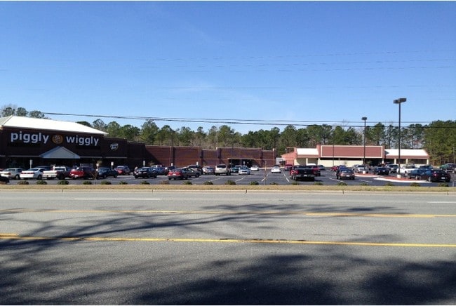
Supermarket
HWY 258 NORTH TR 2B PIGGLY WIGGLEY
X
Lenoir
3720450600K
North Carolina
2025
11.34 AC
2025
North Carolina Southeast Area
011001
Other Market Areas
50,263 SF
Kinston, NC
DEMOGRAPHICS near 2202 Hwy 258 N
1 Mile
3 Mile
5 Mile
2024 Total Population
1,424
10,583
25,688
2029 Population
1,395
10,300
25,370
Pop Growth 2024-2029
(2.04%)
(2.67%)
(1.24%)
Average Age
40
44
43
2024 Total Households
594
4,375
10,870
HH Growth 2024-2029
(2.19%)
(2.83%)
(1.26%)
Median Household Inc
$47,205
$52,037
$40,527
Avg Household Size
2.30
2.30
2.20
2024 Avg HH Vehicles
2.00
2.00
2.00
Median Home Value
$94,816
$145,810
$118,510
Median Year Built
1986
1981
1973
Nearby Places
Map Layers
Map Styles
 Street
 Aerial
- Restaurants
- Banks
- Shops
- Fitness
- Groceries
PUBLIC TRANSPORTATION
AIRPORT
Pitt-Greenville
DRIVE
WALK
Distance
Pitt-Greenville
49 min
34.5 mi
Albert J Ellis
DRIVE
WALK
Distance
Albert J Ellis
68 min
38.9 mi
Coastal Carolina Regional
DRIVE
WALK
Distance
Coastal Carolina Regional
58 min
43.3 mi
SALE & LEASE HISTORY
LISTING DATE
SALE/LEASE

Sep 25, 2016
For Lease
Nearby Properties
Address
Land Use
TOTAL SIZE
Lot Size
Zoning
Address
Land Use
TOTAL SIZE
Lot Size
Zoning
216,063 SF
354.52 AC
I1
Address
Land Use
TOTAL SIZE
Lot Size
Zoning
22,420 SF
762.37 AC
RA6
Address
Land Use
TOTAL SIZE
Lot Size
Zoning
184,270 SF
980.52 AC
Address
Land Use
TOTAL SIZE
Lot Size
Zoning
99,724 SF
23.40 AC
Address
Land Use
TOTAL SIZE
Lot Size
Zoning
25,376 SF
953.68 AC
RA12
Address
Land Use
TOTAL SIZE
Lot Size
Zoning
445,987 SF
957.24 AC
I1
Address
Land Use
TOTAL SIZE
Lot Size
Zoning
185,181 SF
12.24 AC
SC
Address
Land Use
TOTAL SIZE
Lot Size
Zoning
525,000 SF
384.32 AC
I1
Address
Land Use
TOTAL SIZE
Lot Size
Zoning
150,941 SF
20 AC
I1
Address
Land Use
TOTAL SIZE
Lot Size
Zoning
409,695 SF
25 AC
Address
Land Use
TOTAL SIZE
Lot Size
Zoning
107,460 SF
17.70 AC
I2
Address
Land Use
TOTAL SIZE
Lot Size
Zoning
202,946 SF
34.01 AC
I1
Address
Land Use
TOTAL SIZE
Lot Size
Zoning
247,376 SF
99.63 AC
I1
Address
Land Use
TOTAL SIZE
Lot Size
Zoning
64,008 SF
24 AC
I1
Address
Land Use
TOTAL SIZE
Lot Size
Zoning
15,858 SF
54.75 AC
I1
Address
Land Use
TOTAL SIZE
Lot Size
Zoning
156,784 SF
63.12 AC
I1
Address
Land Use
TOTAL SIZE
Lot Size
Zoning
45,675 SF
2.89 AC
IB
Address
Land Use
TOTAL SIZE
Lot Size
Zoning
278,576 SF
30.06 AC
I1
Address
Land Use
TOTAL SIZE
Lot Size
Zoning
118,696 SF
15.62 AC
IB
Address
Land Use
TOTAL SIZE
Lot Size
Zoning
234.71 AC
I1
Address
Land Use
TOTAL SIZE
Lot Size
Zoning
254,440 SF
51.94 AC
I1
Address
Land Use
TOTAL SIZE
Lot Size
Zoning
145,364 SF
76.38 AC
I1
Address
Land Use
TOTAL SIZE
Lot Size
Zoning
20,748 SF
33.22 AC
B1
Address
Land Use
TOTAL SIZE
Lot Size
Zoning
28,034 SF
278.73 AC
RA12
Address
Land Use
TOTAL SIZE
Lot Size
Zoning
101,200 SF
30.89 AC
Address
Land Use
TOTAL SIZE
Lot Size
Zoning
117,120 SF
8.12 AC
I1
Address
Land Use
TOTAL SIZE
Lot Size
Zoning
44,157 SF
25.70 AC
Address
Land Use
TOTAL SIZE
Lot Size
Zoning
424,443 SF
104.04 AC
SC
Address
Land Use
TOTAL SIZE
Lot Size
Zoning
10,900 SF
9.14 AC
SC
Address
Land Use
TOTAL SIZE
Lot Size
Zoning
39,537 SF
1.58 AC
SC
The World's #1 Commercial Real Estate Marketplace
Connect with us
© 2026 CoStar Group
The information above has been obtained from sources believed reliable. While we do not doubt its accuracy we have not verified it and make no guarantee, warranty or representation about it. It is your responsibility to independently confirm its accuracy and completeness. Any projections, opinions, assumptions, or estimates used are for example only and do not represent the current or future performance of the property. The value of this transaction to you depends on tax and other factors which should be evaluated by your tax, financial, and legal advisors. You and your advisors should conduct a careful, independent investigation of the property to determine to your satisfaction the suitability of the property for your needs.