Property Record
2363 Mitchell Park Dr, Petoskey, MI 49770

NEARBY LISTINGS FOR SALE OR LEASE
-
-
View all Petoskey listings for lease on LoopNet.com
Property Detail
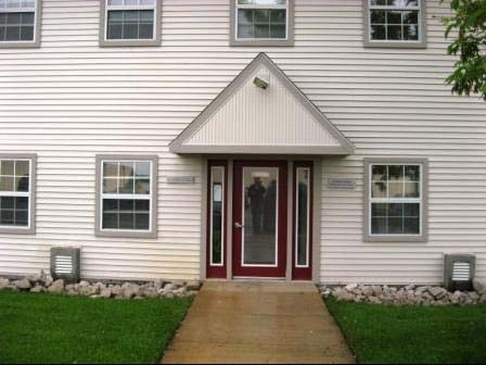
2363 Mitchell Park Dr
Petoskey, MI
S4 T34n R5w
01-19-04-200-004
COM 607.52 FT S OF N 1/4 COR, TH S-87-48-8-E ALG N LN OF MITCHELL PARK RD 448.2FT, TH CONT ALG SD RD ON CURVE TO R 117.61 FT
Commercialnec
Emmet
2024
Michigan
2025
5.01 AC
970600
Michigan North Central Area
31,785 SF
Other Market Areas
DEMOGRAPHICS near 2363 Mitchell Park Dr
1 Mile
3 Mile
5 Mile
2024 Total Population
1,219
9,147
15,155
2029 Population
1,175
9,070
15,200
Pop Growth 2024-2029
(3.61%)
(0.84%)
+ 0.30%
Average Age
41
43
44
2024 Total Households
499
4,179
6,773
HH Growth 2024-2029
(4.01%)
(0.96%)
+ 0.28%
Median Household Inc
$67,954
$63,156
$65,846
Avg Household Size
2.30
2.10
2.10
2024 Avg HH Vehicles
2.00
2.00
2.00
Median Home Value
$298,275
$254,334
$263,162
Median Year Built
1975
1976
1979
Nearby Places
Map Layers
Map Styles
 Street
 Aerial
- Restaurants
- Banks
- Shops
- Fitness
- Groceries
SALE & LEASE HISTORY
LISTING DATE
SALE/LEASE

Feb 09, 2023
For Lease
Nearby Properties
Address
Land Use
TOTAL SIZE
Lot Size
Zoning
Address
Land Use
TOTAL SIZE
Lot Size
Zoning
0.01 AC
EC RR
Address
Land Use
TOTAL SIZE
Lot Size
Zoning
Address
Land Use
TOTAL SIZE
Lot Size
Zoning
17.22 AC
COP B-3
Address
Land Use
TOTAL SIZE
Lot Size
Zoning
19.09 AC
COP PUD
Address
Land Use
TOTAL SIZE
Lot Size
Zoning
31,545 SF
6.10 AC
COP RM-1
Address
Land Use
TOTAL SIZE
Lot Size
Zoning
1.43 AC
COP B-2
Address
Land Use
TOTAL SIZE
Lot Size
Zoning
23.70 AC
EC B-2
Address
Land Use
TOTAL SIZE
Lot Size
Zoning
137,452 SF
14.69 AC
EC B-2
Address
Land Use
TOTAL SIZE
Lot Size
Zoning
11.64 AC
EC R-2
Address
Land Use
TOTAL SIZE
Lot Size
Zoning
1.76 AC
COP PUD
Address
Land Use
TOTAL SIZE
Lot Size
Zoning
15.19 AC
EC R-1
Address
Land Use
TOTAL SIZE
Lot Size
Zoning
2 AC
EC R-2
Address
Land Use
TOTAL SIZE
Lot Size
Zoning
2.71 AC
COP B-3
Address
Land Use
TOTAL SIZE
Lot Size
Zoning
1.25 AC
COP B-3
Address
Land Use
TOTAL SIZE
Lot Size
Zoning
0.45 AC
EC R-2
Address
Land Use
TOTAL SIZE
Lot Size
Zoning
3.83 AC
COP PUD
Address
Land Use
TOTAL SIZE
Lot Size
Zoning
51,672 SF
1.80 AC
COP B-3
Address
Land Use
TOTAL SIZE
Lot Size
Zoning
0.18 AC
COP B-2
Address
Land Use
TOTAL SIZE
Lot Size
Zoning
27,900 SF
6.43 AC
EC B-2
Address
Land Use
TOTAL SIZE
Lot Size
Zoning
4.85 AC
COP B-3B
Address
Land Use
TOTAL SIZE
Lot Size
Zoning
15.46 AC
EC B-2
Address
Land Use
TOTAL SIZE
Lot Size
Zoning
3.61 AC
EC PUD
Address
Land Use
TOTAL SIZE
Lot Size
Zoning
7.91 AC
EC R-1
Address
Land Use
TOTAL SIZE
Lot Size
Zoning
13,929 SF
1.58 AC
COP B-3
Address
Land Use
TOTAL SIZE
Lot Size
Zoning
6.73 AC
COP RM-1
Address
Land Use
TOTAL SIZE
Lot Size
Zoning
15,710 SF
0.40 AC
COP B-2
Address
Land Use
TOTAL SIZE
Lot Size
Zoning
3.33 AC
EC PUD
Address
Land Use
TOTAL SIZE
Lot Size
Zoning
3.25 AC
COP H2
Address
Land Use
TOTAL SIZE
Lot Size
Zoning
662 SF
27.77 AC
EC FF-1
Address
Land Use
TOTAL SIZE
Lot Size
Zoning
0.13 AC
COP B-2
The World's #1 Commercial Real Estate Marketplace
Connect with us
© 2026 CoStar Group
The information above has been obtained from sources believed reliable. While we do not doubt its accuracy we have not verified it and make no guarantee, warranty or representation about it. It is your responsibility to independently confirm its accuracy and completeness. Any projections, opinions, assumptions, or estimates used are for example only and do not represent the current or future performance of the property. The value of this transaction to you depends on tax and other factors which should be evaluated by your tax, financial, and legal advisors. You and your advisors should conduct a careful, independent investigation of the property to determine to your satisfaction the suitability of the property for your needs.