Property Record
2203 E Jay St, Ontario, CA 91764


Property Detail
2203 E Jay St
0110-311-60
PORTION OF FOLLOWING THAT IS LYING IN TRA 4008 DESCRIBED AS PARCEL 3 IN THE CITY OF ONTARIO, COUNTY OF SAN BERNARDINO, STATE OF CALIFORNIA AS SHOWN ON PARCEL MAP NO. 19612 FILED IN BOOK 244, PAGES 40 THROUGH 53 INCLUSIVE, OF PARCEL MAPS IN THE OFFICE
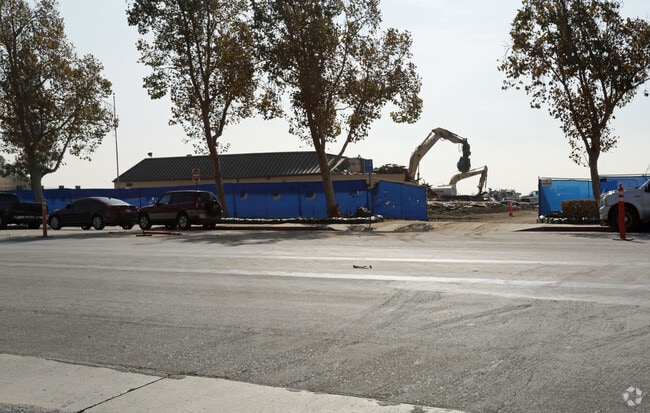
Warehouse
San Bernardino
C and X Area of minimal flood hazard, usually depicted on FIRMs as above the 500-year flood level.
California
2025
14.13 AC
2025
Airport Area
001312
Inland Empire (California)
397,875 SF
Riverside-San Bernardino-Ontario, CA
NEARBY LISTINGS FOR SALE OR LEASE
DEMOGRAPHICS near 2203 E Jay St
1 mile
3 mile
5 mile
2025 Total Population
19,403
123,190
361,279
2030 Population
19,846
124,374
363,979
Pop Growth 2025-2030
+ 2.28%
+ 0.96%
+ 0.75%
Average Age
36
37
38
2025 Total Households
5,822
40,001
116,149
HH Growth 2025-2030
+ 2.47%
+ 1.13%
+ 0.80%
Median Household Inc
$88,658
$85,585
$94,459
Avg Household Size
3.30
3.00
3.00
2025 Avg HH Vehicles
2.00
2.00
2.00
Median Home Value
$613,445
$640,303
$688,450
Median Year Built
1984
1980
1980
Nearby Places
Map Layers
Map Styles
 Street
 Aerial
Transit
 Traffic
 Biking
Places
Listings with unknown addresses are not visible on the map
- Restaurants
- Banks
- Shops
- Fitness
- Groceries
PUBLIC TRANSPORTATION
COMMUTER RAIL
Upland (San Bernardino Line - Southern California Regional Rail Authority (Metrolink))
Drive
Walk
Distance
Upland (San Bernardino Line - Southern California Regional Rail Authority (Metrolink))
6 min
3.5 mi
Rancho Cucamonga (San Bernardino Line - Southern California Regional Rail Authority (Metrolink))
Drive
Walk
Distance
Rancho Cucamonga (San Bernardino Line - Southern California Regional Rail Authority (Metrolink))
7 min
3.7 mi
AIRPORT
Ontario International
Drive
Walk
Distance
Ontario International
5 min
2.4 mi
John Wayne/Orange County
Drive
Walk
Distance
John Wayne/Orange County
53 min
43.3 mi
Nearby Properties
Address
Land Use
TOTAL SIZE
Lot Size
Zoning
Address
Land Use
TOTAL SIZE
Lot Size
Zoning
376,610 SF
25.22 AC
Address
Land Use
TOTAL SIZE
Lot Size
Zoning
244,370 SF
59.72 AC
Address
Land Use
TOTAL SIZE
Lot Size
Zoning
707,551 SF
20.36 AC
Address
Land Use
TOTAL SIZE
Lot Size
Zoning
539,128 SF
10.24 AC
Address
Land Use
TOTAL SIZE
Lot Size
Zoning
293,860 SF
16.10 AC
Address
Land Use
TOTAL SIZE
Lot Size
Zoning
545,161 SF
11.10 AC
Address
Land Use
TOTAL SIZE
Lot Size
Zoning
453,960 SF
18.54 AC
Address
Land Use
TOTAL SIZE
Lot Size
Zoning
591,495 SF
18.29 AC
Address
Land Use
TOTAL SIZE
Lot Size
Zoning
1,052,840 SF
41.85 AC
Address
Land Use
TOTAL SIZE
Lot Size
Zoning
531,988 SF
9.83 AC
Address
Land Use
TOTAL SIZE
Lot Size
Zoning
286,732 SF
9.58 AC
Address
Land Use
TOTAL SIZE
Lot Size
Zoning
261,357 SF
10.03 AC
Address
Land Use
TOTAL SIZE
Lot Size
Zoning
440,209 SF
10.34 AC
Address
Land Use
TOTAL SIZE
Lot Size
Zoning
830,300 SF
39.99 AC
Address
Land Use
TOTAL SIZE
Lot Size
Zoning
190,724 SF
10.69 AC
Address
Land Use
TOTAL SIZE
Lot Size
Zoning
387,965 SF
10.92 AC
Address
Land Use
TOTAL SIZE
Lot Size
Zoning
797,408 SF
66.66 AC
Address
Land Use
TOTAL SIZE
Lot Size
Zoning
709,814 SF
29.40 AC
Address
Land Use
TOTAL SIZE
Lot Size
Zoning
468,682 SF
19.40 AC
Address
Land Use
TOTAL SIZE
Lot Size
Zoning
174,092 SF
4.42 AC
Address
Land Use
TOTAL SIZE
Lot Size
Zoning
656,040 SF
28.47 AC
Address
Land Use
TOTAL SIZE
Lot Size
Zoning
358,375 SF
9.30 AC
Address
Land Use
TOTAL SIZE
Lot Size
Zoning
183,039 SF
8.30 AC
Address
Land Use
TOTAL SIZE
Lot Size
Zoning
246,012 SF
5.97 AC
Address
Land Use
TOTAL SIZE
Lot Size
Zoning
314,559 SF
9.34 AC
Address
Land Use
TOTAL SIZE
Lot Size
Zoning
123,833 SF
11.23 AC
Address
Land Use
TOTAL SIZE
Lot Size
Zoning
573,220 SF
32.33 AC
Address
Land Use
TOTAL SIZE
Lot Size
Zoning
780,648 SF
13.59 AC
Address
Land Use
TOTAL SIZE
Lot Size
Zoning
199,158 SF
8.55 AC
Address
Land Use
TOTAL SIZE
Lot Size
Zoning
273,249 SF
11.07 AC
The World's #1 Commercial Real Estate Marketplace
Connect with us
© 2026 CoStar Group
The information above has been obtained from sources believed reliable. While we do not doubt its accuracy we have not verified it and make no guarantee, warranty or representation about it. It is your responsibility to independently confirm its accuracy and completeness. Any projections, opinions, assumptions, or estimates used are for example only and do not represent the current or future performance of the property. The value of this transaction to you depends on tax and other factors which should be evaluated by your tax, financial, and legal advisors. You and your advisors should conduct a careful, independent investigation of the property to determine to your satisfaction the suitability of the property for your needs.