Property Record
2203 Plaster Rd Ne, Atlanta, GA 30345


NEARBY LISTINGS FOR SALE OR LEASE
Property Detail
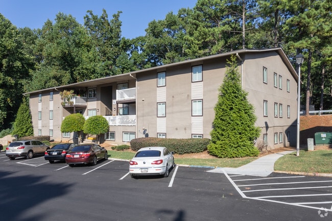
2203 Plaster Rd Ne
Atlanta-Sandy Springs-Roswell, GA
Hacienda Apts Llc Surv
18-245-03-002
398 X 186 X 85 X 731 X 332 X 1208
Apartment
DeKalb
X
Georgia
13089C0056K
2
2025
9.50 AC
2025
Chamblee
021410
Atlanta
127,170 SF
DEMOGRAPHICS near 2203 Plaster Rd Ne
1 Mile
3 Mile
5 Mile
2024 Total Population
16,329
110,014
326,442
2029 Population
16,223
109,861
328,899
Pop Growth 2024-2029
(0.65%)
(0.14%)
+ 0.75%
Average Age
35
37
37
2024 Total Households
6,700
46,300
145,309
HH Growth 2024-2029
(0.79%)
(0.13%)
+ 0.98%
Median Household Inc
$77,650
$95,215
$87,919
Avg Household Size
2.40
2.30
2.20
2024 Avg HH Vehicles
2.00
2.00
2.00
Median Home Value
$411,015
$477,801
$448,527
Median Year Built
1978
1984
1987
Nearby Places
Map Layers
Map Styles
 Street
 Aerial
- Restaurants
- Banks
- Shops
- Fitness
- Groceries
PUBLIC TRANSPORTATION
COMMUTER RAIL
Atlanta (Crescent - Amtrak)
DRIVE
WALK
Distance
Atlanta (Crescent - Amtrak)
13 min
7.6 mi
AIRPORT
Hartsfield - Jackson Atlanta International
DRIVE
WALK
Distance
Hartsfield - Jackson Atlanta International
32 min
20.8 mi
Freight Ports
Georgia Ports - Savannah
DRIVE
WALK
Distance
Georgia Ports - Savannah
294 min
258.8 mi
Nearby Properties
Address
Land Use
TOTAL SIZE
Lot Size
Zoning
Address
Land Use
TOTAL SIZE
Lot Size
Zoning
12,600 SF
508.30 AC
M
Address
Land Use
TOTAL SIZE
Lot Size
Zoning
169,435 SF
76.18 AC
M
Address
Land Use
TOTAL SIZE
Lot Size
Zoning
188,648 SF
4.39 AC
X
Address
Land Use
TOTAL SIZE
Lot Size
Zoning
2,820,296 SF
9.58 AC
RG5
Address
Land Use
TOTAL SIZE
Lot Size
Zoning
299,993 SF
4.72 AC
I1
Address
Land Use
TOTAL SIZE
Lot Size
Zoning
213,408 SF
6.35 AC
I1
Address
Land Use
TOTAL SIZE
Lot Size
Zoning
389,560 SF
4.01 AC
C1
Address
Land Use
TOTAL SIZE
Lot Size
Zoning
432,424 SF
3.87 AC
MC
Address
Land Use
TOTAL SIZE
Lot Size
Zoning
431,259 SF
48.90 AC
RM100
Address
Land Use
TOTAL SIZE
Lot Size
Zoning
276,504 SF
3.40 AC
C1
Address
Land Use
TOTAL SIZE
Lot Size
Zoning
191,941 SF
3.02 AC
OCR
Address
Land Use
TOTAL SIZE
Lot Size
Zoning
257,989 SF
12.41 AC
OI
Address
Land Use
TOTAL SIZE
Lot Size
Zoning
307,824 SF
16.40 AC
X
Address
Land Use
TOTAL SIZE
Lot Size
Zoning
157,133 SF
5.03 AC
M
Address
Land Use
TOTAL SIZE
Lot Size
Zoning
166,377 SF
7.56 AC
X
Address
Land Use
TOTAL SIZE
Lot Size
Zoning
321,334 SF
12.70 AC
RM-HD
Address
Land Use
TOTAL SIZE
Lot Size
Zoning
150,894 SF
3.85 AC
C2
Address
Land Use
TOTAL SIZE
Lot Size
Zoning
457,330 SF
20.49 AC
RM-HD
Address
Land Use
TOTAL SIZE
Lot Size
Zoning
345,441 SF
25.78 AC
C1
Address
Land Use
TOTAL SIZE
Lot Size
Zoning
144,380 SF
3.84 AC
X
Address
Land Use
TOTAL SIZE
Lot Size
Zoning
377,506 SF
8.70 AC
X
Address
Land Use
TOTAL SIZE
Lot Size
Zoning
165,458 SF
4.80 AC
R85
Address
Land Use
TOTAL SIZE
Lot Size
Zoning
267,983 SF
13 AC
X
Address
Land Use
TOTAL SIZE
Lot Size
Zoning
214,915 SF
3.55 AC
Address
Land Use
TOTAL SIZE
Lot Size
Zoning
325,232 SF
23.10 AC
X
Address
Land Use
TOTAL SIZE
Lot Size
Zoning
108,006 SF
11.23 AC
X
Address
Land Use
TOTAL SIZE
Lot Size
Zoning
169,476 SF
3 AC
MC
Address
Land Use
TOTAL SIZE
Lot Size
Zoning
343,471 SF
8.90 AC
X
Address
Land Use
TOTAL SIZE
Lot Size
Zoning
287,657 SF
13.09 AC
X
Address
Land Use
TOTAL SIZE
Lot Size
Zoning
370,414 SF
12.32 AC
OI
The World's #1 Commercial Real Estate Marketplace
Connect with us
© 2025 CoStar Group
The information above has been obtained from sources believed reliable. While we do not doubt its accuracy we have not verified it and make no guarantee, warranty or representation about it. It is your responsibility to independently confirm its accuracy and completeness. Any projections, opinions, assumptions, or estimates used are for example only and do not represent the current or future performance of the property. The value of this transaction to you depends on tax and other factors which should be evaluated by your tax, financial, and legal advisors. You and your advisors should conduct a careful, independent investigation of the property to determine to your satisfaction the suitability of the property for your needs.