Property Record
2203 Us Highway 41 N, Perry, GA 31069

NEARBY LISTINGS FOR SALE OR LEASE
-
-
-
-
-
No Photo
-
View all Perry listings for sale on LoopNet.com
Property Detail
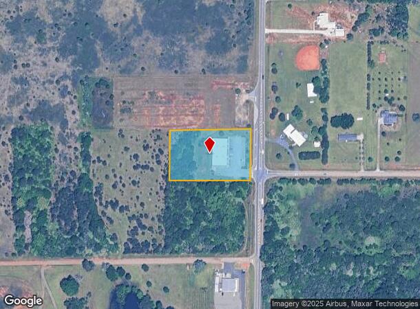
2203 Us Highway 41 N
Warner Robins, GA
Macon Rd Ac
00030A012000
TRACT 13A 2.147 AC LL 53&54 10TH
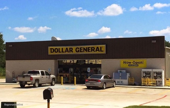
Wholesaleoutletdiscountstore
Houston
X
Georgia
13153C0151E
53&54
2024
2.15 AC
2024
Perry/Warner Robins
021206
Other Market Areas
9,504 SF
DEMOGRAPHICS near 2203 Us Highway 41 N
1 Mile
3 Mile
5 Mile
2024 Total Population
1,250
17,541
43,551
2029 Population
1,394
19,468
47,880
Pop Growth 2024-2029
+ 11.52%
+ 10.99%
+ 9.94%
Average Age
37
39
38
2024 Total Households
467
6,804
15,847
HH Growth 2024-2029
+ 11.13%
+ 10.79%
+ 9.77%
Median Household Inc
$70,124
$72,667
$85,368
Avg Household Size
2.70
2.50
2.70
2024 Avg HH Vehicles
2.00
2.00
2.00
Median Home Value
$194,642
$186,727
$199,875
Median Year Built
2004
1998
2001
Nearby Places
Map Layers
Map Styles
 Street
 Aerial
- Restaurants
- Banks
- Shops
- Fitness
- Groceries
SALE & LEASE HISTORY
LISTING DATE
SALE/LEASE

Jan 25, 2017
For Sale
Jan 24, 2020
For Sale
Nearby Properties
Address
Land Use
TOTAL SIZE
Lot Size
Zoning
Address
Land Use
TOTAL SIZE
Lot Size
Zoning
147,496 SF
66.05 AC
GU
Address
Land Use
TOTAL SIZE
Lot Size
Zoning
158,407 SF
218.84 AC
M2
Address
Land Use
TOTAL SIZE
Lot Size
Zoning
262,500 SF
20 AC
GU
Address
Land Use
TOTAL SIZE
Lot Size
Zoning
0.44 AC
Address
Land Use
TOTAL SIZE
Lot Size
Zoning
158,300 SF
30 AC
GU
Address
Land Use
TOTAL SIZE
Lot Size
Zoning
120,000 SF
20 AC
M1
Address
Land Use
TOTAL SIZE
Lot Size
Zoning
49,947 SF
4.03 AC
C2
Address
Land Use
TOTAL SIZE
Lot Size
Zoning
439.32 AC
M2
Address
Land Use
TOTAL SIZE
Lot Size
Zoning
439.32 AC
M2
Address
Land Use
TOTAL SIZE
Lot Size
Zoning
78,010 SF
20 AC
C2
Address
Land Use
TOTAL SIZE
Lot Size
Zoning
6,382 SF
24.71 AC
RM-2
Address
Land Use
TOTAL SIZE
Lot Size
Zoning
5,736 SF
16.65 AC
RM-2
Address
Land Use
TOTAL SIZE
Lot Size
Zoning
91,249 SF
15.85 AC
GU
Address
Land Use
TOTAL SIZE
Lot Size
Zoning
25,002 SF
15.17 AC
RM-2
Address
Land Use
TOTAL SIZE
Lot Size
Zoning
442.42 AC
M2
Address
Land Use
TOTAL SIZE
Lot Size
Zoning
151,525 SF
17.55 AC
C2
Address
Land Use
TOTAL SIZE
Lot Size
Zoning
106,055 SF
22.72 AC
GU
Address
Land Use
TOTAL SIZE
Lot Size
Zoning
46,200 SF
12.29 AC
C2
Address
Land Use
TOTAL SIZE
Lot Size
Zoning
19,810 SF
79.64 AC
GU
Address
Land Use
TOTAL SIZE
Lot Size
Zoning
31,248 SF
10.30 AC
RM-2
Address
Land Use
TOTAL SIZE
Lot Size
Zoning
54,262 SF
38.29 AC
M1
Address
Land Use
TOTAL SIZE
Lot Size
Zoning
4,820 SF
14.59 AC
RM-2
Address
Land Use
TOTAL SIZE
Lot Size
Zoning
12,000 SF
7.27 AC
RM-2
Address
Land Use
TOTAL SIZE
Lot Size
Zoning
4,800 SF
101.24 AC
RAG
Address
Land Use
TOTAL SIZE
Lot Size
Zoning
30,050 SF
47.52 AC
GU
Address
Land Use
TOTAL SIZE
Lot Size
Zoning
38,066 SF
11.73 AC
GU
Address
Land Use
TOTAL SIZE
Lot Size
Zoning
218.84 AC
M2
Address
Land Use
TOTAL SIZE
Lot Size
Zoning
42,908 SF
7.93 AC
C2
Address
Land Use
TOTAL SIZE
Lot Size
Zoning
4,820 SF
14.95 AC
RM-2
Address
Land Use
TOTAL SIZE
Lot Size
Zoning
124.57 AC
M2
The World's #1 Commercial Real Estate Marketplace
Connect with us
© 2025 CoStar Group
The information above has been obtained from sources believed reliable. While we do not doubt its accuracy we have not verified it and make no guarantee, warranty or representation about it. It is your responsibility to independently confirm its accuracy and completeness. Any projections, opinions, assumptions, or estimates used are for example only and do not represent the current or future performance of the property. The value of this transaction to you depends on tax and other factors which should be evaluated by your tax, financial, and legal advisors. You and your advisors should conduct a careful, independent investigation of the property to determine to your satisfaction the suitability of the property for your needs.