Property Record
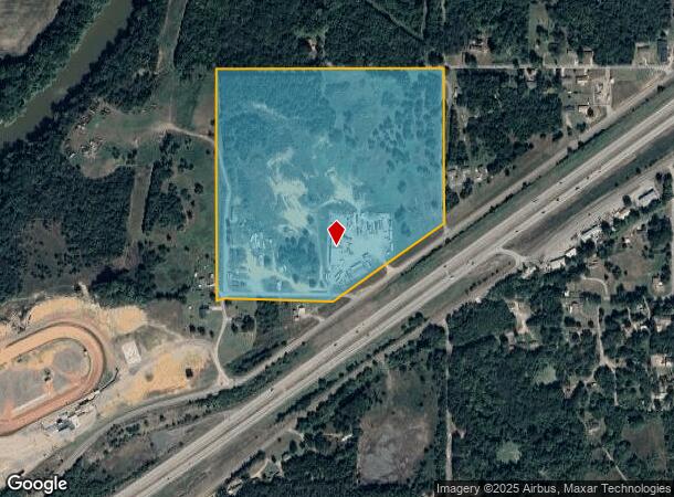
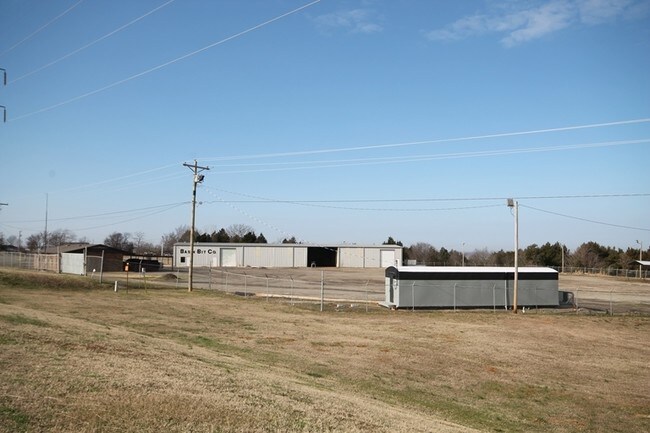
2203 W Race Track Rd, Pocola, OK 74902

NEARBY LISTINGS FOR SALE OR LEASE
Property Detail
2203 W Race Track Rd
Fort Smith
Township Add
Fort Smith, AR-OK
POCOLA TOWNSHIP ADD SEC 4 TWP 9N RNG 27E PT LOT 3 BEG SW COR N02DG31' W1344.1 N88DG06 E1320 TO NE COR NE NW S02DG15' E896 TO
P120-04-09N-27E-0-096-00
Le Flore
Autorepair
Oklahoma
2024
3
2025
37.39 AC
040102
Le Flore County
8,750 SF
DEMOGRAPHICS near 2203 W Race Track Rd
1 Mile
3 Mile
5 Mile
2024 Total Population
319
13,395
30,508
2029 Population
333
13,641
31,113
Pop Growth 2024-2029
+ 4.39%
+ 1.84%
+ 1.98%
Average Age
43
40
40
2024 Total Households
135
5,433
12,480
HH Growth 2024-2029
+ 3.70%
+ 1.80%
+ 1.96%
Median Household Inc
$42,708
$57,257
$52,432
Avg Household Size
2.30
2.40
2.40
2024 Avg HH Vehicles
2.00
2.00
2.00
Median Home Value
$116,216
$161,865
$155,215
Median Year Built
1976
1983
1981
Nearby Places
Map Layers
Map Styles
 Street
 Aerial
- Restaurants
- Banks
- Shops
- Fitness
- Groceries
PUBLIC TRANSPORTATION
AIRPORT
Fort Smith Regional
DRIVE
WALK
Distance
Fort Smith Regional
17 min
8.9 mi
Freight Ports
Tulsa Port of Inola
DRIVE
WALK
Distance
Tulsa Port of Inola
139 min
114.4 mi
SALE & LEASE HISTORY
LISTING DATE
SALE/LEASE

Sep 24, 2016
For Sale
Mar 20, 2017
For Lease
Jan 16, 2018
For Sale
Jan 16, 2018
For Lease
Nearby Properties
Address
Land Use
TOTAL SIZE
Lot Size
Zoning
Address
Land Use
TOTAL SIZE
Lot Size
Zoning
1,350 SF
5.07 AC
C1
Address
Land Use
TOTAL SIZE
Lot Size
Zoning
50,443 SF
37.12 AC
Address
Land Use
TOTAL SIZE
Lot Size
Zoning
87,003 SF
5.29 AC
Address
Land Use
TOTAL SIZE
Lot Size
Zoning
40,551 SF
5 AC
Address
Land Use
TOTAL SIZE
Lot Size
Zoning
31,275 SF
20.54 AC
Address
Land Use
TOTAL SIZE
Lot Size
Zoning
59,176 SF
3.52 AC
Address
Land Use
TOTAL SIZE
Lot Size
Zoning
55,532 SF
6 AC
Address
Land Use
TOTAL SIZE
Lot Size
Zoning
23,548 SF
4.30 AC
Address
Land Use
TOTAL SIZE
Lot Size
Zoning
29,920 SF
4.20 AC
Address
Land Use
TOTAL SIZE
Lot Size
Zoning
35,641 SF
0.96 AC
Address
Land Use
TOTAL SIZE
Lot Size
Zoning
317,972 SF
36.19 AC
Address
Land Use
TOTAL SIZE
Lot Size
Zoning
86,522 SF
4.20 AC
Address
Land Use
TOTAL SIZE
Lot Size
Zoning
15,877 SF
2.51 AC
Address
Land Use
TOTAL SIZE
Lot Size
Zoning
32,792 SF
4.13 AC
Address
Land Use
TOTAL SIZE
Lot Size
Zoning
9,284 SF
2.71 AC
Address
Land Use
TOTAL SIZE
Lot Size
Zoning
49,280 SF
4.14 AC
Address
Land Use
TOTAL SIZE
Lot Size
Zoning
36,136 SF
3.57 AC
Address
Land Use
TOTAL SIZE
Lot Size
Zoning
54,327 SF
4.99 AC
Address
Land Use
TOTAL SIZE
Lot Size
Zoning
48,070 SF
2.94 AC
Address
Land Use
TOTAL SIZE
Lot Size
Zoning
11,303 SF
1.91 AC
Address
Land Use
TOTAL SIZE
Lot Size
Zoning
6,927 SF
1.49 AC
Address
Land Use
TOTAL SIZE
Lot Size
Zoning
31,865 SF
2.24 AC
Address
Land Use
TOTAL SIZE
Lot Size
Zoning
8,640 SF
2.17 AC
Address
Land Use
TOTAL SIZE
Lot Size
Zoning
4,376 SF
3.67 AC
Address
Land Use
TOTAL SIZE
Lot Size
Zoning
22,800 SF
2.58 AC
Address
Land Use
TOTAL SIZE
Lot Size
Zoning
10,542 SF
1.68 AC
Address
Land Use
TOTAL SIZE
Lot Size
Zoning
11,164 SF
1.69 AC
Address
Land Use
TOTAL SIZE
Lot Size
Zoning
3,600 SF
0.84 AC
Address
Land Use
TOTAL SIZE
Lot Size
Zoning
39,150 SF
4.09 AC
Address
Land Use
TOTAL SIZE
Lot Size
Zoning
12,875 SF
15.72 AC
The World's #1 Commercial Real Estate Marketplace
Connect with us
© 2026 CoStar Group
The information above has been obtained from sources believed reliable. While we do not doubt its accuracy we have not verified it and make no guarantee, warranty or representation about it. It is your responsibility to independently confirm its accuracy and completeness. Any projections, opinions, assumptions, or estimates used are for example only and do not represent the current or future performance of the property. The value of this transaction to you depends on tax and other factors which should be evaluated by your tax, financial, and legal advisors. You and your advisors should conduct a careful, independent investigation of the property to determine to your satisfaction the suitability of the property for your needs.