Property Record
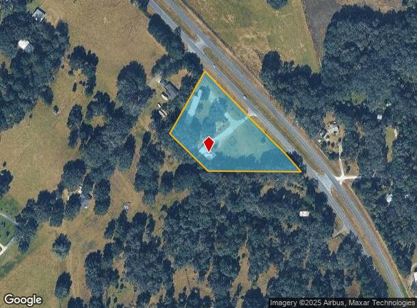
22030 Highway 441 N, Micanopy, FL 32667


NEARBY LISTINGS FOR SALE OR LEASE
Property Detail
22030 Highway 441 N
02118-001-00
SEC 05 TWP 12 RGE 21 COM AT THE SE COR OF SEC 5 TH S 89-52-26 W W 739.71 FT TO THE POB PT ALSO BEING ON A CURVE CONCAVED SWLY HAVING A RADIUS OF 2732.93 FT A CENTRAL ANGLE OF 04-58-36 TH NWLY ALONG ARC OF CURVE 237.36 FT A CHORD BEARING & DISTANCE OF
Restaurantbuilding
Marion
X
Florida
12083C0130D
3.42 AC
2025
Outlying Marion County
2025
Ocala
000203
Ocala, FL
13,707 SF
DEMOGRAPHICS near 22030 Highway 441 N
1 Mile
3 Mile
5 Mile
2024 Total Population
319
1,209
4,260
2029 Population
349
1,308
4,586
Pop Growth 2024-2029
+ 9.40%
+ 8.19%
+ 7.65%
Average Age
46
47
47
2024 Total Households
137
525
1,881
HH Growth 2024-2029
+ 8.76%
+ 8.00%
+ 7.50%
Median Household Inc
$55,000
$59,582
$56,882
Avg Household Size
2.30
2.30
2.20
2024 Avg HH Vehicles
2.00
2.00
2.00
Median Home Value
$264,285
$266,896
$275,184
Median Year Built
1977
1977
1980
Nearby Places
Map Layers
Map Styles
 Street
 Aerial
- Restaurants
- Banks
- Shops
- Fitness
- Groceries
PUBLIC TRANSPORTATION
AIRPORT
Gainesville Regional
DRIVE
WALK
Distance
Gainesville Regional
34 min
20.9 mi
Freight Ports
Jacksonville Port
DRIVE
WALK
Distance
Jacksonville Port
119 min
90.7 mi
Nearby Properties
Address
Land Use
TOTAL SIZE
Lot Size
Zoning
Address
Land Use
TOTAL SIZE
Lot Size
Zoning
12,319 SF
50.98 AC
A1
Address
Land Use
TOTAL SIZE
Lot Size
Zoning
21,120 SF
3.14 AC
B5
Address
Land Use
TOTAL SIZE
Lot Size
Zoning
9,603 SF
6.30 AC
GU
Address
Land Use
TOTAL SIZE
Lot Size
Zoning
6,468 SF
159.54 AC
A1
Address
Land Use
TOTAL SIZE
Lot Size
Zoning
9,230 SF
1.24 AC
B4
Address
Land Use
TOTAL SIZE
Lot Size
Zoning
5,091 SF
19.70 AC
A1
Address
Land Use
TOTAL SIZE
Lot Size
Zoning
2,805 SF
52.99 AC
B2
Address
Land Use
TOTAL SIZE
Lot Size
Zoning
316 AC
A
Address
Land Use
TOTAL SIZE
Lot Size
Zoning
5,318 SF
7.09 AC
A1
Address
Land Use
TOTAL SIZE
Lot Size
Zoning
9,927 SF
3.42 AC
B4
Address
Land Use
TOTAL SIZE
Lot Size
Zoning
3,947 SF
20.71 AC
A
Address
Land Use
TOTAL SIZE
Lot Size
Zoning
16,475 SF
8 AC
M1
Address
Land Use
TOTAL SIZE
Lot Size
Zoning
2,160 SF
30.61 AC
A1
Address
Land Use
TOTAL SIZE
Lot Size
Zoning
6,766 SF
12.33 AC
A
Address
Land Use
TOTAL SIZE
Lot Size
Zoning
3,528 SF
1.18 AC
B2
Address
Land Use
TOTAL SIZE
Lot Size
Zoning
7,649 SF
2.70 AC
PD
Address
Land Use
TOTAL SIZE
Lot Size
Zoning
4,800 SF
0.66 AC
B2
Address
Land Use
TOTAL SIZE
Lot Size
Zoning
5,349 SF
0.75 AC
A
Address
Land Use
TOTAL SIZE
Lot Size
Zoning
6,349 SF
0.90 AC
GU
Address
Land Use
TOTAL SIZE
Lot Size
Zoning
5,000 SF
7.46 AC
B4
Address
Land Use
TOTAL SIZE
Lot Size
Zoning
5,000 SF
0.34 AC
R1
Address
Land Use
TOTAL SIZE
Lot Size
Zoning
4,716 SF
160.39 AC
A
Address
Land Use
TOTAL SIZE
Lot Size
Zoning
6,756 SF
3.01 AC
A1
Address
Land Use
TOTAL SIZE
Lot Size
Zoning
1,920 SF
16.74 AC
A1
Address
Land Use
TOTAL SIZE
Lot Size
Zoning
3,337 SF
10 AC
A
Address
Land Use
TOTAL SIZE
Lot Size
Zoning
1,200 SF
4 AC
B4
Address
Land Use
TOTAL SIZE
Lot Size
Zoning
2,056 SF
2.07 AC
GU
Address
Land Use
TOTAL SIZE
Lot Size
Zoning
3,452 SF
0.83 AC
A
Address
Land Use
TOTAL SIZE
Lot Size
Zoning
4,766 SF
0.32 AC
C1
Address
Land Use
TOTAL SIZE
Lot Size
Zoning
3,781 SF
3 AC
B5
The World's #1 Commercial Real Estate Marketplace
Connect with us
© 2026 CoStar Group
The information above has been obtained from sources believed reliable. While we do not doubt its accuracy we have not verified it and make no guarantee, warranty or representation about it. It is your responsibility to independently confirm its accuracy and completeness. Any projections, opinions, assumptions, or estimates used are for example only and do not represent the current or future performance of the property. The value of this transaction to you depends on tax and other factors which should be evaluated by your tax, financial, and legal advisors. You and your advisors should conduct a careful, independent investigation of the property to determine to your satisfaction the suitability of the property for your needs.