Property Record
2205 Nw 132Nd Pl, Miami, FL 33182


NEARBY LISTINGS FOR SALE OR LEASE
Property Detail
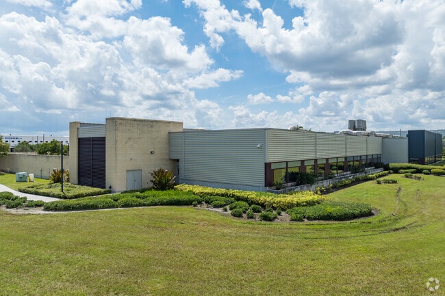
2205 Nw 132Nd Pl
30-3935-015-0010
Beacon Lakes Eagle
Officebuilding
BEACON LAKES EAGLE PB 168-077 T-23034 TR A LOT SIZE 398182 SQ FT M/L FAU 30 3935 007 0032 F/A/U 3039350150010
AH
Miami/Dade
12086C0266L
Florida
2024
9.14 AC
2025
Miami Airport West
014100
South Florida
56,215 SF
Miami-Miami Beach-Kendall, FL
DEMOGRAPHICS near 2205 Nw 132Nd Pl
1 Mile
3 Mile
5 Mile
2024 Total Population
1,115
66,014
250,376
2029 Population
1,072
63,762
244,660
Pop Growth 2024-2029
(3.86%)
(3.41%)
(2.28%)
Average Age
44
42
41
2024 Total Households
320
20,328
79,910
HH Growth 2024-2029
(4.38%)
(3.89%)
(2.66%)
Median Household Inc
$92,209
$64,380
$67,404
Avg Household Size
3.40
3.10
3.00
2024 Avg HH Vehicles
2.00
2.00
2.00
Median Home Value
$401,031
$352,940
$393,369
Median Year Built
1993
1988
1988
Nearby Places
Map Layers
Map Styles
 Street
 Aerial
- Restaurants
- Banks
- Shops
- Fitness
- Groceries
PUBLIC TRANSPORTATION
COMMUTER RAIL
Palmetto (Metrorail Green Line - Miami-Dade Transit (Metrorail/Metromover))
DRIVE
WALK
Distance
Palmetto (Metrorail Green Line - Miami-Dade Transit (Metrorail/Metromover))
20 min
9.5 mi
AIRPORT
Miami International
DRIVE
WALK
Distance
Miami International
20 min
8.7 mi
Fort Lauderdale/Hollywood International
DRIVE
WALK
Distance
Fort Lauderdale/Hollywood International
46 min
34.0 mi
Freight Ports
Port of Miami
DRIVE
WALK
Distance
Port of Miami
31 min
17.9 mi
Nearby Properties
Address
Land Use
TOTAL SIZE
Lot Size
Zoning
Address
Land Use
TOTAL SIZE
Lot Size
Zoning
2,512,642 SF
100.78 AC
6400
Address
Land Use
TOTAL SIZE
Lot Size
Zoning
585,943 SF
22.41 AC
3800
Address
Land Use
TOTAL SIZE
Lot Size
Zoning
475,423 SF
14.56 AC
9450
Address
Land Use
TOTAL SIZE
Lot Size
Zoning
899,162 SF
9.89 AC
7700
Address
Land Use
TOTAL SIZE
Lot Size
Zoning
448,531 SF
37 AC
6400
Address
Land Use
TOTAL SIZE
Lot Size
Zoning
540,427 SF
26.86 AC
3700
Address
Land Use
TOTAL SIZE
Lot Size
Zoning
145.77 AC
7700
Address
Land Use
TOTAL SIZE
Lot Size
Zoning
755,156 SF
29.44 AC
7100
Address
Land Use
TOTAL SIZE
Lot Size
Zoning
359,107 SF
9.58 AC
9450
Address
Land Use
TOTAL SIZE
Lot Size
Zoning
468,411 SF
21.36 AC
7100
Address
Land Use
TOTAL SIZE
Lot Size
Zoning
318,775 SF
18.88 AC
3700
Address
Land Use
TOTAL SIZE
Lot Size
Zoning
1,182,342 SF
14.60 AC
7100
Address
Land Use
TOTAL SIZE
Lot Size
Zoning
301,695 SF
17.60 AC
3700
Address
Land Use
TOTAL SIZE
Lot Size
Zoning
477,987 SF
26.98 AC
7100
Address
Land Use
TOTAL SIZE
Lot Size
Zoning
267,129 SF
16.55 AC
3800
Address
Land Use
TOTAL SIZE
Lot Size
Zoning
312,456 SF
15.66 AC
7100
Address
Land Use
TOTAL SIZE
Lot Size
Zoning
197,776 SF
20.15 AC
6600
Address
Land Use
TOTAL SIZE
Lot Size
Zoning
126,793 SF
5.86 AC
6400
Address
Land Use
TOTAL SIZE
Lot Size
Zoning
400,278 SF
18.37 AC
7100
Address
Land Use
TOTAL SIZE
Lot Size
Zoning
398,620 SF
17.39 AC
7600
Address
Land Use
TOTAL SIZE
Lot Size
Zoning
236,116 SF
3.59 AC
6400
Address
Land Use
TOTAL SIZE
Lot Size
Zoning
157,214 SF
12.82 AC
7100
Address
Land Use
TOTAL SIZE
Lot Size
Zoning
356,472 SF
11.66 AC
8900
Address
Land Use
TOTAL SIZE
Lot Size
Zoning
336,559 SF
24.23 AC
7100
Address
Land Use
TOTAL SIZE
Lot Size
Zoning
336,526 SF
16.44 AC
7100
Address
Land Use
TOTAL SIZE
Lot Size
Zoning
315,831 SF
16.41 AC
9500
Address
Land Use
TOTAL SIZE
Lot Size
Zoning
246,114 SF
3.01 AC
3800
Address
Land Use
TOTAL SIZE
Lot Size
Zoning
297,851 SF
34.21 AC
7100
Address
Land Use
TOTAL SIZE
Lot Size
Zoning
310,064 SF
508.34 AC
8900
Address
Land Use
TOTAL SIZE
Lot Size
Zoning
484,900 SF
152.93 AC
8900
The World's #1 Commercial Real Estate Marketplace
Connect with us
© 2025 CoStar Group
The information above has been obtained from sources believed reliable. While we do not doubt its accuracy we have not verified it and make no guarantee, warranty or representation about it. It is your responsibility to independently confirm its accuracy and completeness. Any projections, opinions, assumptions, or estimates used are for example only and do not represent the current or future performance of the property. The value of this transaction to you depends on tax and other factors which should be evaluated by your tax, financial, and legal advisors. You and your advisors should conduct a careful, independent investigation of the property to determine to your satisfaction the suitability of the property for your needs.