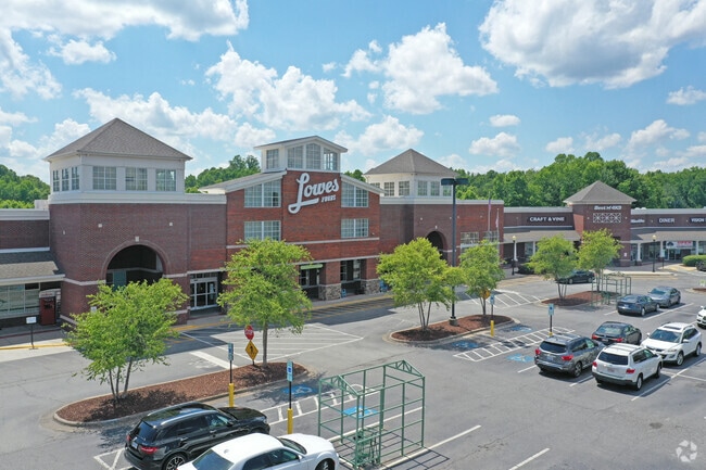
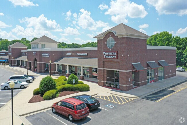
Property Record
2205 Oak Ridge Rd, Oak Ridge, NC 27310

Property Detail
2205 Oak Ridge Rd
0166224
OAK RIDGE COMMONS SHOPPING CENTER LO:LAM1 PL:147-131
Storebuilding
GUILFORD
SC
North Carolina
B and X Area of moderate flood hazard, usually the area between the limits of the 100-year and 500-year floods.
18
2024
13.16 AC
2025
NW Guilford County
015902
Greensboro/Winston-Salem
100,320 SF
Greensboro-High Point, NC
NEARBY LISTINGS FOR SALE OR LEASE
DEMOGRAPHICS near 2205 Oak Ridge Rd
1 mile
3 mile
5 mile
2025 Total Population
1,610
13,730
41,551
2030 Population
1,685
14,318
43,148
Pop Growth 2025-2030
+ 4.66%
+ 4.28%
+ 3.84%
Average Age
41
41
41
2025 Total Households
554
4,791
15,392
HH Growth 2025-2030
+ 4.69%
+ 4.45%
+ 4.02%
Median Household Inc
$150,781
$133,672
$107,151
Avg Household Size
2.90
2.90
2.70
2025 Avg HH Vehicles
3.00
3.00
2.00
Median Home Value
$552,631
$528,815
$389,791
Median Year Built
1998
1999
1995
Nearby Places
Map Layers
Map Styles
 Street
 Aerial
Layers
 Traffic
 Biking
Places
Listings with unknown addresses are not visible on the map
- Restaurants
- Banks
- Shops
- Fitness
- Groceries
PUBLIC TRANSPORTATION
AIRPORT
Piedmont Triad International
Drive
Walk
Distance
Piedmont Triad International
20 min
10.9 mi
Freight Ports
Virginia Port Authority - Richmond
Drive
Walk
Distance
Virginia Port Authority - Richmond
249 min
214.7 mi
SALE & LEASE HISTORY
LISTING DATE
SALE/LEASE

Sep 25, 2016
For Lease
Nov 11, 2025
For Lease
Mar 30, 2017
For Lease
Jan 23, 2020
For Lease
Nearby Properties
Address
Land Use
TOTAL SIZE
Lot Size
Zoning
Address
Land Use
TOTAL SIZE
Lot Size
Zoning
169,401 SF
30.89 AC
PI
Address
Land Use
TOTAL SIZE
Lot Size
Zoning
254,857 SF
82.98 AC
PI
Address
Land Use
TOTAL SIZE
Lot Size
Zoning
22,757 SF
94.40 AC
PI
Address
Land Use
TOTAL SIZE
Lot Size
Zoning
25,755 SF
509.95 AC
AG
Address
Land Use
TOTAL SIZE
Lot Size
Zoning
50,853 SF
23.39 AC
CD-HB
Address
Land Use
TOTAL SIZE
Lot Size
Zoning
0.77 AC
CU-SC
Address
Land Use
TOTAL SIZE
Lot Size
Zoning
21,768 SF
3.06 AC
CU-SC
Address
Land Use
TOTAL SIZE
Lot Size
Zoning
20,418 SF
31.84 AC
PI
Address
Land Use
TOTAL SIZE
Lot Size
Zoning
16,445 SF
2.69 AC
CU-GO-M
Address
Land Use
TOTAL SIZE
Lot Size
Zoning
6.38 AC
PUD
Address
Land Use
TOTAL SIZE
Lot Size
Zoning
8,336 SF
4.01 AC
CU-LB
Address
Land Use
TOTAL SIZE
Lot Size
Zoning
5,761 SF
39.01 AC
PI
Address
Land Use
TOTAL SIZE
Lot Size
Zoning
10,820 SF
1.95 AC
CU-GB
Address
Land Use
TOTAL SIZE
Lot Size
Zoning
4,692 SF
1.17 AC
CU-SC
Address
Land Use
TOTAL SIZE
Lot Size
Zoning
3,715 SF
1.34 AC
CU-GO-M
Address
Land Use
TOTAL SIZE
Lot Size
Zoning
66.19 AC
PI
Address
Land Use
TOTAL SIZE
Lot Size
Zoning
4,237 SF
10.82 AC
GO-M
Address
Land Use
TOTAL SIZE
Lot Size
Zoning
3,594 SF
1.15 AC
SC
Address
Land Use
TOTAL SIZE
Lot Size
Zoning
115.46 AC
AG
Address
Land Use
TOTAL SIZE
Lot Size
Zoning
13,872 SF
1.96 AC
GO-M
Address
Land Use
TOTAL SIZE
Lot Size
Zoning
9,287 SF
1.66 AC
CU-SC
Address
Land Use
TOTAL SIZE
Lot Size
Zoning
14,350 SF
1.45 AC
LB
Address
Land Use
TOTAL SIZE
Lot Size
Zoning
3,874 SF
1.74 AC
CU-SC
Address
Land Use
TOTAL SIZE
Lot Size
Zoning
4,950 SF
52.58 AC
AG
Address
Land Use
TOTAL SIZE
Lot Size
Zoning
6,368 SF
22.42 AC
AG
Address
Land Use
TOTAL SIZE
Lot Size
Zoning
14,023 SF
6.38 AC
AG
Address
Land Use
TOTAL SIZE
Lot Size
Zoning
6,675 SF
1.20 AC
SC
Address
Land Use
TOTAL SIZE
Lot Size
Zoning
14,922 SF
6 AC
RS-30
Address
Land Use
TOTAL SIZE
Lot Size
Zoning
14,280 SF
3.98 AC
PI
The World's #1 Commercial Real Estate Marketplace
Connect with us
© 2026 CoStar Group
The information above has been obtained from sources believed reliable. While we do not doubt its accuracy we have not verified it and make no guarantee, warranty or representation about it. It is your responsibility to independently confirm its accuracy and completeness. Any projections, opinions, assumptions, or estimates used are for example only and do not represent the current or future performance of the property. The value of this transaction to you depends on tax and other factors which should be evaluated by your tax, financial, and legal advisors. You and your advisors should conduct a careful, independent investigation of the property to determine to your satisfaction the suitability of the property for your needs.