Property Record
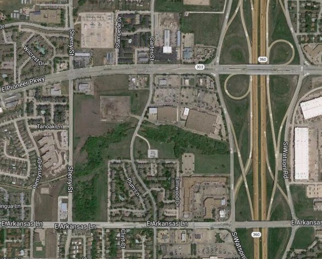
2205 Sherry St, Arlington, TX 76010

Property Detail
2205 Sherry St
Dallas-Fort Worth-Arlington, TX
PIONEER VILLAGE BLOCK 2 LOT 1
42564881
TARRANT
Residentialacreage
Texas
AE The base floodplain where base flood elevations are provided. AE Zones are now used on new format FIRMs instead of A1-A30 Zones.
1
2023
4.12 AC
2025
Arlington/Mansfield
122901
Dallas/Ft Worth
NEARBY LISTINGS FOR SALE OR LEASE
DEMOGRAPHICS near 2205 Sherry St
1 mile
3 mile
5 mile
2025 Total Population
23,999
136,853
369,991
2030 Population
25,004
144,231
386,980
Pop Growth 2025-2030
+ 4.19%
+ 5.39%
+ 4.59%
Average Age
34
34
36
2025 Total Households
8,385
46,380
131,175
HH Growth 2025-2030
+ 4.26%
+ 5.54%
+ 4.77%
Median Household Inc
$49,697
$55,910
$64,140
Avg Household Size
2.80
2.80
2.70
2025 Avg HH Vehicles
2.00
2.00
2.00
Median Home Value
$221,567
$247,377
$270,450
Median Year Built
1979
1981
1983
Nearby Places
Map Layers
Map Styles
 Street
 Aerial
Layers
 Traffic
 Biking
Places
Listings with unknown addresses are not visible on the map
- Restaurants
- Banks
- Shops
- Fitness
- Groceries
PUBLIC TRANSPORTATION
COMMUTER RAIL
Drive
Walk
Distance
15 min
9.2 mi
AIRPORT
Dallas-Fort Worth International
Drive
Walk
Distance
Dallas-Fort Worth International
24 min
15.5 mi
Dallas Love Field
Drive
Walk
Distance
Dallas Love Field
35 min
24.2 mi
SALE & LEASE HISTORY
LISTING DATE
SALE/LEASE

Apr 17, 2017
For Sale
Nearby Properties
Address
Land Use
TOTAL SIZE
Lot Size
Zoning
Address
Land Use
TOTAL SIZE
Lot Size
Zoning
1,700,000 SF
8.23 AC
Address
Land Use
TOTAL SIZE
Lot Size
Zoning
3,015,800 SF
72.86 AC
Address
Land Use
TOTAL SIZE
Lot Size
Zoning
1,400,000 SF
15.30 AC
Address
Land Use
TOTAL SIZE
Lot Size
Zoning
269,257 SF
21.33 AC
Address
Land Use
TOTAL SIZE
Lot Size
Zoning
378,182 SF
5.02 AC
Address
Land Use
TOTAL SIZE
Lot Size
Zoning
287,560 SF
3.28 AC
Address
Land Use
TOTAL SIZE
Lot Size
Zoning
320,636 SF
12.71 AC
Address
Land Use
TOTAL SIZE
Lot Size
Zoning
595,207 SF
7.20 AC
Address
Land Use
TOTAL SIZE
Lot Size
Zoning
5,995,915 SF
248.78 AC
Address
Land Use
TOTAL SIZE
Lot Size
Zoning
804,384 SF
48.38 AC
Address
Land Use
TOTAL SIZE
Lot Size
Zoning
799,893 SF
19.43 AC
Address
Land Use
TOTAL SIZE
Lot Size
Zoning
1,577,320 SF
122.55 AC
Z123
Address
Land Use
TOTAL SIZE
Lot Size
Zoning
860,445 SF
50.39 AC
Z123
Address
Land Use
TOTAL SIZE
Lot Size
Zoning
529,992 SF
35.21 AC
Address
Land Use
TOTAL SIZE
Lot Size
Zoning
456,473 SF
32.79 AC
Address
Land Use
TOTAL SIZE
Lot Size
Zoning
1,114,563 SF
89.72 AC
Address
Land Use
TOTAL SIZE
Lot Size
Zoning
462,207 SF
2.82 AC
Address
Land Use
TOTAL SIZE
Lot Size
Zoning
368,004 SF
13.89 AC
Address
Land Use
TOTAL SIZE
Lot Size
Zoning
422,300 SF
2.50 AC
Address
Land Use
TOTAL SIZE
Lot Size
Zoning
347,421 SF
4.47 AC
Address
Land Use
TOTAL SIZE
Lot Size
Zoning
377,463 SF
19.50 AC
Address
Land Use
TOTAL SIZE
Lot Size
Zoning
1,261,810 SF
80.53 AC
Address
Land Use
TOTAL SIZE
Lot Size
Zoning
139,821 SF
Address
Land Use
TOTAL SIZE
Lot Size
Zoning
492,837 SF
4.99 AC
Address
Land Use
TOTAL SIZE
Lot Size
Zoning
389,946 SF
2.35 AC
Address
Land Use
TOTAL SIZE
Lot Size
Zoning
753,721 SF
42.65 AC
Address
Land Use
TOTAL SIZE
Lot Size
Zoning
247,880 SF
20.93 AC
Z236
Address
Land Use
TOTAL SIZE
Lot Size
Zoning
206,650 SF
18.92 AC
Address
Land Use
TOTAL SIZE
Lot Size
Zoning
402,935 SF
20.72 AC
Address
Land Use
TOTAL SIZE
Lot Size
Zoning
375,213 SF
17.77 AC
The World's #1 Commercial Real Estate Marketplace
Connect with us
© 2026 CoStar Group
The information above has been obtained from sources believed reliable. While we do not doubt its accuracy we have not verified it and make no guarantee, warranty or representation about it. It is your responsibility to independently confirm its accuracy and completeness. Any projections, opinions, assumptions, or estimates used are for example only and do not represent the current or future performance of the property. The value of this transaction to you depends on tax and other factors which should be evaluated by your tax, financial, and legal advisors. You and your advisors should conduct a careful, independent investigation of the property to determine to your satisfaction the suitability of the property for your needs.