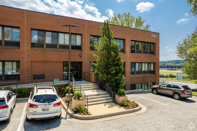
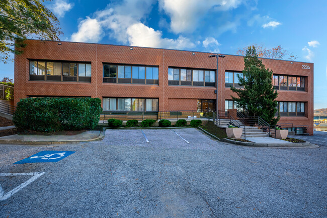
Property Record
2 Roundridge Rd, Lutherville Timonium, MD 21093

Current Lease Availabilities
Property Detail
2 Roundridge Rd
08-0803049980
STRATFORD
Commercialacreage
BALTIMORE
RO
Maryland
B and X Area of moderate flood hazard, usually the area between the limits of the 100-year and 500-year floods.
1
2024
0.49 AC
2025
Route 83 Corridor South
408703
Baltimore
361 SF
Baltimore-Columbia-Towson, MD
NEARBY LISTINGS FOR SALE OR LEASE
DEMOGRAPHICS near 2 Roundridge Rd
1 mile
3 mile
5 mile
2025 Total Population
9,613
68,379
134,425
2030 Population
9,608
68,531
135,175
Pop Growth 2025-2030
(0.05%)
+ 0.22%
+ 0.56%
Average Age
41
42
42
2025 Total Households
3,696
28,244
54,227
HH Growth 2025-2030
(0.19%)
+ 0.25%
+ 0.66%
Median Household Inc
$115,246
$101,388
$104,803
Avg Household Size
2.50
2.30
2.30
2025 Avg HH Vehicles
2.00
2.00
2.00
Median Home Value
$451,742
$466,404
$477,741
Median Year Built
1966
1975
1973
Nearby Places
Map Layers
Map Styles
 Street
 Aerial
Transit
 Traffic
 Biking
Places
Listings with unknown addresses are not visible on the map
- Restaurants
- Banks
- Shops
- Fitness
- Groceries
PUBLIC TRANSPORTATION
TRANSIT/SUBWAY
Timonium (Hunt Valley & BWI Marshall - Maryland Transit Administration Light Rail (Baltimore Light Rail), Timonium & Cromwell - Maryland Transit Administration Light Rail (Baltimore Light Rail))
Drive
Walk
Distance
Timonium (Hunt Valley & BWI Marshall - Maryland Transit Administration Light Rail (Baltimore Light Rail), Timonium & Cromwell - Maryland Transit Administration Light Rail (Baltimore Light Rail))
4 min
11 min
0.6 mi
AIRPORT
Baltimore/Washington International Thurgood Marshall
Drive
Walk
Distance
Baltimore/Washington International Thurgood Marshall
38 min
24.7 mi
Freight Ports
Port of Baltimore
Drive
Walk
Distance
Port of Baltimore
31 min
16.4 mi
Nearby Properties
Address
Land Use
TOTAL SIZE
Lot Size
Zoning
Address
Land Use
TOTAL SIZE
Lot Size
Zoning
217,147 SF
5.08 AC
MLIM
Address
Land Use
TOTAL SIZE
Lot Size
Zoning
720,989 SF
32.65 AC
Address
Land Use
TOTAL SIZE
Lot Size
Zoning
561,042 SF
38.91 AC
DR2
Address
Land Use
TOTAL SIZE
Lot Size
Zoning
38.89 AC
DR16
Address
Land Use
TOTAL SIZE
Lot Size
Zoning
13,468 SF
32.08 AC
DR16
Address
Land Use
TOTAL SIZE
Lot Size
Zoning
28.74 AC
DR16
Address
Land Use
TOTAL SIZE
Lot Size
Zoning
0.01 AC
DR5,5
Address
Land Use
TOTAL SIZE
Lot Size
Zoning
362,686 SF
88.84 AC
MR
Address
Land Use
TOTAL SIZE
Lot Size
Zoning
330,145 SF
16.20 AC
Address
Land Use
TOTAL SIZE
Lot Size
Zoning
26.73 AC
DR16
Address
Land Use
TOTAL SIZE
Lot Size
Zoning
4.94 AC
DR16
Address
Land Use
TOTAL SIZE
Lot Size
Zoning
178,200 SF
5.58 AC
BR-CR
Address
Land Use
TOTAL SIZE
Lot Size
Zoning
176,584 SF
31 AC
Address
Land Use
TOTAL SIZE
Lot Size
Zoning
10.63 AC
DR16
Address
Land Use
TOTAL SIZE
Lot Size
Zoning
157,062 SF
22 AC
Address
Land Use
TOTAL SIZE
Lot Size
Zoning
125,398 SF
15.13 AC
BM
Address
Land Use
TOTAL SIZE
Lot Size
Zoning
11.99 AC
DR16
Address
Land Use
TOTAL SIZE
Lot Size
Zoning
211,559 SF
15.88 AC
Address
Land Use
TOTAL SIZE
Lot Size
Zoning
73,186 SF
34 AC
Address
Land Use
TOTAL SIZE
Lot Size
Zoning
152,164 SF
8.13 AC
BM
Address
Land Use
TOTAL SIZE
Lot Size
Zoning
44.76 AC
DR3.5
Address
Land Use
TOTAL SIZE
Lot Size
Zoning
8.69 AC
DR16
Address
Land Use
TOTAL SIZE
Lot Size
Zoning
172,782 SF
5.35 AC
ML-IM
Address
Land Use
TOTAL SIZE
Lot Size
Zoning
12.86 AC
DR16
Address
Land Use
TOTAL SIZE
Lot Size
Zoning
14.49 AC
DR16
Address
Land Use
TOTAL SIZE
Lot Size
Zoning
94,534 SF
15.68 AC
BLCCC
Address
Land Use
TOTAL SIZE
Lot Size
Zoning
18.07 AC
DR3.5
Address
Land Use
TOTAL SIZE
Lot Size
Zoning
13.46 AC
DR16
Address
Land Use
TOTAL SIZE
Lot Size
Zoning
18.68 AC
DR3.5
Address
Land Use
TOTAL SIZE
Lot Size
Zoning
204,329 SF
25.45 AC
ML
The World's #1 Commercial Real Estate Marketplace
Connect with us
© 2026 CoStar Group
The information above has been obtained from sources believed reliable. While we do not doubt its accuracy we have not verified it and make no guarantee, warranty or representation about it. It is your responsibility to independently confirm its accuracy and completeness. Any projections, opinions, assumptions, or estimates used are for example only and do not represent the current or future performance of the property. The value of this transaction to you depends on tax and other factors which should be evaluated by your tax, financial, and legal advisors. You and your advisors should conduct a careful, independent investigation of the property to determine to your satisfaction the suitability of the property for your needs.