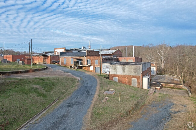
Property Record
2206 Dumont St, Asheboro, NC 27203

NEARBY LISTINGS FOR SALE OR LEASE
Property Detail
2206 Dumont St
Greensboro-High Point, NC
Central Falls
7773-03-7192
CENTRAL FALLS VLG;L8
Warehouse
Randolph
AE
North Carolina
3710777300J
8
2025
30.59 AC
2025
Randleman
030301
Greensboro/Winston-Salem
15,980 SF
DEMOGRAPHICS near 2206 Dumont St
1 Mile
3 Mile
5 Mile
2024 Total Population
1,101
15,206
37,276
2029 Population
1,154
15,832
38,747
Pop Growth 2024-2029
+ 4.81%
+ 4.12%
+ 3.95%
Average Age
39
37
39
2024 Total Households
418
5,866
14,688
HH Growth 2024-2029
+ 4.78%
+ 4.04%
+ 3.89%
Median Household Inc
$52,388
$52,062
$50,183
Avg Household Size
2.60
2.50
2.50
2024 Avg HH Vehicles
2.00
2.00
2.00
Median Home Value
$112,698
$127,041
$138,236
Median Year Built
1992
1990
1979
Nearby Places
Map Layers
Map Styles
 Street
 Aerial
- Restaurants
- Banks
- Shops
- Fitness
- Groceries
PUBLIC TRANSPORTATION
AIRPORT
Piedmont Triad International
DRIVE
WALK
Distance
Piedmont Triad International
44 min
30.9 mi
Freight Ports
Port of Wilmington
DRIVE
WALK
Distance
Port of Wilmington
232 min
194.7 mi
Nearby Properties
Address
Land Use
TOTAL SIZE
Lot Size
Zoning
Address
Land Use
TOTAL SIZE
Lot Size
Zoning
19,346 SF
46.13 AC
I2
Address
Land Use
TOTAL SIZE
Lot Size
Zoning
394,076 SF
28.62 AC
I2 (CZ)
Address
Land Use
TOTAL SIZE
Lot Size
Zoning
4,068 SF
30.24 AC
I3
Address
Land Use
TOTAL SIZE
Lot Size
Zoning
4,800 SF
24.07 AC
RA6
Address
Land Use
TOTAL SIZE
Lot Size
Zoning
84,857 SF
8.31 AC
B2
Address
Land Use
TOTAL SIZE
Lot Size
Zoning
143,671 SF
11.48 AC
I2
Address
Land Use
TOTAL SIZE
Lot Size
Zoning
172,096 SF
11.84 AC
I2
Address
Land Use
TOTAL SIZE
Lot Size
Zoning
6,336 SF
13.69 AC
OA6 (CZ)
Address
Land Use
TOTAL SIZE
Lot Size
Zoning
1,920 SF
13.75 AC
RA6
Address
Land Use
TOTAL SIZE
Lot Size
Zoning
159,217 SF
25.99 AC
I1
Address
Land Use
TOTAL SIZE
Lot Size
Zoning
85,333 SF
31.10 AC
I2
Address
Land Use
TOTAL SIZE
Lot Size
Zoning
1,948 SF
71.18 AC
I3
Address
Land Use
TOTAL SIZE
Lot Size
Zoning
2,800 SF
6.64 AC
RA6
Address
Land Use
TOTAL SIZE
Lot Size
Zoning
125,738 SF
27.16 AC
I2
Address
Land Use
TOTAL SIZE
Lot Size
Zoning
25,184 SF
8.23 AC
RA6
Address
Land Use
TOTAL SIZE
Lot Size
Zoning
89,012 SF
74.39 AC
RA
Address
Land Use
TOTAL SIZE
Lot Size
Zoning
179,650 SF
10.04 AC
I2
Address
Land Use
TOTAL SIZE
Lot Size
Zoning
115,296 SF
25.95 AC
I3
Address
Land Use
TOTAL SIZE
Lot Size
Zoning
1,595 SF
53.92 AC
R10 (CZ)
Address
Land Use
TOTAL SIZE
Lot Size
Zoning
16,540 SF
11.38 AC
I2
Address
Land Use
TOTAL SIZE
Lot Size
Zoning
16,500 SF
9.81 AC
I2
Address
Land Use
TOTAL SIZE
Lot Size
Zoning
7,652 SF
7.94 AC
RA6 (CZ)
Address
Land Use
TOTAL SIZE
Lot Size
Zoning
62,145 SF
10.12 AC
I2
Address
Land Use
TOTAL SIZE
Lot Size
Zoning
22,728 SF
1.78 AC
B2
Address
Land Use
TOTAL SIZE
Lot Size
Zoning
5,400 SF
3.77 AC
RA6
Address
Land Use
TOTAL SIZE
Lot Size
Zoning
35,662 SF
5.18 AC
OA6 (CZ)
Address
Land Use
TOTAL SIZE
Lot Size
Zoning
117,621 SF
12.16 AC
I3
Address
Land Use
TOTAL SIZE
Lot Size
Zoning
24,900 SF
4.57 AC
B2
Address
Land Use
TOTAL SIZE
Lot Size
Zoning
3,368 SF
206.24 AC
I3
Address
Land Use
TOTAL SIZE
Lot Size
Zoning
39,650 SF
9.27 AC
I2
The World's #1 Commercial Real Estate Marketplace
Connect with us
© 2025 CoStar Group
The information above has been obtained from sources believed reliable. While we do not doubt its accuracy we have not verified it and make no guarantee, warranty or representation about it. It is your responsibility to independently confirm its accuracy and completeness. Any projections, opinions, assumptions, or estimates used are for example only and do not represent the current or future performance of the property. The value of this transaction to you depends on tax and other factors which should be evaluated by your tax, financial, and legal advisors. You and your advisors should conduct a careful, independent investigation of the property to determine to your satisfaction the suitability of the property for your needs.