Property Record
2209 Conowingo Rd, Bel Air, MD 21015


NEARBY LISTINGS FOR SALE OR LEASE
Property Detail
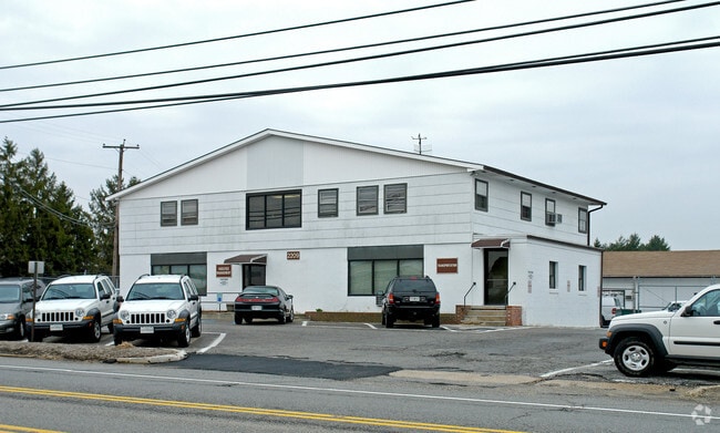
2209 Conowingo Rd
Baltimore-Columbia-Towson, MD
Wyndemede
03-031462
LOTS 1 & 2 1.45 AC 2209 CONOWINGO ROAD WYNDEMEDE S1 PT 11/36
Taxexempt
Harford
X
Maryland
24025C0154E
1,2
0
1.45 AC
2025
Outlying Harford County
303101
Baltimore
DEMOGRAPHICS near 2209 Conowingo Rd
1 Mile
3 Mile
5 Mile
2024 Total Population
2,385
39,939
78,988
2029 Population
2,446
40,972
81,013
Pop Growth 2024-2029
+ 2.56%
+ 2.59%
+ 2.56%
Average Age
39
41
42
2024 Total Households
776
14,750
29,361
HH Growth 2024-2029
+ 2.58%
+ 2.64%
+ 2.65%
Median Household Inc
$131,349
$104,210
$108,478
Avg Household Size
3.00
2.60
2.60
2024 Avg HH Vehicles
3.00
2.00
2.00
Median Home Value
$447,058
$363,417
$377,465
Median Year Built
1992
1988
1987
Nearby Places
Map Layers
Map Styles
 Street
 Aerial
- Restaurants
- Banks
- Shops
- Fitness
- Groceries
PUBLIC TRANSPORTATION
AIRPORT
Baltimore/Washington International Thurgood Marshall
DRIVE
WALK
Distance
Baltimore/Washington International Thurgood Marshall
59 min
40.7 mi
Freight Ports
Port Newark Container Terminal
DRIVE
WALK
Distance
Port Newark Container Terminal
47 min
30.3 mi
Nearby Properties
Address
Land Use
TOTAL SIZE
Lot Size
Zoning
Address
Land Use
TOTAL SIZE
Lot Size
Zoning
51,475 SF
7.85 AC
C1
Address
Land Use
TOTAL SIZE
Lot Size
Zoning
5,674 SF
288 AC
R4
Address
Land Use
TOTAL SIZE
Lot Size
Zoning
161,723 SF
72.26 AC
R1
Address
Land Use
TOTAL SIZE
Lot Size
Zoning
228 AC
COS
Address
Land Use
TOTAL SIZE
Lot Size
Zoning
55,164 SF
16.22 AC
B2
Address
Land Use
TOTAL SIZE
Lot Size
Zoning
13.02 AC
R3
Address
Land Use
TOTAL SIZE
Lot Size
Zoning
12.38 AC
R2
Address
Land Use
TOTAL SIZE
Lot Size
Zoning
6,084 SF
6.03 AC
B2
Address
Land Use
TOTAL SIZE
Lot Size
Zoning
78,264 SF
16.71 AC
AG
Address
Land Use
TOTAL SIZE
Lot Size
Zoning
52,245 SF
2.43 AC
R3/B1
Address
Land Use
TOTAL SIZE
Lot Size
Zoning
74,842 SF
0.77 AC
B2 B3
Address
Land Use
TOTAL SIZE
Lot Size
Zoning
10.73 AC
B2
Address
Land Use
TOTAL SIZE
Lot Size
Zoning
229,355 SF
59.83 AC
R2
Address
Land Use
TOTAL SIZE
Lot Size
Zoning
46,247 SF
10.45 AC
R2 B2
Address
Land Use
TOTAL SIZE
Lot Size
Zoning
35.99 AC
R2
Address
Land Use
TOTAL SIZE
Lot Size
Zoning
78,394 SF
24.56 AC
CI
Address
Land Use
TOTAL SIZE
Lot Size
Zoning
7,104 SF
10.95 AC
R2 R3
Address
Land Use
TOTAL SIZE
Lot Size
Zoning
77,649 SF
10.42 AC
GI
Address
Land Use
TOTAL SIZE
Lot Size
Zoning
63,392 SF
8.44 AC
VR
Address
Land Use
TOTAL SIZE
Lot Size
Zoning
9,464 SF
3.51 AC
R3
Address
Land Use
TOTAL SIZE
Lot Size
Zoning
97,060 SF
8.39 AC
B2
Address
Land Use
TOTAL SIZE
Lot Size
Zoning
51,868 SF
6.25 AC
R3
Address
Land Use
TOTAL SIZE
Lot Size
Zoning
149,009 SF
0.69 AC
B3
Address
Land Use
TOTAL SIZE
Lot Size
Zoning
17,901 SF
6.74 AC
R3
Address
Land Use
TOTAL SIZE
Lot Size
Zoning
19,224 SF
6.43 AC
R2
Address
Land Use
TOTAL SIZE
Lot Size
Zoning
53,964 SF
1.31 AC
R1
Address
Land Use
TOTAL SIZE
Lot Size
Zoning
84,100 SF
2.58 AC
B3
Address
Land Use
TOTAL SIZE
Lot Size
Zoning
5,690 SF
10.86 AC
R2
Address
Land Use
TOTAL SIZE
Lot Size
Zoning
12,900 SF
19.24 AC
AG
Address
Land Use
TOTAL SIZE
Lot Size
Zoning
45,890 SF
20.67 AC
R2
The World's #1 Commercial Real Estate Marketplace
Connect with us
© 2025 CoStar Group
The information above has been obtained from sources believed reliable. While we do not doubt its accuracy we have not verified it and make no guarantee, warranty or representation about it. It is your responsibility to independently confirm its accuracy and completeness. Any projections, opinions, assumptions, or estimates used are for example only and do not represent the current or future performance of the property. The value of this transaction to you depends on tax and other factors which should be evaluated by your tax, financial, and legal advisors. You and your advisors should conduct a careful, independent investigation of the property to determine to your satisfaction the suitability of the property for your needs.