Property Record
221 N Main St, Templeton, CA 93465

Current Lease Availabilities
NEARBY LISTINGS FOR SALE OR LEASE
Property Detail
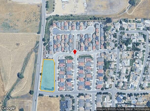
221 N Main St
San Luis Obispo-Paso Robles, CA
Tract 2994
040-216-001
TRACT 2994 35/97-111 LT 108
Commercialacreage
San Luis Obispo
X
California
06079C0612G
108
2024
1.52 AC
2025
North 101 Corridor
010302
San Luis Obispo/Paso Robles
DEMOGRAPHICS near 221 N Main St
1 mile
3 mile
5 mile
2024 Total Population
3,545
10,392
41,280
2029 Population
3,498
10,245
40,732
Pop Growth 2024-2029
(1.33%)
(1.41%)
(1.33%)
Average Age
40
43
42
2024 Total Households
1,299
3,884
15,413
HH Growth 2024-2029
(1.69%)
(1.75%)
(1.58%)
Median Household Inc
$101,416
$111,600
$100,195
Avg Household Size
2.60
2.60
2.60
2024 Avg HH Vehicles
2.00
2.00
2.00
Median Home Value
$730,636
$789,239
$750,159
Median Year Built
1989
1992
1985
Nearby Places
Map Layers
Map Styles
 Street
 Aerial
Transit
 Traffic
 Biking
Places
Listings with unknown addresses are not visible on the map
- Restaurants
- Banks
- Shops
- Fitness
- Groceries
PUBLIC TRANSPORTATION
COMMUTER RAIL
Paso Robles Amtrak Station (Coast Starlight - Amtrak)
Drive
Walk
Distance
Paso Robles Amtrak Station (Coast Starlight - Amtrak)
8 min
4.8 mi
AIRPORT
San Luis County Regional
Drive
Walk
Distance
San Luis County Regional
41 min
30.3 mi
Freight Ports
The Port of Hueneme
Drive
Walk
Distance
The Port of Hueneme
198 min
157.4 mi
Nearby Properties
Address
Land Use
TOTAL SIZE
Lot Size
Zoning
Address
Land Use
TOTAL SIZE
Lot Size
Zoning
23,092 SF
1.38 AC
Address
Land Use
TOTAL SIZE
Lot Size
Zoning
16 AC
PF
Address
Land Use
TOTAL SIZE
Lot Size
Zoning
138.68 AC
AG
Address
Land Use
TOTAL SIZE
Lot Size
Zoning
88,191 SF
4.01 AC
CPK
Address
Land Use
TOTAL SIZE
Lot Size
Zoning
221,386 SF
10.45 AC
M
Address
Land Use
TOTAL SIZE
Lot Size
Zoning
25,298 SF
1.84 AC
RSF
Address
Land Use
TOTAL SIZE
Lot Size
Zoning
49,520 SF
1.57 AC
C2
Address
Land Use
TOTAL SIZE
Lot Size
Zoning
3.26 AC
OP
Address
Land Use
TOTAL SIZE
Lot Size
Zoning
1,448 SF
3.17 AC
C2
Address
Land Use
TOTAL SIZE
Lot Size
Zoning
46,269 SF
2.30 AC
C2
Address
Land Use
TOTAL SIZE
Lot Size
Zoning
26,256 SF
1.19 AC
OP
Address
Land Use
TOTAL SIZE
Lot Size
Zoning
64,748 SF
5.41 AC
RMF
Address
Land Use
TOTAL SIZE
Lot Size
Zoning
12 AC
CPK
Address
Land Use
TOTAL SIZE
Lot Size
Zoning
26,866 SF
2.01 AC
OP
Address
Land Use
TOTAL SIZE
Lot Size
Zoning
46,942 SF
2.82 AC
IND
Address
Land Use
TOTAL SIZE
Lot Size
Zoning
8.75 AC
Address
Land Use
TOTAL SIZE
Lot Size
Zoning
3,853 SF
24.30 AC
RSF
Address
Land Use
TOTAL SIZE
Lot Size
Zoning
4.45 AC
OP
Address
Land Use
TOTAL SIZE
Lot Size
Zoning
7,114 SF
32.04 AC
AG
Address
Land Use
TOTAL SIZE
Lot Size
Zoning
228.80 AC
AG
Address
Land Use
TOTAL SIZE
Lot Size
Zoning
2,080 SF
2.76 AC
OP
Address
Land Use
TOTAL SIZE
Lot Size
Zoning
21,230 SF
2.36 AC
CR
Address
Land Use
TOTAL SIZE
Lot Size
Zoning
41,800 SF
3 AC
IND
Address
Land Use
TOTAL SIZE
Lot Size
Zoning
18,765 SF
1.30 AC
OP
Address
Land Use
TOTAL SIZE
Lot Size
Zoning
3,040 SF
25 AC
AG
Address
Land Use
TOTAL SIZE
Lot Size
Zoning
5.40 AC
RMF
Address
Land Use
TOTAL SIZE
Lot Size
Zoning
5,728 SF
21.09 AC
RS
Address
Land Use
TOTAL SIZE
Lot Size
Zoning
58,871 SF
2.95 AC
M
Address
Land Use
TOTAL SIZE
Lot Size
Zoning
11,317 SF
1.62 AC
CR
Address
Land Use
TOTAL SIZE
Lot Size
Zoning
151.15 AC
AG
The World's #1 Commercial Real Estate Marketplace
Connect with us
© 2026 CoStar Group
The information above has been obtained from sources believed reliable. While we do not doubt its accuracy we have not verified it and make no guarantee, warranty or representation about it. It is your responsibility to independently confirm its accuracy and completeness. Any projections, opinions, assumptions, or estimates used are for example only and do not represent the current or future performance of the property. The value of this transaction to you depends on tax and other factors which should be evaluated by your tax, financial, and legal advisors. You and your advisors should conduct a careful, independent investigation of the property to determine to your satisfaction the suitability of the property for your needs.