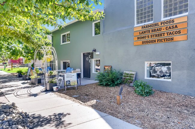
Property Record
221 Perry St, Castle Rock, CO 80104


NEARBY LISTINGS FOR SALE OR LEASE
Property Detail
221 Perry St
Denver-Aurora-Lakewood, CO
Castle Rock Town Of
2505-112-13-014
LOT 2A BLOCK 22 TOWN OF CASTLE ROCK AMD 32 0.213 AM/L
Commercialnec
Douglas
X
Colorado
08035C0301G
2a
2024
0.21 AC
2025
Parker/Castle Rock
014504
Denver
8,416 SF
DEMOGRAPHICS near 221 Perry St
1 Mile
3 Mile
5 Mile
2024 Total Population
7,781
54,274
84,942
2029 Population
8,858
62,145
97,079
Pop Growth 2024-2029
+ 13.84%
+ 14.50%
+ 14.29%
Average Age
41
38
38
2024 Total Households
3,214
19,253
29,457
HH Growth 2024-2029
+ 13.88%
+ 14.55%
+ 14.36%
Median Household Inc
$71,146
$122,714
$130,313
Avg Household Size
2.40
2.70
2.80
2024 Avg HH Vehicles
2.00
2.00
2.00
Median Home Value
$474,276
$551,628
$601,200
Median Year Built
1985
2005
2005
Nearby Places
Map Layers
Map Styles
 Street
 Aerial
- Restaurants
- Banks
- Shops
- Fitness
- Groceries
PUBLIC TRANSPORTATION
AIRPORT
Denver International
DRIVE
WALK
Distance
Denver International
51 min
46.0 mi
SALE & LEASE HISTORY
LISTING DATE
SALE/LEASE

Sep 18, 2019
For Sale
Jul 30, 2018
For Lease
Jul 30, 2018
For Lease
Feb 24, 2020
For Sale
Nearby Properties
Address
Land Use
TOTAL SIZE
Lot Size
Zoning
Address
Land Use
TOTAL SIZE
Lot Size
Zoning
836,412 SF
29.20 AC
Address
Land Use
TOTAL SIZE
Lot Size
Zoning
297,865 SF
39.95 AC
Address
Land Use
TOTAL SIZE
Lot Size
Zoning
463,911 SF
55.80 AC
Address
Land Use
TOTAL SIZE
Lot Size
Zoning
117,447 SF
9.99 AC
Address
Land Use
TOTAL SIZE
Lot Size
Zoning
120,023 SF
30.87 AC
Address
Land Use
TOTAL SIZE
Lot Size
Zoning
464,037 SF
18.90 AC
Address
Land Use
TOTAL SIZE
Lot Size
Zoning
150,896 SF
1.38 AC
Address
Land Use
TOTAL SIZE
Lot Size
Zoning
62,718 SF
3.47 AC
Address
Land Use
TOTAL SIZE
Lot Size
Zoning
105,496 SF
10.22 AC
Address
Land Use
TOTAL SIZE
Lot Size
Zoning
227,703 SF
48.20 AC
A1
Address
Land Use
TOTAL SIZE
Lot Size
Zoning
178,877 SF
1.34 AC
Address
Land Use
TOTAL SIZE
Lot Size
Zoning
73,146 SF
10.25 AC
Address
Land Use
TOTAL SIZE
Lot Size
Zoning
407,977 SF
15.04 AC
Address
Land Use
TOTAL SIZE
Lot Size
Zoning
59,843 SF
39.95 AC
Address
Land Use
TOTAL SIZE
Lot Size
Zoning
47,354 SF
14.93 AC
Address
Land Use
TOTAL SIZE
Lot Size
Zoning
255,509 SF
11.34 AC
Address
Land Use
TOTAL SIZE
Lot Size
Zoning
74,586 SF
13.90 AC
Address
Land Use
TOTAL SIZE
Lot Size
Zoning
250,910 SF
12.06 AC
Address
Land Use
TOTAL SIZE
Lot Size
Zoning
256,820 SF
11.02 AC
A1
Address
Land Use
TOTAL SIZE
Lot Size
Zoning
67,426 SF
7.16 AC
Address
Land Use
TOTAL SIZE
Lot Size
Zoning
115,466 SF
1.05 AC
Address
Land Use
TOTAL SIZE
Lot Size
Zoning
115,324 SF
7.44 AC
Address
Land Use
TOTAL SIZE
Lot Size
Zoning
65,489 SF
223.07 AC
A1
Address
Land Use
TOTAL SIZE
Lot Size
Zoning
35,863 SF
15.97 AC
Address
Land Use
TOTAL SIZE
Lot Size
Zoning
98,750 SF
5.42 AC
Address
Land Use
TOTAL SIZE
Lot Size
Zoning
195,804 SF
21.70 AC
Address
Land Use
TOTAL SIZE
Lot Size
Zoning
89,071 SF
21.64 AC
Address
Land Use
TOTAL SIZE
Lot Size
Zoning
50,150 SF
10.19 AC
Address
Land Use
TOTAL SIZE
Lot Size
Zoning
138,444 SF
12.54 AC
Address
Land Use
TOTAL SIZE
Lot Size
Zoning
122,676 SF
12.59 AC
The World's #1 Commercial Real Estate Marketplace
Connect with us
© 2025 CoStar Group
The information above has been obtained from sources believed reliable. While we do not doubt its accuracy we have not verified it and make no guarantee, warranty or representation about it. It is your responsibility to independently confirm its accuracy and completeness. Any projections, opinions, assumptions, or estimates used are for example only and do not represent the current or future performance of the property. The value of this transaction to you depends on tax and other factors which should be evaluated by your tax, financial, and legal advisors. You and your advisors should conduct a careful, independent investigation of the property to determine to your satisfaction the suitability of the property for your needs.