Property Record
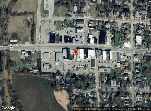
221 W Main St, Morenci, MI 49256


NEARBY LISTINGS FOR SALE OR LEASE
-
-
View all Morenci listings for sale on LoopNet.com
Property Detail
221 W Main St
Adrian, MI
Original Plat Jasper Village
XM0-000-0152-00
N 42 FT OF E 25 FT OF LOT 15 EX E 10.5 FT ORIG PLAT
Commercialacreage
Lenawee
X
Michigan
26091C0425D
15
2024
0.01 AC
2025
Lenawee County
061900
Toledo
DEMOGRAPHICS near 221 W Main St
1 Mile
3 Mile
5 Mile
2024 Total Population
2,271
2,977
4,013
2029 Population
2,246
2,937
3,946
Pop Growth 2024-2029
(1.10%)
(1.34%)
(1.67%)
Average Age
40
40
40
2024 Total Households
875
1,144
1,535
HH Growth 2024-2029
(1.37%)
(1.57%)
(1.76%)
Median Household Inc
$46,000
$48,365
$50,950
Avg Household Size
2.50
2.60
2.60
2024 Avg HH Vehicles
2.00
2.00
2.00
Median Home Value
$90,867
$99,877
$118,080
Median Year Built
1950
1950
1949
Nearby Places
Map Layers
Map Styles
 Street
 Aerial
- Restaurants
- Banks
- Shops
- Fitness
- Groceries
PUBLIC TRANSPORTATION
AIRPORT
Eugene F Kranz Toledo Express
DRIVE
WALK
Distance
Eugene F Kranz Toledo Express
54 min
35.4 mi
Freight Ports
Port of Toledo
DRIVE
WALK
Distance
Port of Toledo
74 min
45.2 mi
Nearby Properties
Address
Land Use
TOTAL SIZE
Lot Size
Zoning
Address
Land Use
TOTAL SIZE
Lot Size
Zoning
450 SF
69.97 AC
Address
Land Use
TOTAL SIZE
Lot Size
Zoning
15.17 AC
Address
Land Use
TOTAL SIZE
Lot Size
Zoning
2.82 AC
Address
Land Use
TOTAL SIZE
Lot Size
Zoning
17.13 AC
Address
Land Use
TOTAL SIZE
Lot Size
Zoning
3.03 AC
Address
Land Use
TOTAL SIZE
Lot Size
Zoning
3.16 AC
Address
Land Use
TOTAL SIZE
Lot Size
Zoning
3.16 AC
Address
Land Use
TOTAL SIZE
Lot Size
Zoning
3.44 AC
Address
Land Use
TOTAL SIZE
Lot Size
Zoning
4.40 AC
Address
Land Use
TOTAL SIZE
Lot Size
Zoning
3.05 AC
Address
Land Use
TOTAL SIZE
Lot Size
Zoning
217.35 AC
Address
Land Use
TOTAL SIZE
Lot Size
Zoning
2.40 AC
Address
Land Use
TOTAL SIZE
Lot Size
Zoning
5.64 AC
Address
Land Use
TOTAL SIZE
Lot Size
Zoning
4.56 AC
Address
Land Use
TOTAL SIZE
Lot Size
Zoning
160 AC
Address
Land Use
TOTAL SIZE
Lot Size
Zoning
155.34 AC
Address
Land Use
TOTAL SIZE
Lot Size
Zoning
126.27 AC
Address
Land Use
TOTAL SIZE
Lot Size
Zoning
Address
Land Use
TOTAL SIZE
Lot Size
Zoning
5.98 AC
Address
Land Use
TOTAL SIZE
Lot Size
Zoning
188.70 AC
Address
Land Use
TOTAL SIZE
Lot Size
Zoning
157.41 AC
Address
Land Use
TOTAL SIZE
Lot Size
Zoning
Address
Land Use
TOTAL SIZE
Lot Size
Zoning
144.77 AC
Address
Land Use
TOTAL SIZE
Lot Size
Zoning
125.69 AC
Address
Land Use
TOTAL SIZE
Lot Size
Zoning
118.98 AC
Address
Land Use
TOTAL SIZE
Lot Size
Zoning
137.13 AC
Address
Land Use
TOTAL SIZE
Lot Size
Zoning
130.75 AC
Address
Land Use
TOTAL SIZE
Lot Size
Zoning
2.66 AC
Address
Land Use
TOTAL SIZE
Lot Size
Zoning
78.67 AC
Address
Land Use
TOTAL SIZE
Lot Size
Zoning
The World's #1 Commercial Real Estate Marketplace
Connect with us
© 2025 CoStar Group
The information above has been obtained from sources believed reliable. While we do not doubt its accuracy we have not verified it and make no guarantee, warranty or representation about it. It is your responsibility to independently confirm its accuracy and completeness. Any projections, opinions, assumptions, or estimates used are for example only and do not represent the current or future performance of the property. The value of this transaction to you depends on tax and other factors which should be evaluated by your tax, financial, and legal advisors. You and your advisors should conduct a careful, independent investigation of the property to determine to your satisfaction the suitability of the property for your needs.