Property Record
221 Washington St, Attleboro, MA 02703


NEARBY LISTINGS FOR SALE OR LEASE
Property Detail
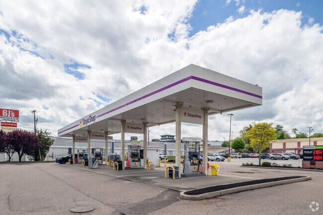
221 Washington St
ATTL-000014-000000-000075-B000000
Bristol
Commercialnec
Massachusetts
X
75b
25005C0111G
11.03 AC
2022
Attleboro/New Bedford
2025
Boston
631102
Providence-Warwick, RI-MA
10,920 SF
DEMOGRAPHICS near 221 Washington St
1 Mile
3 Mile
5 Mile
2024 Total Population
4,785
71,513
202,450
2029 Population
4,764
70,567
200,493
Pop Growth 2024-2029
(0.44%)
(1.32%)
(0.97%)
Average Age
40
40
40
2024 Total Households
1,582
27,848
80,594
HH Growth 2024-2029
(0.51%)
(1.42%)
(1.04%)
Median Household Inc
$112,632
$75,020
$71,212
Avg Household Size
2.90
2.50
2.40
2024 Avg HH Vehicles
2.00
2.00
2.00
Median Home Value
$430,988
$339,343
$340,105
Median Year Built
1984
1960
1959
Nearby Places
Map Layers
Map Styles
 Street
 Aerial
- Restaurants
- Banks
- Shops
- Fitness
- Groceries
PUBLIC TRANSPORTATION
COMMUTER RAIL
South Attleboro (Providence/Stoughton Line - Massachusetts Bay Transportation Authority Commuter Rail (Purple Line))
DRIVE
WALK
Distance
South Attleboro (Providence/Stoughton Line - Massachusetts Bay Transportation Authority Commuter Rail (Purple Line))
4 min
2.0 mi
DRIVE
WALK
Distance
8 min
4.3 mi
AIRPORT
Rhode Island Tf Green International
DRIVE
WALK
Distance
Rhode Island Tf Green International
31 min
17.4 mi
Nearby Properties
Address
Land Use
TOTAL SIZE
Lot Size
Zoning
Address
Land Use
TOTAL SIZE
Lot Size
Zoning
170,531 SF
3 AC
M-2
Address
Land Use
TOTAL SIZE
Lot Size
Zoning
28,208 SF
38.19 AC
PHB
Address
Land Use
TOTAL SIZE
Lot Size
Zoning
741,896 SF
27.75 AC
GU
Address
Land Use
TOTAL SIZE
Lot Size
Zoning
64.31 AC
C60
Address
Land Use
TOTAL SIZE
Lot Size
Zoning
5,059 SF
217.41 AC
Address
Land Use
TOTAL SIZE
Lot Size
Zoning
312,784 SF
11.53 AC
MO
Address
Land Use
TOTAL SIZE
Lot Size
Zoning
14,841 SF
15.70 AC
PHB
Address
Land Use
TOTAL SIZE
Lot Size
Zoning
88,698 SF
1.44 AC
RM
Address
Land Use
TOTAL SIZE
Lot Size
Zoning
14.66 AC
CG
Address
Land Use
TOTAL SIZE
Lot Size
Zoning
190,458 SF
16.30 AC
C60
Address
Land Use
TOTAL SIZE
Lot Size
Zoning
2.97 AC
MB
Address
Land Use
TOTAL SIZE
Lot Size
Zoning
112,766 SF
31.06 AC
Address
Land Use
TOTAL SIZE
Lot Size
Zoning
55,103 SF
2.98 AC
RT
Address
Land Use
TOTAL SIZE
Lot Size
Zoning
341,251 SF
16.22 AC
60
Address
Land Use
TOTAL SIZE
Lot Size
Zoning
15,086 SF
2.61 AC
C-2
Address
Land Use
TOTAL SIZE
Lot Size
Zoning
115,258 SF
10.08 AC
100
Address
Land Use
TOTAL SIZE
Lot Size
Zoning
98,968 SF
1.66 AC
R-2
Address
Land Use
TOTAL SIZE
Lot Size
Zoning
105,878 SF
12.05 AC
C60
Address
Land Use
TOTAL SIZE
Lot Size
Zoning
189,308 SF
19.76 AC
I
Address
Land Use
TOTAL SIZE
Lot Size
Zoning
85,626 SF
2.22 AC
RT
Address
Land Use
TOTAL SIZE
Lot Size
Zoning
155,731 SF
41.03 AC
PHB
Address
Land Use
TOTAL SIZE
Lot Size
Zoning
126,073 SF
22.90 AC
C60
Address
Land Use
TOTAL SIZE
Lot Size
Zoning
69,053 SF
0.87 AC
C-2
Address
Land Use
TOTAL SIZE
Lot Size
Zoning
27,264 SF
6.20 AC
Address
Land Use
TOTAL SIZE
Lot Size
Zoning
90,812 SF
12.39 AC
Address
Land Use
TOTAL SIZE
Lot Size
Zoning
97,027 SF
12.02 AC
C60
Address
Land Use
TOTAL SIZE
Lot Size
Zoning
6 AC
120
Address
Land Use
TOTAL SIZE
Lot Size
Zoning
89,242 SF
14.65 AC
C60
Address
Land Use
TOTAL SIZE
Lot Size
Zoning
100,019 SF
10.37 AC
120
The World's #1 Commercial Real Estate Marketplace
Connect with us
© 2025 CoStar Group
The information above has been obtained from sources believed reliable. While we do not doubt its accuracy we have not verified it and make no guarantee, warranty or representation about it. It is your responsibility to independently confirm its accuracy and completeness. Any projections, opinions, assumptions, or estimates used are for example only and do not represent the current or future performance of the property. The value of this transaction to you depends on tax and other factors which should be evaluated by your tax, financial, and legal advisors. You and your advisors should conduct a careful, independent investigation of the property to determine to your satisfaction the suitability of the property for your needs.