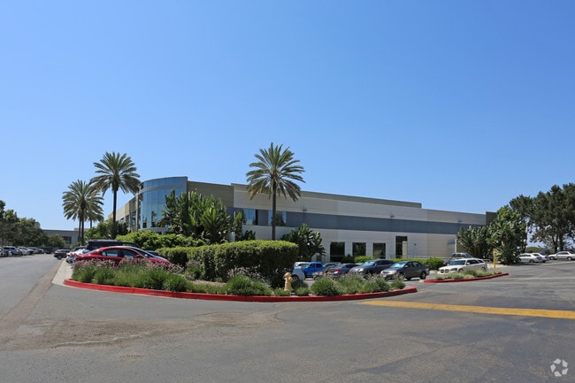
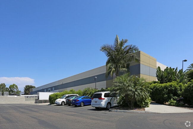
Property Record
2210 Faraday Ave, Carlsbad, CA 92008


Property Detail
2210 Faraday Ave
San Diego-Chula Vista-Carlsbad, CA
LOT 45 DOC05-0275881 IN LOT 44&IN TR 11810
212-120-55
San Diego
Scientificpharmaceuticalmedicalresearchfacility
California
C-M
45,44
B and X Area of moderate flood hazard, usually the area between the limits of the 100-year and 500-year floods.
6.90 AC
2025
Carlsbad
2025
San Diego
022101
NEARBY LISTINGS FOR SALE OR LEASE
DEMOGRAPHICS near 2210 Faraday Ave
1 mile
3 mile
5 mile
2025 Total Population
1,384
73,358
242,888
2030 Population
1,366
73,558
243,900
Pop Growth 2025-2030
(1.30%)
+ 0.27%
+ 0.42%
Average Age
45
44
42
2025 Total Households
508
28,133
91,339
HH Growth 2025-2030
(1.38%)
+ 0.14%
+ 0.38%
Median Household Inc
$179,504
$139,831
$117,725
Avg Household Size
2.60
2.60
2.60
2025 Avg HH Vehicles
2.00
2.00
2.00
Median Home Value
$1,031,311
$1,056,553
$997,161
Median Year Built
1996
1991
1986
Nearby Places
Map Layers
Map Styles
 Street
 Aerial
Transit
 Traffic
 Biking
Places
Listings with unknown addresses are not visible on the map
- Restaurants
- Banks
- Shops
- Fitness
- Groceries
PUBLIC TRANSPORTATION
COMMUTER RAIL
Carlsbad Poinsettia (Coaster - San Diego North County Transit District (Coaster/Sprinter/Breeze))
Drive
Walk
Distance
Carlsbad Poinsettia (Coaster - San Diego North County Transit District (Coaster/Sprinter/Breeze))
9 min
4.1 mi
Carlsbad Village (Coaster - San Diego North County Transit District (Coaster/Sprinter/Breeze))
Drive
Walk
Distance
Carlsbad Village (Coaster - San Diego North County Transit District (Coaster/Sprinter/Breeze))
13 min
6.0 mi
AIRPORT
San Diego International
Drive
Walk
Distance
San Diego International
43 min
31.9 mi
Freight Ports
Port of San Diego
Drive
Walk
Distance
Port of San Diego
48 min
36.3 mi
SALE & LEASE HISTORY
LISTING DATE
SALE/LEASE

Apr 29, 2021
For Lease
Nearby Properties
Address
Land Use
TOTAL SIZE
Lot Size
Zoning
Address
Land Use
TOTAL SIZE
Lot Size
Zoning
132.11 AC
C-T-Q
Address
Land Use
TOTAL SIZE
Lot Size
Zoning
13.92 AC
P-M
Address
Land Use
TOTAL SIZE
Lot Size
Zoning
24.15 AC
RM-B
Address
Land Use
TOTAL SIZE
Lot Size
Zoning
26.65 AC
C-2-Q
Address
Land Use
TOTAL SIZE
Lot Size
Zoning
12.62 AC
P-C
Address
Land Use
TOTAL SIZE
Lot Size
Zoning
8.76 AC
P-C
Address
Land Use
TOTAL SIZE
Lot Size
Zoning
12.71 AC
P-M
Address
Land Use
TOTAL SIZE
Lot Size
Zoning
14.32 AC
P-M
Address
Land Use
TOTAL SIZE
Lot Size
Zoning
7.31 AC
P-C
Address
Land Use
TOTAL SIZE
Lot Size
Zoning
28.15 AC
C-M
Address
Land Use
TOTAL SIZE
Lot Size
Zoning
12.49 AC
P-C
Address
Land Use
TOTAL SIZE
Lot Size
Zoning
16.79 AC
R-3-Q
Address
Land Use
TOTAL SIZE
Lot Size
Zoning
10.96 AC
C-M
Address
Land Use
TOTAL SIZE
Lot Size
Zoning
13.86 AC
C-M
Address
Land Use
TOTAL SIZE
Lot Size
Zoning
13.07 AC
P-M
Address
Land Use
TOTAL SIZE
Lot Size
Zoning
9.65 AC
P-C
Address
Land Use
TOTAL SIZE
Lot Size
Zoning
18.34 AC
P-C
Address
Land Use
TOTAL SIZE
Lot Size
Zoning
9.69 AC
C-T-Q
Address
Land Use
TOTAL SIZE
Lot Size
Zoning
69,200 SF
4.52 AC
P-M
Address
Land Use
TOTAL SIZE
Lot Size
Zoning
20.86 AC
P-M-Q
Address
Land Use
TOTAL SIZE
Lot Size
Zoning
11.49 AC
P-M
Address
Land Use
TOTAL SIZE
Lot Size
Zoning
14.73 AC
C-L
Address
Land Use
TOTAL SIZE
Lot Size
Zoning
10.94 AC
P-M
Address
Land Use
TOTAL SIZE
Lot Size
Zoning
11.10 AC
RD-M-Q
Address
Land Use
TOTAL SIZE
Lot Size
Zoning
3.17 AC
C-T
Address
Land Use
TOTAL SIZE
Lot Size
Zoning
13.20 AC
P-M
Address
Land Use
TOTAL SIZE
Lot Size
Zoning
7.42 AC
P-M
Address
Land Use
TOTAL SIZE
Lot Size
Zoning
7.91 AC
SPI
Address
Land Use
TOTAL SIZE
Lot Size
Zoning
9.74 AC
C-M
Address
Land Use
TOTAL SIZE
Lot Size
Zoning
19.35 AC
P-M
The World's #1 Commercial Real Estate Marketplace
Connect with us
© 2026 CoStar Group
The information above has been obtained from sources believed reliable. While we do not doubt its accuracy we have not verified it and make no guarantee, warranty or representation about it. It is your responsibility to independently confirm its accuracy and completeness. Any projections, opinions, assumptions, or estimates used are for example only and do not represent the current or future performance of the property. The value of this transaction to you depends on tax and other factors which should be evaluated by your tax, financial, and legal advisors. You and your advisors should conduct a careful, independent investigation of the property to determine to your satisfaction the suitability of the property for your needs.