Property Record
2211 Bel Pre Rd, Silver Spring, MD 20906
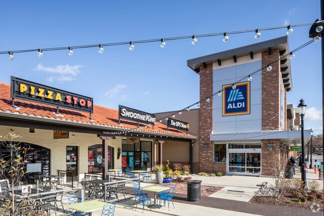


Property Detail
2211 Bel Pre Rd
13-00985207
TREMOULIS PROPERTY LAYHILL
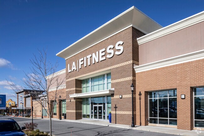
Regionalshoppingcenterormallwithanchorstore
MONTGOMERY
NR0.7
Maryland
B and X Area of moderate flood hazard, usually the area between the limits of the 100-year and 500-year floods.
2
2024
8.62 AC
2025
Kensington/Wheaton
703220
Washington, DC
118,204 SF
Washington-Arlington-Alexandria, DC-VA-MD-WV
NEARBY LISTINGS FOR SALE OR LEASE
DEMOGRAPHICS near 2211 Bel Pre Rd
1 mile
3 mile
5 mile
2025 Total Population
14,262
115,893
311,150
2030 Population
14,663
118,990
319,836
Pop Growth 2025-2030
+ 2.81%
+ 2.67%
+ 2.79%
Average Age
42
43
41
2025 Total Households
4,914
39,601
110,100
HH Growth 2025-2030
+ 2.97%
+ 2.75%
+ 2.85%
Median Household Inc
$94,862
$108,380
$115,088
Avg Household Size
2.80
2.80
2.70
2025 Avg HH Vehicles
2.00
2.00
2.00
Median Home Value
$520,469
$540,843
$602,266
Median Year Built
1982
1973
1973
Nearby Places
Map Layers
Map Styles
 Street
 Aerial
Layers
 Traffic
 Biking
Places
Listings with unknown addresses are not visible on the map
- Restaurants
- Banks
- Shops
- Fitness
- Groceries
PUBLIC TRANSPORTATION
COMMUTER RAIL
Kensington Marc Eb (BRUNSWICK - WASHINGTON - Maryland Transit Administration)
Drive
Walk
Distance
Kensington Marc Eb (BRUNSWICK - WASHINGTON - Maryland Transit Administration)
12 min
6.4 mi
Garrett Park Marc Eb (BRUNSWICK - WASHINGTON - Maryland Transit Administration)
Drive
Walk
Distance
Garrett Park Marc Eb (BRUNSWICK - WASHINGTON - Maryland Transit Administration)
15 min
7.6 mi
AIRPORT
Ronald Reagan Washington Ntl
Drive
Walk
Distance
Ronald Reagan Washington Ntl
37 min
18.9 mi
Baltimore/Washington International Thurgood Marshall
Drive
Walk
Distance
Baltimore/Washington International Thurgood Marshall
39 min
29.8 mi
Washington Dulles International
Drive
Walk
Distance
Washington Dulles International
54 min
31.6 mi
Freight Ports
Port of Baltimore
Drive
Walk
Distance
Port of Baltimore
44 min
32.6 mi
SALE & LEASE HISTORY
LISTING DATE
SALE/LEASE

Sep 25, 2016
For Lease
Nearby Properties
Address
Land Use
TOTAL SIZE
Lot Size
Zoning
Address
Land Use
TOTAL SIZE
Lot Size
Zoning
431,630 SF
25.77 AC
R60
Address
Land Use
TOTAL SIZE
Lot Size
Zoning
643,335 SF
29.18 AC
R20
Address
Land Use
TOTAL SIZE
Lot Size
Zoning
515,740 SF
19.97 AC
R20
Address
Land Use
TOTAL SIZE
Lot Size
Zoning
258,000 SF
6.34 AC
PRC
Address
Land Use
TOTAL SIZE
Lot Size
Zoning
164,307 SF
16.45 AC
R90
Address
Land Use
TOTAL SIZE
Lot Size
Zoning
251,862 SF
91.09 AC
RE2C
Address
Land Use
TOTAL SIZE
Lot Size
Zoning
164,764 SF
15.42 AC
NR0.7
Address
Land Use
TOTAL SIZE
Lot Size
Zoning
131,521 SF
13.40 AC
PRC
Address
Land Use
TOTAL SIZE
Lot Size
Zoning
294,082 SF
12.18 AC
R20
Address
Land Use
TOTAL SIZE
Lot Size
Zoning
427,500 SF
25.70 AC
R30
Address
Land Use
TOTAL SIZE
Lot Size
Zoning
425,295 SF
15.72 AC
CRT22
Address
Land Use
TOTAL SIZE
Lot Size
Zoning
215,937 SF
2.91 AC
CR2.0
Address
Land Use
TOTAL SIZE
Lot Size
Zoning
321,840 SF
13.95 AC
R20
Address
Land Use
TOTAL SIZE
Lot Size
Zoning
283,516 SF
9.18 AC
R90
Address
Land Use
TOTAL SIZE
Lot Size
Zoning
332,133 SF
28.24 AC
R90
Address
Land Use
TOTAL SIZE
Lot Size
Zoning
262,984 SF
7.58 AC
R20
Address
Land Use
TOTAL SIZE
Lot Size
Zoning
387,943 SF
8.91 AC
R60
Address
Land Use
TOTAL SIZE
Lot Size
Zoning
188,160 SF
7.42 AC
R20
Address
Land Use
TOTAL SIZE
Lot Size
Zoning
74,243 SF
5.48 AC
NR0.7
Address
Land Use
TOTAL SIZE
Lot Size
Zoning
148,718 SF
17.08 AC
R60
Address
Land Use
TOTAL SIZE
Lot Size
Zoning
119,567 SF
10.77 AC
R60
Address
Land Use
TOTAL SIZE
Lot Size
Zoning
255,986 SF
9.37 AC
R20
Address
Land Use
TOTAL SIZE
Lot Size
Zoning
220,320 SF
14.36 AC
R30
Address
Land Use
TOTAL SIZE
Lot Size
Zoning
120,205 SF
19.90 AC
RE2
Address
Land Use
TOTAL SIZE
Lot Size
Zoning
229,669 SF
9.25 AC
R200
Address
Land Use
TOTAL SIZE
Lot Size
Zoning
102,198 SF
7.21 AC
R200
Address
Land Use
TOTAL SIZE
Lot Size
Zoning
121,154 SF
8.03 AC
R60
Address
Land Use
TOTAL SIZE
Lot Size
Zoning
99,491 SF
5.97 AC
R200
Address
Land Use
TOTAL SIZE
Lot Size
Zoning
194,736 SF
9.33 AC
R20
The World's #1 Commercial Real Estate Marketplace
Connect with us
© 2026 CoStar Group
The information above has been obtained from sources believed reliable. While we do not doubt its accuracy we have not verified it and make no guarantee, warranty or representation about it. It is your responsibility to independently confirm its accuracy and completeness. Any projections, opinions, assumptions, or estimates used are for example only and do not represent the current or future performance of the property. The value of this transaction to you depends on tax and other factors which should be evaluated by your tax, financial, and legal advisors. You and your advisors should conduct a careful, independent investigation of the property to determine to your satisfaction the suitability of the property for your needs.