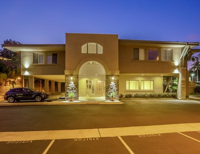
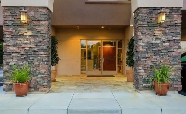
Property Record
2211 Encinitas Blvd, Encinitas, CA 92024


Current Lease Availabilities
Property Detail
2211 Encinitas Blvd
259-190-63
PAR 4 ST CLSD& TR PM07474
Storemultistory
San Diego
OP
California
B and X Area of moderate flood hazard, usually the area between the limits of the 100-year and 500-year floods.
0.71 AC
2024
North Beach Cities
2025
San Diego
017403
San Diego-Chula Vista-Carlsbad, CA
11,000 SF
NEARBY LISTINGS FOR SALE OR LEASE
DEMOGRAPHICS near 2211 Encinitas Blvd
1 mile
3 mile
5 mile
2025 Total Population
7,710
64,379
132,630
2030 Population
7,650
64,367
133,078
Pop Growth 2025-2030
(0.78%)
(0.02%)
+ 0.34%
Average Age
45
43
44
2025 Total Households
2,938
24,140
51,676
HH Growth 2025-2030
(0.88%)
(0.07%)
+ 0.39%
Median Household Inc
$150,997
$170,422
$169,488
Avg Household Size
2.50
2.60
2.50
2025 Avg HH Vehicles
2.00
2.00
2.00
Median Home Value
$1,096,673
$1,120,955
$1,114,701
Median Year Built
1977
1980
1982
Nearby Places
Map Layers
Map Styles
 Street
 Aerial
Transit
 Traffic
 Biking
Places
Listings with unknown addresses are not visible on the map
- Restaurants
- Banks
- Shops
- Fitness
- Groceries
PUBLIC TRANSPORTATION
COMMUTER RAIL
Encinitas (Coaster - San Diego North County Transit District (Coaster/Sprinter/Breeze))
Drive
Walk
Distance
Encinitas (Coaster - San Diego North County Transit District (Coaster/Sprinter/Breeze))
7 min
3.7 mi
Solana Beach (Coaster - San Diego North County Transit District (Coaster/Sprinter/Breeze))
Drive
Walk
Distance
Solana Beach (Coaster - San Diego North County Transit District (Coaster/Sprinter/Breeze))
10 min
5.1 mi
AIRPORT
San Diego International
Drive
Walk
Distance
San Diego International
33 min
24.0 mi
Nearby Properties
Address
Land Use
TOTAL SIZE
Lot Size
Zoning
Address
Land Use
TOTAL SIZE
Lot Size
Zoning
18.19 AC
P-C
Address
Land Use
TOTAL SIZE
Lot Size
Zoning
13.11 AC
P/SP
Address
Land Use
TOTAL SIZE
Lot Size
Zoning
17.80 AC
GC
Address
Land Use
TOTAL SIZE
Lot Size
Zoning
12.44 AC
P/SP
Address
Land Use
TOTAL SIZE
Lot Size
Zoning
4.46 AC
RR1
Address
Land Use
TOTAL SIZE
Lot Size
Zoning
4.77 AC
ER-MU1
Address
Land Use
TOTAL SIZE
Lot Size
Zoning
46,415 SF
5.96 AC
S88
Address
Land Use
TOTAL SIZE
Lot Size
Zoning
11 AC
GC
Address
Land Use
TOTAL SIZE
Lot Size
Zoning
74,583 SF
5.61 AC
R11
Address
Land Use
TOTAL SIZE
Lot Size
Zoning
7,484 SF
6.77 AC
RR2
Address
Land Use
TOTAL SIZE
Lot Size
Zoning
62,682 SF
7.36 AC
GC
Address
Land Use
TOTAL SIZE
Lot Size
Zoning
66,540 SF
6.35 AC
R11
Address
Land Use
TOTAL SIZE
Lot Size
Zoning
62,357 SF
4.38 AC
R11
Address
Land Use
TOTAL SIZE
Lot Size
Zoning
6.96 AC
R15
Address
Land Use
TOTAL SIZE
Lot Size
Zoning
5.49 AC
R15
Address
Land Use
TOTAL SIZE
Lot Size
Zoning
71,962 SF
5.33 AC
P/SP
Address
Land Use
TOTAL SIZE
Lot Size
Zoning
9.41 AC
R15
Address
Land Use
TOTAL SIZE
Lot Size
Zoning
53,017 SF
2.08 AC
R11
Address
Land Use
TOTAL SIZE
Lot Size
Zoning
10.76 AC
GC
Address
Land Use
TOTAL SIZE
Lot Size
Zoning
97,263 SF
7.73 AC
GC
Address
Land Use
TOTAL SIZE
Lot Size
Zoning
32,742 SF
5.91 AC
GC
Address
Land Use
TOTAL SIZE
Lot Size
Zoning
94,704 SF
4.21 AC
R25
Address
Land Use
TOTAL SIZE
Lot Size
Zoning
55,772 SF
4.54 AC
P-C
Address
Land Use
TOTAL SIZE
Lot Size
Zoning
6.32 AC
P-C
Address
Land Use
TOTAL SIZE
Lot Size
Zoning
7.32 AC
GC
Address
Land Use
TOTAL SIZE
Lot Size
Zoning
14,598 SF
1.01 AC
C36
Address
Land Use
TOTAL SIZE
Lot Size
Zoning
9.16 AC
ER-C
Address
Land Use
TOTAL SIZE
Lot Size
Zoning
5.51 AC
C-6
Address
Land Use
TOTAL SIZE
Lot Size
Zoning
49,792 SF
2.48 AC
RR
Address
Land Use
TOTAL SIZE
Lot Size
Zoning
85,552 SF
6.01 AC
P-C
The World's #1 Commercial Real Estate Marketplace
Connect with us
© 2026 CoStar Group
The information above has been obtained from sources believed reliable. While we do not doubt its accuracy we have not verified it and make no guarantee, warranty or representation about it. It is your responsibility to independently confirm its accuracy and completeness. Any projections, opinions, assumptions, or estimates used are for example only and do not represent the current or future performance of the property. The value of this transaction to you depends on tax and other factors which should be evaluated by your tax, financial, and legal advisors. You and your advisors should conduct a careful, independent investigation of the property to determine to your satisfaction the suitability of the property for your needs.