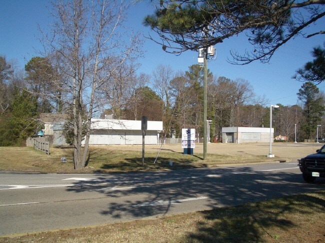
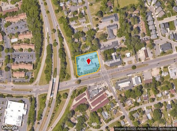
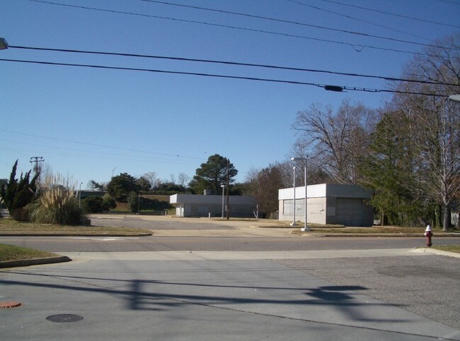
Property Record
2211 Greenwell Rd, Virginia Beach, VA 23455

NEARBY LISTINGS FOR SALE OR LEASE
Property Detail
2211 Greenwell Rd
Virginia Beach-Chesapeake-Norfolk, VA-NC
Shore Drive Estates
1479-67-4580
SHORE DRIVE ESTATES LOT R-1 1.2462 AC
Municipalproperty
Virginia Beach
X
Virginia
5155310019G
r-1
0
1.25 AC
2025
Haygood/Bayside
041804
Hampton Roads
14,697 SF
DEMOGRAPHICS near 2211 Greenwell Rd
1 Mile
3 Mile
5 Mile
2024 Total Population
13,016
47,601
142,513
2029 Population
13,025
47,352
141,673
Pop Growth 2024-2029
+ 0.07%
(0.52%)
(0.59%)
Average Age
37
42
40
2024 Total Households
5,071
20,133
58,876
HH Growth 2024-2029
+ 0.04%
(0.62%)
(0.71%)
Median Household Inc
$78,070
$84,565
$74,843
Avg Household Size
2.40
2.30
2.30
2024 Avg HH Vehicles
2.00
2.00
2.00
Median Home Value
$547,619
$426,105
$356,685
Median Year Built
1977
1979
1980
Nearby Places
Map Layers
Map Styles
 Street
 Aerial
- Restaurants
- Banks
- Shops
- Fitness
- Groceries
PUBLIC TRANSPORTATION
AIRPORT
Norfolk International
DRIVE
WALK
Distance
Norfolk International
16 min
8.0 mi
Newport News/Williamsburg International
DRIVE
WALK
Distance
Newport News/Williamsburg International
50 min
33.8 mi
Freight Ports
Virginia Port Authority - Portsmouth
DRIVE
WALK
Distance
Virginia Port Authority - Portsmouth
31 min
14.7 mi
Nearby Properties
Address
Land Use
TOTAL SIZE
Lot Size
Zoning
Address
Land Use
TOTAL SIZE
Lot Size
Zoning
10 SF
207.44 AC
I2
Address
Land Use
TOTAL SIZE
Lot Size
Zoning
1,191,707 SF
15.20 AC
B4
Address
Land Use
TOTAL SIZE
Lot Size
Zoning
1,802 SF
14.40 AC
A24
Address
Land Use
TOTAL SIZE
Lot Size
Zoning
226,775 SF
13.14 AC
B2
Address
Land Use
TOTAL SIZE
Lot Size
Zoning
Address
Land Use
TOTAL SIZE
Lot Size
Zoning
1 SF
17.15 AC
A24
Address
Land Use
TOTAL SIZE
Lot Size
Zoning
318,496 SF
13.79 AC
A18
Address
Land Use
TOTAL SIZE
Lot Size
Zoning
1 SF
14.97 AC
A18
Address
Land Use
TOTAL SIZE
Lot Size
Zoning
180,023 SF
16.84 AC
B2
Address
Land Use
TOTAL SIZE
Lot Size
Zoning
1 SF
10.60 AC
A18
Address
Land Use
TOTAL SIZE
Lot Size
Zoning
1 SF
0.01 AC
A24
Address
Land Use
TOTAL SIZE
Lot Size
Zoning
71,160 SF
0.01 AC
R15
Address
Land Use
TOTAL SIZE
Lot Size
Zoning
1 SF
12.13 AC
A18
Address
Land Use
TOTAL SIZE
Lot Size
Zoning
205,006 SF
12.94 AC
O2
Address
Land Use
TOTAL SIZE
Lot Size
Zoning
194,728 SF
25.75 AC
R75
Address
Land Use
TOTAL SIZE
Lot Size
Zoning
124,314 SF
7.29 AC
A18
Address
Land Use
TOTAL SIZE
Lot Size
Zoning
85,607 SF
18.48 AC
R10
Address
Land Use
TOTAL SIZE
Lot Size
Zoning
75,438 SF
14.60 AC
P1
Address
Land Use
TOTAL SIZE
Lot Size
Zoning
97,944 SF
5.87 AC
A18
Address
Land Use
TOTAL SIZE
Lot Size
Zoning
1 SF
4.86 AC
A18
Address
Land Use
TOTAL SIZE
Lot Size
Zoning
92,922 SF
5.18 AC
A18
Address
Land Use
TOTAL SIZE
Lot Size
Zoning
140,638 SF
24.96 AC
R30
Address
Land Use
TOTAL SIZE
Lot Size
Zoning
74,876 SF
9.18 AC
R75
Address
Land Use
TOTAL SIZE
Lot Size
Zoning
1 SF
8.73 AC
A18
Address
Land Use
TOTAL SIZE
Lot Size
Zoning
1 SF
4.89 AC
A18
Address
Land Use
TOTAL SIZE
Lot Size
Zoning
6,029 SF
7.20 AC
B2
Address
Land Use
TOTAL SIZE
Lot Size
Zoning
79,092 SF
1.15 AC
B2
Address
Land Use
TOTAL SIZE
Lot Size
Zoning
496 SF
93.42 AC
I2
Address
Land Use
TOTAL SIZE
Lot Size
Zoning
83,635 SF
19.25 AC
P1
Address
Land Use
TOTAL SIZE
Lot Size
Zoning
1 SF
3.20 AC
A18
The World's #1 Commercial Real Estate Marketplace
Connect with us
© 2026 CoStar Group
The information above has been obtained from sources believed reliable. While we do not doubt its accuracy we have not verified it and make no guarantee, warranty or representation about it. It is your responsibility to independently confirm its accuracy and completeness. Any projections, opinions, assumptions, or estimates used are for example only and do not represent the current or future performance of the property. The value of this transaction to you depends on tax and other factors which should be evaluated by your tax, financial, and legal advisors. You and your advisors should conduct a careful, independent investigation of the property to determine to your satisfaction the suitability of the property for your needs.