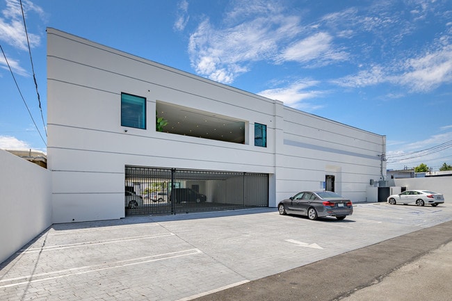
Property Record
2211 W Burbank Blvd, Burbank, CA 91506


NEARBY LISTINGS FOR SALE OR LEASE
Property Detail
2211 W Burbank Blvd
Los Angeles-Long Beach-Glendale, CA
Tract No 1936
2438-016-042
TR=7936 EX OF ST LOTS 3,4,5,6 AND 7
Officebuilding
Los Angeles
X
California
06037C1337F
3-7
2024
0.31 AC
2025
Burbank
310900
Los Angeles
9,442 SF
DEMOGRAPHICS near 2211 W Burbank Blvd
1 Mile
3 Mile
5 Mile
2024 Total Population
22,528
213,868
447,668
2029 Population
21,774
207,367
434,492
Pop Growth 2024-2029
(3.35%)
(3.04%)
(2.94%)
Average Age
41
40
41
2024 Total Households
8,390
86,074
177,398
HH Growth 2024-2029
(3.65%)
(3.19%)
(3.13%)
Median Household Inc
$96,917
$74,461
$78,491
Avg Household Size
2.60
2.40
2.40
2024 Avg HH Vehicles
2.00
2.00
2.00
Median Home Value
$824,852
$844,992
$897,082
Median Year Built
1948
1964
1965
Nearby Places
Map Layers
Map Styles
 Street
 Aerial
- Restaurants
- Banks
- Shops
- Fitness
- Groceries
PUBLIC TRANSPORTATION
COMMUTER RAIL
Burbank-Bob Hope Airport (Ventura County Line - Southern California Regional Rail Authority (Metrolink))
DRIVE
WALK
Distance
Burbank-Bob Hope Airport (Ventura County Line - Southern California Regional Rail Authority (Metrolink))
4 min
1.9 mi
Downtown Burbank (Antelope Valley Line - Southern California Regional Rail Authority (Metrolink), Ventura County Line - Southern California Regional Rail Authority (Metrolink))
DRIVE
WALK
Distance
Downtown Burbank (Antelope Valley Line - Southern California Regional Rail Authority (Metrolink), Ventura County Line - Southern California Regional Rail Authority (Metrolink))
5 min
2.2 mi
AIRPORT
Bob Hope
DRIVE
WALK
Distance
Bob Hope
9 min
3.9 mi
Los Angeles International
DRIVE
WALK
Distance
Los Angeles International
39 min
27.8 mi
Long Beach (Daugherty Field)
DRIVE
WALK
Distance
Long Beach (Daugherty Field)
46 min
34.3 mi
Freight Ports
Port of Long Beach
DRIVE
WALK
Distance
Port of Long Beach
49 min
36.2 mi
SALE & LEASE HISTORY
LISTING DATE
SALE/LEASE

Sep 01, 2017
For Lease
Mar 10, 2017
For Sale
Mar 10, 2017
For Sale
Jul 07, 2017
For Lease
Aug 27, 2019
For Sale
Nearby Properties
Address
Land Use
TOTAL SIZE
Lot Size
Zoning
Address
Land Use
TOTAL SIZE
Lot Size
Zoning
152,217 SF
70.95 AC
BUM1*
Address
Land Use
TOTAL SIZE
Lot Size
Zoning
735,900 SF
34.87 AC
BUPD*
Address
Land Use
TOTAL SIZE
Lot Size
Zoning
207,766 SF
42.81 AC
BUM1*
Address
Land Use
TOTAL SIZE
Lot Size
Zoning
12,827 SF
130.37 AC
LAM11/2*
Address
Land Use
TOTAL SIZE
Lot Size
Zoning
849,801 SF
59.25 AC
BUM2
Address
Land Use
TOTAL SIZE
Lot Size
Zoning
616,662 SF
19.66 AC
BUM1*
Address
Land Use
TOTAL SIZE
Lot Size
Zoning
986,983 SF
105.50 AC
LARE40
Address
Land Use
TOTAL SIZE
Lot Size
Zoning
397,477 SF
2.75 AC
BUR4
Address
Land Use
TOTAL SIZE
Lot Size
Zoning
690,600 SF
6.57 AC
LACM
Address
Land Use
TOTAL SIZE
Lot Size
Zoning
475,433 SF
19.35 AC
BUM1*
Address
Land Use
TOTAL SIZE
Lot Size
Zoning
489,466 SF
2.90 AC
BUM1
Address
Land Use
TOTAL SIZE
Lot Size
Zoning
452,048 SF
21.58 AC
BCCM
Address
Land Use
TOTAL SIZE
Lot Size
Zoning
696,128 SF
2.42 AC
BUC3*
Address
Land Use
TOTAL SIZE
Lot Size
Zoning
43,558 SF
30.11 AC
BUMI-C2*
Address
Land Use
TOTAL SIZE
Lot Size
Zoning
1,328,547 SF
39.36 AC
BUPD
Address
Land Use
TOTAL SIZE
Lot Size
Zoning
432,232 SF
7.17 AC
BUM2
Address
Land Use
TOTAL SIZE
Lot Size
Zoning
219,607 SF
1.51 AC
BUR4
Address
Land Use
TOTAL SIZE
Lot Size
Zoning
380,017 SF
Address
Land Use
TOTAL SIZE
Lot Size
Zoning
354,068 SF
2.72 AC
LAR4
Address
Land Use
TOTAL SIZE
Lot Size
Zoning
336,041 SF
2.05 AC
LAC4
Address
Land Use
TOTAL SIZE
Lot Size
Zoning
440,774 SF
2.20 AC
BUR4*
Address
Land Use
TOTAL SIZE
Lot Size
Zoning
462,896 SF
1.38 AC
BUR4*
Address
Land Use
TOTAL SIZE
Lot Size
Zoning
362,863 SF
1.82 AC
BUMZ
Address
Land Use
TOTAL SIZE
Lot Size
Zoning
346,186 SF
11.72 AC
BUM2*
Address
Land Use
TOTAL SIZE
Lot Size
Zoning
232,965 SF
3.78 AC
LAC4
Address
Land Use
TOTAL SIZE
Lot Size
Zoning
388,171 SF
2.42 AC
LAC4
Address
Land Use
TOTAL SIZE
Lot Size
Zoning
558,532 SF
5.20 AC
BUC4*
Address
Land Use
TOTAL SIZE
Lot Size
Zoning
660,463 SF
6.88 AC
BUR4*
Address
Land Use
TOTAL SIZE
Lot Size
Zoning
612,976 SF
3.53 AC
BUC2*
Address
Land Use
TOTAL SIZE
Lot Size
Zoning
227,746 SF
4.03 AC
LAC4
The World's #1 Commercial Real Estate Marketplace
Connect with us
© 2025 CoStar Group
The information above has been obtained from sources believed reliable. While we do not doubt its accuracy we have not verified it and make no guarantee, warranty or representation about it. It is your responsibility to independently confirm its accuracy and completeness. Any projections, opinions, assumptions, or estimates used are for example only and do not represent the current or future performance of the property. The value of this transaction to you depends on tax and other factors which should be evaluated by your tax, financial, and legal advisors. You and your advisors should conduct a careful, independent investigation of the property to determine to your satisfaction the suitability of the property for your needs.