Property Record
2211 W Shore Rd, Warwick, RI 02889
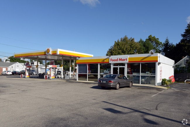

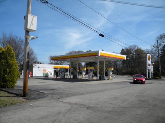
Property Detail
2211 W Shore Rd
Commercialbuilding
Kent
GB
Rhode Island
B and X Area of moderate flood hazard, usually the area between the limits of the 100-year and 500-year floods.
0.39 AC
2025
Warwick
2025
Providence
021800
Providence-Warwick, RI-MA
1,564 SF
WARW-000350-000241-000000
NEARBY LISTINGS FOR SALE OR LEASE
DEMOGRAPHICS near 2211 W Shore Rd
1 mile
3 mile
5 mile
2025 Total Population
9,933
50,123
118,849
2030 Population
10,082
50,667
120,492
Pop Growth 2025-2030
+ 1.50%
+ 1.09%
+ 1.38%
Average Age
43
44
44
2025 Total Households
4,097
21,302
50,701
HH Growth 2025-2030
+ 1.54%
+ 1.12%
+ 1.42%
Median Household Inc
$84,716
$92,601
$93,215
Avg Household Size
2.40
2.30
2.20
2025 Avg HH Vehicles
2.00
2.00
2.00
Median Home Value
$324,453
$350,235
$376,565
Median Year Built
1965
1958
1959
Nearby Places
Map Layers
Map Styles
 Street
 Aerial
Layers
 Traffic
 Biking
Places
Listings with unknown addresses are not visible on the map
- Restaurants
- Banks
- Shops
- Fitness
- Groceries
PUBLIC TRANSPORTATION
COMMUTER RAIL
Drive
Walk
Distance
7 min
3.8 mi
Providence (Providence/Stoughton Line - Massachusetts Bay Transportation Authority Commuter Rail (Purple Line))
Drive
Walk
Distance
Providence (Providence/Stoughton Line - Massachusetts Bay Transportation Authority Commuter Rail (Purple Line))
18 min
9.9 mi
AIRPORT
Rhode Island Tf Green International
Drive
Walk
Distance
Rhode Island Tf Green International
10 min
4.0 mi
Freight Ports
Port of Davisville, RI
Drive
Walk
Distance
Port of Davisville, RI
27 min
15.1 mi
Nearby Properties
Address
Land Use
TOTAL SIZE
Lot Size
Zoning
Address
Land Use
TOTAL SIZE
Lot Size
Zoning
6,640 SF
0.01 AC
A10
Address
Land Use
TOTAL SIZE
Lot Size
Zoning
40,385 SF
70 AC
A40
Address
Land Use
TOTAL SIZE
Lot Size
Zoning
228,067 SF
30.74 AC
A7
Address
Land Use
TOTAL SIZE
Lot Size
Zoning
485,238 SF
2.05 AC
GB
Address
Land Use
TOTAL SIZE
Lot Size
Zoning
517,743 SF
3.55 AC
GI
Address
Land Use
TOTAL SIZE
Lot Size
Zoning
491,496 SF
46.72 AC
LI
Address
Land Use
TOTAL SIZE
Lot Size
Zoning
100,638 SF
6.80 AC
GB
Address
Land Use
TOTAL SIZE
Lot Size
Zoning
135,317 SF
27.16 AC
A10
Address
Land Use
TOTAL SIZE
Lot Size
Zoning
294,355 SF
19.51 AC
Address
Land Use
TOTAL SIZE
Lot Size
Zoning
278,684 SF
1.39 AC
GB
Address
Land Use
TOTAL SIZE
Lot Size
Zoning
73,193 SF
19.87 AC
A10
Address
Land Use
TOTAL SIZE
Lot Size
Zoning
99,177 SF
LI
Address
Land Use
TOTAL SIZE
Lot Size
Zoning
19,584 SF
A10
Address
Land Use
TOTAL SIZE
Lot Size
Zoning
24,865 SF
A7
Address
Land Use
TOTAL SIZE
Lot Size
Zoning
4,288 SF
10.23 AC
GB
Address
Land Use
TOTAL SIZE
Lot Size
Zoning
103,020 SF
2.29 AC
GI
Address
Land Use
TOTAL SIZE
Lot Size
Zoning
18,876 SF
44.45 AC
A7
Address
Land Use
TOTAL SIZE
Lot Size
Zoning
600,771 SF
30.33 AC
Address
Land Use
TOTAL SIZE
Lot Size
Zoning
135,991 SF
3.73 AC
GB
Address
Land Use
TOTAL SIZE
Lot Size
Zoning
48,800 SF
78.50 AC
A15
Address
Land Use
TOTAL SIZE
Lot Size
Zoning
12,240 SF
A10
Address
Land Use
TOTAL SIZE
Lot Size
Zoning
20,768 SF
13.04 AC
A10
Address
Land Use
TOTAL SIZE
Lot Size
Zoning
18,032 SF
4.37 AC
A7
Address
Land Use
TOTAL SIZE
Lot Size
Zoning
67,252 SF
6.60 AC
A10
Address
Land Use
TOTAL SIZE
Lot Size
Zoning
39,041 SF
18.31 AC
GB
Address
Land Use
TOTAL SIZE
Lot Size
Zoning
79.02 AC
A7
Address
Land Use
TOTAL SIZE
Lot Size
Zoning
5.09 AC
Address
Land Use
TOTAL SIZE
Lot Size
Zoning
4,622 SF
473.27 AC
OS
Address
Land Use
TOTAL SIZE
Lot Size
Zoning
74,419 SF
3.12 AC
GB
Address
Land Use
TOTAL SIZE
Lot Size
Zoning
3,912 SF
11 AC
WB
The World's #1 Commercial Real Estate Marketplace
Connect with us
© 2026 CoStar Group
The information above has been obtained from sources believed reliable. While we do not doubt its accuracy we have not verified it and make no guarantee, warranty or representation about it. It is your responsibility to independently confirm its accuracy and completeness. Any projections, opinions, assumptions, or estimates used are for example only and do not represent the current or future performance of the property. The value of this transaction to you depends on tax and other factors which should be evaluated by your tax, financial, and legal advisors. You and your advisors should conduct a careful, independent investigation of the property to determine to your satisfaction the suitability of the property for your needs.