Property Record
22111 N White Rd, Maricopa, AZ 85139

Save to a Folder
{{folder.Name}}
{{folder.ListingIds.length}} Properties
{{folder.ListingIds.length}} Property
Create a New Folder
Property Detail
22111 N White Rd
Phoenix-Mesa-Chandler, AZ
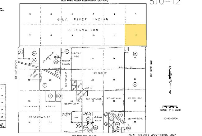
LOTS 1 & 2 SEC 18-4S-3E 87.05 AC
510-12-003
Pinal
Storageyardjunkautowreckingsalvage
Arizona
A Areas with a 1% annual chance of flooding and a 26% chance of flooding over the life of a 30-year mortgage.
1,2
2024
87.05 AC
2025
Pinal County
001701
Phoenix
11,585 SF
NEARBY LISTINGS FOR SALE OR LEASE
DEMOGRAPHICS near 22111 N White Rd
1 mile
3 mile
5 mile
2025 Total Population
0
3,212
43,468
2030 Population
0
3,748
50,736
Pop Growth 2025-2030
0.00%
+ 16.69%
+ 16.72%
Average Age
0
37
39
2025 Total Households
0
1,010
14,146
HH Growth 2025-2030
0.00%
+ 16.24%
+ 16.63%
Median Household Inc
$0
$90,624
$95,459
Avg Household Size
.00
3.10
3.00
2025 Avg HH Vehicles
.00
2.00
2.00
Median Home Value
$0
$348,402
$382,512
Median Year Built
0
2004
2005
Nearby Places
Map Layers
Map Styles
 Street
 Aerial
Layers
 Traffic
 Biking
Places
Listings with unknown addresses are not visible on the map
- Restaurants
- Banks
- Shops
- Fitness
- Groceries
PUBLIC TRANSPORTATION
COMMUTER RAIL
Maricopa (Sunset Limited - Amtrak, Texas Eagle - Amtrak)
Drive
Walk
Distance
Maricopa (Sunset Limited - Amtrak, Texas Eagle - Amtrak)
7 min
4.6 mi
AIRPORT
Phoenix Sky Harbor International
Drive
Walk
Distance
Phoenix Sky Harbor International
46 min
32.2 mi
Phoenix-Mesa Gateway
Drive
Walk
Distance
Phoenix-Mesa Gateway
54 min
37.3 mi
Freight Ports
Port of San Diego
Drive
Walk
Distance
Port of San Diego
370 min
325.2 mi
Nearby Properties
Address
Land Use
TOTAL SIZE
Lot Size
Zoning
Address
Land Use
TOTAL SIZE
Lot Size
Zoning
108,328 SF
320 AC
Address
Land Use
TOTAL SIZE
Lot Size
Zoning
38,215 SF
9.84 AC
Address
Land Use
TOTAL SIZE
Lot Size
Zoning
19,650 SF
317.62 AC
UNDESIGNAT
Address
Land Use
TOTAL SIZE
Lot Size
Zoning
147,666 SF
14.01 AC
Address
Land Use
TOTAL SIZE
Lot Size
Zoning
5.83 AC
Address
Land Use
TOTAL SIZE
Lot Size
Zoning
28,535 SF
320 AC
Address
Land Use
TOTAL SIZE
Lot Size
Zoning
16,269 SF
81.42 AC
Address
Land Use
TOTAL SIZE
Lot Size
Zoning
68.47 AC
UNDESIGNAT
Address
Land Use
TOTAL SIZE
Lot Size
Zoning
7,184 SF
23.34 AC
Address
Land Use
TOTAL SIZE
Lot Size
Zoning
Address
Land Use
TOTAL SIZE
Lot Size
Zoning
77.08 AC
GR
Address
Land Use
TOTAL SIZE
Lot Size
Zoning
Address
Land Use
TOTAL SIZE
Lot Size
Zoning
3,552 SF
10 AC
CI2
Address
Land Use
TOTAL SIZE
Lot Size
Zoning
60.52 AC
UNDESIGNAT
Address
Land Use
TOTAL SIZE
Lot Size
Zoning
Address
Land Use
TOTAL SIZE
Lot Size
Zoning
46.96 AC
CI2
Address
Land Use
TOTAL SIZE
Lot Size
Zoning
4,800 SF
5 AC
CI2
Address
Land Use
TOTAL SIZE
Lot Size
Zoning
2,352 SF
5 AC
CI2
Address
Land Use
TOTAL SIZE
Lot Size
Zoning
2,358 SF
5 AC
CI2
Address
Land Use
TOTAL SIZE
Lot Size
Zoning
Address
Land Use
TOTAL SIZE
Lot Size
Zoning
5,034 SF
0.34 AC
Address
Land Use
TOTAL SIZE
Lot Size
Zoning
4,720 SF
5 AC
CI2
The World's #1 Commercial Real Estate Marketplace
Connect with us
© 2026 CoStar Group
The information above has been obtained from sources believed reliable. While we do not doubt its accuracy we have not verified it and make no guarantee, warranty or representation about it. It is your responsibility to independently confirm its accuracy and completeness. Any projections, opinions, assumptions, or estimates used are for example only and do not represent the current or future performance of the property. The value of this transaction to you depends on tax and other factors which should be evaluated by your tax, financial, and legal advisors. You and your advisors should conduct a careful, independent investigation of the property to determine to your satisfaction the suitability of the property for your needs.