Property Record
2212 Highway 78 Nw, Monroe, GA 30655

NEARBY LISTINGS FOR SALE OR LEASE
Property Detail
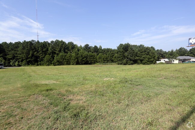
2212 Highway 78 Nw
Atlanta-Sandy Springs-Roswell, GA
09094-Sf-Hwy 78 Major
C061000000159A00
TR#3 1.76AC
Commercialnec
Walton
X
Georgia
13297C0105E
0.97 AC
2024
Walton County
2024
Atlanta
110702
DEMOGRAPHICS near 2212 Highway 78 Nw
1 Mile
3 Mile
5 Mile
2024 Total Population
1,347
13,707
46,186
2029 Population
1,547
15,759
52,662
Pop Growth 2024-2029
+ 14.85%
+ 14.97%
+ 14.02%
Average Age
41
41
40
2024 Total Households
449
4,651
15,390
HH Growth 2024-2029
+ 15.14%
+ 15.33%
+ 14.42%
Median Household Inc
$83,104
$84,675
$86,548
Avg Household Size
2.90
2.90
2.90
2024 Avg HH Vehicles
2.00
2.00
2.00
Median Home Value
$306,908
$286,535
$287,170
Median Year Built
1997
1998
1999
Nearby Places
Map Layers
Map Styles
 Street
 Aerial
- Restaurants
- Banks
- Shops
- Fitness
- Groceries
SALE & LEASE HISTORY
LISTING DATE
SALE/LEASE

Sep 24, 2016
For Sale
Nearby Properties
Address
Land Use
TOTAL SIZE
Lot Size
Zoning
Address
Land Use
TOTAL SIZE
Lot Size
Zoning
3,480 SF
57.72 AC
RM8
Address
Land Use
TOTAL SIZE
Lot Size
Zoning
154,281 SF
45.25 AC
R44
Address
Land Use
TOTAL SIZE
Lot Size
Zoning
34,128 SF
61.26 AC
A1 B2 M1
Address
Land Use
TOTAL SIZE
Lot Size
Zoning
33,685 SF
17.71 AC
CH
Address
Land Use
TOTAL SIZE
Lot Size
Zoning
2,100 SF
25 AC
R44
Address
Land Use
TOTAL SIZE
Lot Size
Zoning
25,039 SF
3.05 AC
OI
Address
Land Use
TOTAL SIZE
Lot Size
Zoning
20.13 AC
CH
Address
Land Use
TOTAL SIZE
Lot Size
Zoning
4,950 SF
6.96 AC
M1
Address
Land Use
TOTAL SIZE
Lot Size
Zoning
8,640 SF
53 AC
A1
Address
Land Use
TOTAL SIZE
Lot Size
Zoning
12,800 SF
7.36 AC
B3
Address
Land Use
TOTAL SIZE
Lot Size
Zoning
25,340 SF
7.59 AC
B1
Address
Land Use
TOTAL SIZE
Lot Size
Zoning
9,316 SF
2.40 AC
OI
Address
Land Use
TOTAL SIZE
Lot Size
Zoning
37.27 AC
MHP
Address
Land Use
TOTAL SIZE
Lot Size
Zoning
6,300 SF
1.64 AC
B2
Address
Land Use
TOTAL SIZE
Lot Size
Zoning
188.42 AC
B2 R1
Address
Land Use
TOTAL SIZE
Lot Size
Zoning
5,000 SF
5.83 AC
B2
Address
Land Use
TOTAL SIZE
Lot Size
Zoning
10,903 SF
9.92 AC
A1
Address
Land Use
TOTAL SIZE
Lot Size
Zoning
16,450 SF
7.06 AC
B2
Address
Land Use
TOTAL SIZE
Lot Size
Zoning
4,336 SF
3.76 AC
M1
Address
Land Use
TOTAL SIZE
Lot Size
Zoning
8.98 AC
CH
Address
Land Use
TOTAL SIZE
Lot Size
Zoning
8.69 AC
OI
Address
Land Use
TOTAL SIZE
Lot Size
Zoning
18,180 SF
10 AC
A1
Address
Land Use
TOTAL SIZE
Lot Size
Zoning
160.43 AC
R1
Address
Land Use
TOTAL SIZE
Lot Size
Zoning
8,135 SF
16.22 AC
B2
Address
Land Use
TOTAL SIZE
Lot Size
Zoning
25,300 SF
5.34 AC
B2
Address
Land Use
TOTAL SIZE
Lot Size
Zoning
21,500 SF
2 AC
M1
Address
Land Use
TOTAL SIZE
Lot Size
Zoning
9,000 SF
3.69 AC
B3
Address
Land Use
TOTAL SIZE
Lot Size
Zoning
28.01 AC
B2
Address
Land Use
TOTAL SIZE
Lot Size
Zoning
13,500 SF
2.99 AC
I1
Address
Land Use
TOTAL SIZE
Lot Size
Zoning
11,000 SF
3 AC
CH
The World's #1 Commercial Real Estate Marketplace
Connect with us
© 2025 CoStar Group
The information above has been obtained from sources believed reliable. While we do not doubt its accuracy we have not verified it and make no guarantee, warranty or representation about it. It is your responsibility to independently confirm its accuracy and completeness. Any projections, opinions, assumptions, or estimates used are for example only and do not represent the current or future performance of the property. The value of this transaction to you depends on tax and other factors which should be evaluated by your tax, financial, and legal advisors. You and your advisors should conduct a careful, independent investigation of the property to determine to your satisfaction the suitability of the property for your needs.