Property Record
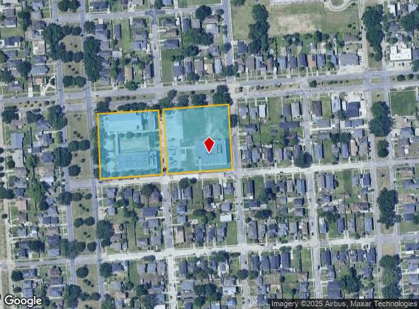
2212 Prentiss Ave, New Orleans, LA 70122

NEARBY LISTINGS FOR SALE OR LEASE
Property Detail
2212 Prentiss Ave
New Orleans-Metairie, LA
St Raphael Ii
3-8W-4-207-01
SQS 4414 AND 4415 LOT 2 SQUARES EXEMPT BR CATHOLIC CHURCH(TRANSFIGURATION) E REC PERMIT (311)
Religious
Orleans
AE
Louisiana
22051C0150F
2
0
4.39 AC
2025
Gentilly/St Claude
002501
New Orleans/Metairie/Kenner
DEMOGRAPHICS near 2212 Prentiss Ave
1 Mile
3 Mile
5 Mile
2024 Total Population
16,418
77,974
215,438
2029 Population
15,516
74,346
207,796
Pop Growth 2024-2029
(5.49%)
(4.65%)
(3.55%)
Average Age
40
41
41
2024 Total Households
6,565
31,754
95,887
HH Growth 2024-2029
(5.91%)
(4.93%)
(3.49%)
Median Household Inc
$46,975
$39,330
$44,132
Avg Household Size
2.30
2.30
2.10
2024 Avg HH Vehicles
1.00
1.00
1.00
Median Home Value
$256,245
$251,440
$289,987
Median Year Built
1958
1957
1957
Nearby Places
Map Layers
Map Styles
 Street
 Aerial
- Restaurants
- Banks
- Shops
- Fitness
- Groceries
PUBLIC TRANSPORTATION
AIRPORT
Louis Armstrong New Orleans International
DRIVE
WALK
Distance
Louis Armstrong New Orleans International
26 min
15.6 mi
Freight Ports
Port of New Orleans
DRIVE
WALK
Distance
Port of New Orleans
1 min
6.7 mi
Nearby Properties
Address
Land Use
TOTAL SIZE
Lot Size
Zoning
Address
Land Use
TOTAL SIZE
Lot Size
Zoning
Address
Land Use
TOTAL SIZE
Lot Size
Zoning
150.60 AC
EC
Address
Land Use
TOTAL SIZE
Lot Size
Zoning
33.64 AC
EC
Address
Land Use
TOTAL SIZE
Lot Size
Zoning
225,284 SF
16.83 AC
S-RD
Address
Land Use
TOTAL SIZE
Lot Size
Zoning
224,374 SF
92.67 AC
HU-RD1
Address
Land Use
TOTAL SIZE
Lot Size
Zoning
189,613 SF
71.45 AC
S-RD
Address
Land Use
TOTAL SIZE
Lot Size
Zoning
8,300 SF
30.83 AC
EC
Address
Land Use
TOTAL SIZE
Lot Size
Zoning
14.83 AC
EC
Address
Land Use
TOTAL SIZE
Lot Size
Zoning
484,670 SF
18.69 AC
EC
Address
Land Use
TOTAL SIZE
Lot Size
Zoning
173,008 SF
4.03 AC
S-RS
Address
Land Use
TOTAL SIZE
Lot Size
Zoning
20.49 AC
S-RS
Address
Land Use
TOTAL SIZE
Lot Size
Zoning
183.59 AC
OS-R
Address
Land Use
TOTAL SIZE
Lot Size
Zoning
Address
Land Use
TOTAL SIZE
Lot Size
Zoning
136,984 SF
4.67 AC
S-RS
Address
Land Use
TOTAL SIZE
Lot Size
Zoning
98,642 SF
7.30 AC
HU-RS
Address
Land Use
TOTAL SIZE
Lot Size
Zoning
1.14 AC
S-B2
Address
Land Use
TOTAL SIZE
Lot Size
Zoning
104,900 SF
7.37 AC
S-RS
Address
Land Use
TOTAL SIZE
Lot Size
Zoning
108,104 SF
8.98 AC
S-LRS1
Address
Land Use
TOTAL SIZE
Lot Size
Zoning
435,732 SF
29.06 AC
LI
Address
Land Use
TOTAL SIZE
Lot Size
Zoning
31,894 SF
500 AC
MI
Address
Land Use
TOTAL SIZE
Lot Size
Zoning
13,496 SF
3.01 AC
HU-RD2
Address
Land Use
TOTAL SIZE
Lot Size
Zoning
210,959 SF
6.61 AC
EC
Address
Land Use
TOTAL SIZE
Lot Size
Zoning
7.32 AC
S-RS
Address
Land Use
TOTAL SIZE
Lot Size
Zoning
13.23 AC
MI
Address
Land Use
TOTAL SIZE
Lot Size
Zoning
3.06 AC
HU-RD1
Address
Land Use
TOTAL SIZE
Lot Size
Zoning
95,728 SF
5.01 AC
S-RS
Address
Land Use
TOTAL SIZE
Lot Size
Zoning
94,050 SF
4.96 AC
S-RS
Address
Land Use
TOTAL SIZE
Lot Size
Zoning
98,500 SF
5.54 AC
S-RS
Address
Land Use
TOTAL SIZE
Lot Size
Zoning
6.62 AC
MU-1
The World's #1 Commercial Real Estate Marketplace
Connect with us
© 2026 CoStar Group
The information above has been obtained from sources believed reliable. While we do not doubt its accuracy we have not verified it and make no guarantee, warranty or representation about it. It is your responsibility to independently confirm its accuracy and completeness. Any projections, opinions, assumptions, or estimates used are for example only and do not represent the current or future performance of the property. The value of this transaction to you depends on tax and other factors which should be evaluated by your tax, financial, and legal advisors. You and your advisors should conduct a careful, independent investigation of the property to determine to your satisfaction the suitability of the property for your needs.