Property Record
22131 Rothwood Rd, Spring, TX 77389
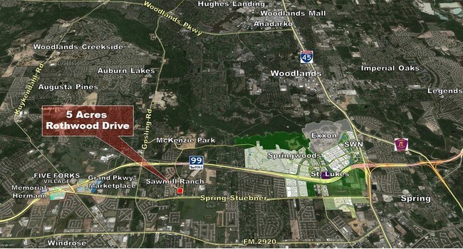


NEARBY LISTINGS FOR SALE OR LEASE
Property Detail
22131 Rothwood Rd
1384120010001
Rothwood Center
Outdoorrecreationbeachmountaindesert
TR 22-1 ABST 189 J COOPER
X
Harris
48339C0680G
Texas
2024
4.48 AC
2025
The Woodlands
554902
Houston
69,940 SF
Houston-The Woodlands-Sugar Land, TX
DEMOGRAPHICS near 22131 Rothwood Rd
1 Mile
3 Mile
5 Mile
2024 Total Population
8,465
71,896
225,560
2029 Population
8,828
74,453
238,001
Pop Growth 2024-2029
+ 4.29%
+ 3.56%
+ 5.52%
Average Age
35
37
37
2024 Total Households
2,707
24,473
79,450
HH Growth 2024-2029
+ 4.14%
+ 3.75%
+ 6.14%
Median Household Inc
$89,481
$98,176
$92,589
Avg Household Size
3.10
2.90
2.80
2024 Avg HH Vehicles
2.00
2.00
2.00
Median Home Value
$259,378
$261,288
$272,449
Median Year Built
2009
2004
2001
Nearby Places
Map Layers
Map Styles
 Street
 Aerial
- Restaurants
- Banks
- Shops
- Fitness
- Groceries
PUBLIC TRANSPORTATION
AIRPORT
George Bush Intcntl/Houston
DRIVE
WALK
Distance
George Bush Intcntl/Houston
28 min
20.4 mi
Freight Ports
Port of Houston
DRIVE
WALK
Distance
Port of Houston
49 min
34.7 mi
SALE & LEASE HISTORY
LISTING DATE
SALE/LEASE

Sep 24, 2016
For Sale
Mar 13, 2017
For Sale
Jul 18, 2019
For Lease
Nearby Properties
Address
Land Use
TOTAL SIZE
Lot Size
Zoning
Address
Land Use
TOTAL SIZE
Lot Size
Zoning
178,645 SF
8.74 AC
Address
Land Use
TOTAL SIZE
Lot Size
Zoning
382,636 SF
25.51 AC
Address
Land Use
TOTAL SIZE
Lot Size
Zoning
379,180 SF
15.52 AC
Address
Land Use
TOTAL SIZE
Lot Size
Zoning
454,599 SF
22.79 AC
Address
Land Use
TOTAL SIZE
Lot Size
Zoning
320,507 SF
25.29 AC
Address
Land Use
TOTAL SIZE
Lot Size
Zoning
156,885 SF
26.24 AC
Address
Land Use
TOTAL SIZE
Lot Size
Zoning
368,000 SF
8.65 AC
Address
Land Use
TOTAL SIZE
Lot Size
Zoning
375,293 SF
19.29 AC
Address
Land Use
TOTAL SIZE
Lot Size
Zoning
394,700 SF
17.34 AC
Address
Land Use
TOTAL SIZE
Lot Size
Zoning
532,751 SF
6.43 AC
Address
Land Use
TOTAL SIZE
Lot Size
Zoning
364,860 SF
14.96 AC
Address
Land Use
TOTAL SIZE
Lot Size
Zoning
341,336 SF
14.03 AC
Address
Land Use
TOTAL SIZE
Lot Size
Zoning
343,806 SF
17.76 AC
Address
Land Use
TOTAL SIZE
Lot Size
Zoning
335,258 SF
12.18 AC
Address
Land Use
TOTAL SIZE
Lot Size
Zoning
328,692 SF
18.47 AC
Address
Land Use
TOTAL SIZE
Lot Size
Zoning
434,400 SF
23.55 AC
Address
Land Use
TOTAL SIZE
Lot Size
Zoning
304,096 SF
14.80 AC
Address
Land Use
TOTAL SIZE
Lot Size
Zoning
282,661 SF
17.81 AC
Address
Land Use
TOTAL SIZE
Lot Size
Zoning
266,594 SF
10.71 AC
Address
Land Use
TOTAL SIZE
Lot Size
Zoning
343,521 SF
9.88 AC
Address
Land Use
TOTAL SIZE
Lot Size
Zoning
290,353 SF
10.79 AC
Address
Land Use
TOTAL SIZE
Lot Size
Zoning
413,131 SF
12.52 AC
Address
Land Use
TOTAL SIZE
Lot Size
Zoning
291,073 SF
11.70 AC
Address
Land Use
TOTAL SIZE
Lot Size
Zoning
296,117 SF
21.52 AC
Address
Land Use
TOTAL SIZE
Lot Size
Zoning
241,113 SF
6.29 AC
Address
Land Use
TOTAL SIZE
Lot Size
Zoning
188,265 SF
15.65 AC
Address
Land Use
TOTAL SIZE
Lot Size
Zoning
135.95 AC
Address
Land Use
TOTAL SIZE
Lot Size
Zoning
219,000 SF
46.59 AC
Address
Land Use
TOTAL SIZE
Lot Size
Zoning
800 SF
23.53 AC
Address
Land Use
TOTAL SIZE
Lot Size
Zoning
114,917 SF
18.61 AC
The World's #1 Commercial Real Estate Marketplace
Connect with us
© 2025 CoStar Group
The information above has been obtained from sources believed reliable. While we do not doubt its accuracy we have not verified it and make no guarantee, warranty or representation about it. It is your responsibility to independently confirm its accuracy and completeness. Any projections, opinions, assumptions, or estimates used are for example only and do not represent the current or future performance of the property. The value of this transaction to you depends on tax and other factors which should be evaluated by your tax, financial, and legal advisors. You and your advisors should conduct a careful, independent investigation of the property to determine to your satisfaction the suitability of the property for your needs.