Property Record
Lake Murray Blvd, Columbia, SC 29212


This Property Is For Sale
NEARBY LISTINGS FOR SALE OR LEASE
Property Detail
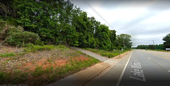
Lake Murray Blvd
002697-01-046
TRACT FW-1 (4.93 AC) & NORTHERN PORTION OF TRACT FW-2 - MOSTLY POND AREA
Commercialacreage
Lexington
AE
South Carolina
45063C0129J
6.09 AC
2025
Dutch Fork/Irmo
2024
Columbia
021110
Columbia, SC
DEMOGRAPHICS near Lake Murray Blvd
1 Mile
3 Mile
5 Mile
2024 Total Population
4,311
30,854
77,827
2029 Population
4,768
32,825
81,995
Pop Growth 2024-2029
+ 10.60%
+ 6.39%
+ 5.36%
Average Age
42
42
41
2024 Total Households
1,915
12,759
31,536
HH Growth 2024-2029
+ 10.86%
+ 6.66%
+ 5.42%
Median Household Inc
$88,342
$80,348
$80,702
Avg Household Size
2.20
2.40
2.40
2024 Avg HH Vehicles
2.00
2.00
2.00
Median Home Value
$241,337
$199,239
$225,200
Median Year Built
1998
1985
1990
Nearby Places
Map Layers
Map Styles
 Street
 Aerial
- Restaurants
- Banks
- Shops
- Fitness
- Groceries
PUBLIC TRANSPORTATION
AIRPORT
Columbia Metro
DRIVE
WALK
Distance
Columbia Metro
34 min
18.2 mi
Freight Ports
North Charleston Terminal
DRIVE
WALK
Distance
North Charleston Terminal
134 min
114.5 mi
Nearby Properties
Address
Land Use
TOTAL SIZE
Lot Size
Zoning
Address
Land Use
TOTAL SIZE
Lot Size
Zoning
24.90 AC
PD
Address
Land Use
TOTAL SIZE
Lot Size
Zoning
215,796 SF
12.71 AC
PD
Address
Land Use
TOTAL SIZE
Lot Size
Zoning
86,542 SF
3.25 AC
PD
Address
Land Use
TOTAL SIZE
Lot Size
Zoning
88,284 SF
0.78 AC
PD
Address
Land Use
TOTAL SIZE
Lot Size
Zoning
81,197 SF
10.34 AC
C-3
Address
Land Use
TOTAL SIZE
Lot Size
Zoning
153,210 SF
31.78 AC
LM
Address
Land Use
TOTAL SIZE
Lot Size
Zoning
77,644 SF
2.59 AC
PD
Address
Land Use
TOTAL SIZE
Lot Size
Zoning
75,358 SF
13.84 AC
M-1
Address
Land Use
TOTAL SIZE
Lot Size
Zoning
66,351 SF
2.20 AC
PD
Address
Land Use
TOTAL SIZE
Lot Size
Zoning
8,358 SF
9.12 AC
CG
Address
Land Use
TOTAL SIZE
Lot Size
Zoning
243,045 SF
12.97 AC
PD
Address
Land Use
TOTAL SIZE
Lot Size
Zoning
76,204 SF
2.26 AC
CN
Address
Land Use
TOTAL SIZE
Lot Size
Zoning
66,612 SF
5.56 AC
CG
Address
Land Use
TOTAL SIZE
Lot Size
Zoning
54,842 SF
1.73 AC
PD
Address
Land Use
TOTAL SIZE
Lot Size
Zoning
85,201 SF
48.22 AC
CG
Address
Land Use
TOTAL SIZE
Lot Size
Zoning
13.81 AC
M-1
Address
Land Use
TOTAL SIZE
Lot Size
Zoning
49,840 SF
2.25 AC
CG
Address
Land Use
TOTAL SIZE
Lot Size
Zoning
67,864 SF
3.94 AC
CG
Address
Land Use
TOTAL SIZE
Lot Size
Zoning
95,450 SF
3.68 AC
PDD
Address
Land Use
TOTAL SIZE
Lot Size
Zoning
56,958 SF
6.21 AC
CG
Address
Land Use
TOTAL SIZE
Lot Size
Zoning
49,050 SF
1.86 AC
PD
Address
Land Use
TOTAL SIZE
Lot Size
Zoning
449,903 SF
34.47 AC
C1
Address
Land Use
TOTAL SIZE
Lot Size
Zoning
14,370 SF
6.84 AC
RU
Address
Land Use
TOTAL SIZE
Lot Size
Zoning
14,400 SF
2.31 AC
CN
Address
Land Use
TOTAL SIZE
Lot Size
Zoning
7.25 AC
PD
Address
Land Use
TOTAL SIZE
Lot Size
Zoning
15,000 SF
3.98 AC
RU
Address
Land Use
TOTAL SIZE
Lot Size
Zoning
15,252 SF
5.70 AC
RS-LD
Address
Land Use
TOTAL SIZE
Lot Size
Zoning
43,068 SF
2.19 AC
PD
Address
Land Use
TOTAL SIZE
Lot Size
Zoning
4,405 SF
1.14 AC
PD
Address
Land Use
TOTAL SIZE
Lot Size
Zoning
31,731 SF
5 AC
CG
The World's #1 Commercial Real Estate Marketplace
Connect with us
© 2026 CoStar Group
The information above has been obtained from sources believed reliable. While we do not doubt its accuracy we have not verified it and make no guarantee, warranty or representation about it. It is your responsibility to independently confirm its accuracy and completeness. Any projections, opinions, assumptions, or estimates used are for example only and do not represent the current or future performance of the property. The value of this transaction to you depends on tax and other factors which should be evaluated by your tax, financial, and legal advisors. You and your advisors should conduct a careful, independent investigation of the property to determine to your satisfaction the suitability of the property for your needs.