Property Record
2214 Scurlock Rd, Panama City, FL 32409

NEARBY LISTINGS FOR SALE OR LEASE
Property Detail
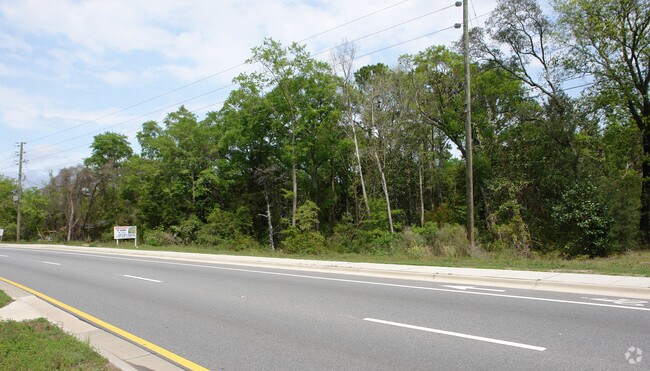
2214 Scurlock Rd
08015-000-000
27 2S 14W -105- BEG 320 E OF S LI KIRKWD RD & E LI RD 52 TH SELY 222.2 NELY 160NWLY 222.2 TO RD SWLY 160 TO POB ORB 3910 P 943
Residentialacreage
Bay
AE
Florida
12005C0220J
0.30 AC
2024
Panama City
2025
Other Market Areas
000203
Panama City-Panama City Beach, FL
910 SF
DEMOGRAPHICS near 2214 Scurlock Rd
1 mile
3 mile
5 mile
2024 Total Population
1,480
8,934
28,429
2029 Population
1,589
9,437
29,721
Pop Growth 2024-2029
+ 7.36%
+ 5.63%
+ 4.54%
Average Age
40
42
41
2024 Total Households
553
3,323
10,765
HH Growth 2024-2029
+ 8.14%
+ 6.14%
+ 4.96%
Median Household Inc
$46,964
$60,534
$71,015
Avg Household Size
2.70
2.60
2.60
2024 Avg HH Vehicles
2.00
2.00
2.00
Median Home Value
$172,784
$248,330
$251,696
Median Year Built
1992
1990
1992
Nearby Places
Map Layers
Map Styles
 Street
 Aerial
Transit
 Traffic
 Biking
Places
Listings with unknown addresses are not visible on the map
- Restaurants
- Banks
- Shops
- Fitness
- Groceries
PUBLIC TRANSPORTATION
AIRPORT
Northwest Florida Beaches International
Drive
Walk
Distance
Northwest Florida Beaches International
21 min
13.7 mi
Nearby Properties
Address
Land Use
TOTAL SIZE
Lot Size
Zoning
Address
Land Use
TOTAL SIZE
Lot Size
Zoning
50,491 SF
6.48 AC
BC14
Address
Land Use
TOTAL SIZE
Lot Size
Zoning
241.76 AC
BC01
Address
Land Use
TOTAL SIZE
Lot Size
Zoning
5,972 SF
12.53 AC
AAA
Address
Land Use
TOTAL SIZE
Lot Size
Zoning
42,809 SF
0.77 AC
PSP
Address
Land Use
TOTAL SIZE
Lot Size
Zoning
27,485 SF
4.71 AC
BC16
Address
Land Use
TOTAL SIZE
Lot Size
Zoning
2,895 SF
97.83 AC
Address
Land Use
TOTAL SIZE
Lot Size
Zoning
69,020 SF
4.44 AC
BC14
Address
Land Use
TOTAL SIZE
Lot Size
Zoning
6,273 SF
2.06 AC
R1
Address
Land Use
TOTAL SIZE
Lot Size
Zoning
16,165 SF
1.72 AC
RB
Address
Land Use
TOTAL SIZE
Lot Size
Zoning
9,276 SF
0.66 AC
AAA
Address
Land Use
TOTAL SIZE
Lot Size
Zoning
24,134 SF
5.17 AC
UND
Address
Land Use
TOTAL SIZE
Lot Size
Zoning
6.65 AC
BC13
Address
Land Use
TOTAL SIZE
Lot Size
Zoning
73,792 SF
7.53 AC
PSP
Address
Land Use
TOTAL SIZE
Lot Size
Zoning
31 AC
BC16
Address
Land Use
TOTAL SIZE
Lot Size
Zoning
5,178 SF
0.48 AC
R1
Address
Land Use
TOTAL SIZE
Lot Size
Zoning
6,440 SF
0.72 AC
AAA
Address
Land Use
TOTAL SIZE
Lot Size
Zoning
57,580 SF
4.01 AC
BC05
Address
Land Use
TOTAL SIZE
Lot Size
Zoning
8,399 SF
0.61 AC
AAA
Address
Land Use
TOTAL SIZE
Lot Size
Zoning
3,890 SF
43.10 AC
BC16
Address
Land Use
TOTAL SIZE
Lot Size
Zoning
231.05 AC
BC08
Address
Land Use
TOTAL SIZE
Lot Size
Zoning
4,981 SF
0.73 AC
UND
Address
Land Use
TOTAL SIZE
Lot Size
Zoning
6,892 SF
1.39 AC
BC15
Address
Land Use
TOTAL SIZE
Lot Size
Zoning
17,169 SF
4.06 AC
BC14
Address
Land Use
TOTAL SIZE
Lot Size
Zoning
8,430 SF
0.46 AC
AAA
Address
Land Use
TOTAL SIZE
Lot Size
Zoning
7,529 SF
0.72 AC
AAA
Address
Land Use
TOTAL SIZE
Lot Size
Zoning
4,484 SF
4.49 AC
BC16
Address
Land Use
TOTAL SIZE
Lot Size
Zoning
5,504 SF
0.69 AC
R1
Address
Land Use
TOTAL SIZE
Lot Size
Zoning
7,127 SF
0.36 AC
UND
Address
Land Use
TOTAL SIZE
Lot Size
Zoning
6,578 SF
0.92 AC
BC15
Address
Land Use
TOTAL SIZE
Lot Size
Zoning
12,060 SF
50.03 AC
BC14
The World's #1 Commercial Real Estate Marketplace
Connect with us
© 2026 CoStar Group
The information above has been obtained from sources believed reliable. While we do not doubt its accuracy we have not verified it and make no guarantee, warranty or representation about it. It is your responsibility to independently confirm its accuracy and completeness. Any projections, opinions, assumptions, or estimates used are for example only and do not represent the current or future performance of the property. The value of this transaction to you depends on tax and other factors which should be evaluated by your tax, financial, and legal advisors. You and your advisors should conduct a careful, independent investigation of the property to determine to your satisfaction the suitability of the property for your needs.