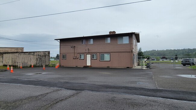
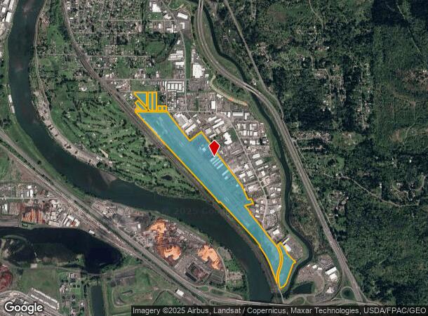
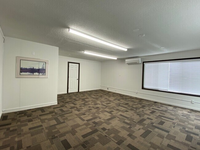
Property Record
2215 Parrott Way, Kelso, WA 98626
NEARBY LISTINGS FOR SALE OR LEASE
Property Detail
2215 Parrott Way
Longview, WA
Kelso Outlot
2-408727
817 (KELSO OUTLOT) -KEOL -305U, 257, 2 -7N -2W HUNTINGTON D DLC. KEOL 257B-1,257D-1,305D-1,305-O1,309B, TURNERS HOME TRS 1 BLK 1 LOT 14 THRU 18, 22, BLK 2 LOT 1 THRU 4, BLK 3 LOT 1 THRU 8, BLK 4 LOT 4,5, LL01090 LOT 2 EXC KEOL 305U-1 FEE 941122009.
Airport
Cowlitz
X
Washington
53015C0682G
305u
2025
114.62 AC
2024
Cowlitz County
001100
Portland
9,020 SF
DEMOGRAPHICS near 2215 Parrott Way
1 Mile
3 Mile
5 Mile
2024 Total Population
2,917
37,762
64,935
2029 Population
3,020
39,083
67,232
Pop Growth 2024-2029
+ 3.53%
+ 3.50%
+ 3.54%
Average Age
38
40
41
2024 Total Households
1,055
15,292
25,762
HH Growth 2024-2029
+ 3.79%
+ 3.62%
+ 3.62%
Median Household Inc
$44,507
$55,435
$62,963
Avg Household Size
2.70
2.40
2.40
2024 Avg HH Vehicles
2.00
2.00
2.00
Median Home Value
$168,918
$304,104
$329,985
Median Year Built
1970
1958
1965
Nearby Places
Map Layers
Map Styles
 Street
 Aerial
- Restaurants
- Banks
- Shops
- Fitness
- Groceries
PUBLIC TRANSPORTATION
COMMUTER RAIL
Kelso-Longview (Amtrak Cascades - Amtrak, Coast Starlight - Amtrak)
DRIVE
WALK
Distance
Kelso-Longview (Amtrak Cascades - Amtrak, Coast Starlight - Amtrak)
4 min
2.0 mi
Freight Ports
Port of Long View, WA
DRIVE
WALK
Distance
Port of Long View, WA
12 min
6.0 mi
SALE & LEASE HISTORY
LISTING DATE
SALE/LEASE

Jun 06, 2022
For Lease
Nearby Properties
Address
Land Use
TOTAL SIZE
Lot Size
Zoning
Address
Land Use
TOTAL SIZE
Lot Size
Zoning
93.25 AC
MH0
Address
Land Use
TOTAL SIZE
Lot Size
Zoning
83,033 SF
27.78 AC
R01
Address
Land Use
TOTAL SIZE
Lot Size
Zoning
40.70 AC
MH0
Address
Land Use
TOTAL SIZE
Lot Size
Zoning
Address
Land Use
TOTAL SIZE
Lot Size
Zoning
9,600 SF
26.83 AC
MH0
Address
Land Use
TOTAL SIZE
Lot Size
Zoning
92.77 AC
I02
Address
Land Use
TOTAL SIZE
Lot Size
Zoning
40.41 AC
R02
Address
Land Use
TOTAL SIZE
Lot Size
Zoning
10.12 AC
I01
Address
Land Use
TOTAL SIZE
Lot Size
Zoning
139,660 SF
2.76 AC
Address
Land Use
TOTAL SIZE
Lot Size
Zoning
206,926 SF
4.80 AC
C02
Address
Land Use
TOTAL SIZE
Lot Size
Zoning
1 SF
76.14 AC
MH0
Address
Land Use
TOTAL SIZE
Lot Size
Zoning
28.39 AC
M02
Address
Land Use
TOTAL SIZE
Lot Size
Zoning
1 SF
88.15 AC
M01
Address
Land Use
TOTAL SIZE
Lot Size
Zoning
160,069 SF
20.68 AC
M01
Address
Land Use
TOTAL SIZE
Lot Size
Zoning
106.19 AC
M01
Address
Land Use
TOTAL SIZE
Lot Size
Zoning
48,368 SF
6.32 AC
RF1
Address
Land Use
TOTAL SIZE
Lot Size
Zoning
8.20 AC
C03
Address
Land Use
TOTAL SIZE
Lot Size
Zoning
1 SF
34.61 AC
Address
Land Use
TOTAL SIZE
Lot Size
Zoning
138,715 SF
7.43 AC
C04
Address
Land Use
TOTAL SIZE
Lot Size
Zoning
157,970 SF
12.36 AC
R01
Address
Land Use
TOTAL SIZE
Lot Size
Zoning
1 SF
43.48 AC
MH0
Address
Land Use
TOTAL SIZE
Lot Size
Zoning
50.37 AC
MH0
Address
Land Use
TOTAL SIZE
Lot Size
Zoning
18.59 AC
MH0
Address
Land Use
TOTAL SIZE
Lot Size
Zoning
25.61 AC
R04
Address
Land Use
TOTAL SIZE
Lot Size
Zoning
45,998 SF
1.84 AC
R01
Address
Land Use
TOTAL SIZE
Lot Size
Zoning
129,423 SF
2.34 AC
SR0
Address
Land Use
TOTAL SIZE
Lot Size
Zoning
81,854 SF
20 AC
R02
Address
Land Use
TOTAL SIZE
Lot Size
Zoning
100,505 SF
2.06 AC
C03
Address
Land Use
TOTAL SIZE
Lot Size
Zoning
117,312 SF
4.67 AC
R04
The World's #1 Commercial Real Estate Marketplace
Connect with us
© 2025 CoStar Group
The information above has been obtained from sources believed reliable. While we do not doubt its accuracy we have not verified it and make no guarantee, warranty or representation about it. It is your responsibility to independently confirm its accuracy and completeness. Any projections, opinions, assumptions, or estimates used are for example only and do not represent the current or future performance of the property. The value of this transaction to you depends on tax and other factors which should be evaluated by your tax, financial, and legal advisors. You and your advisors should conduct a careful, independent investigation of the property to determine to your satisfaction the suitability of the property for your needs.