Property Record
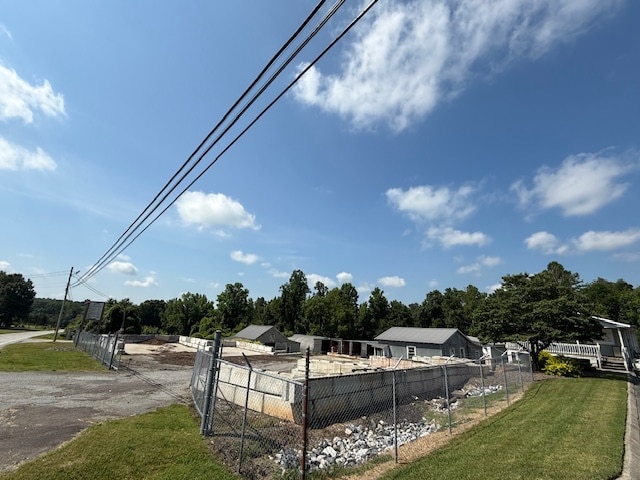
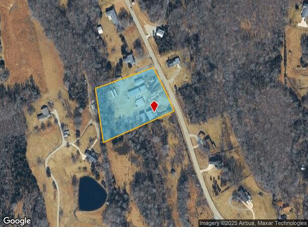
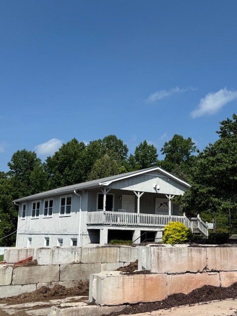
2217 Chestnut Street Ext, High Point, NC 27262
Current Lease Availabilities
NEARBY LISTINGS FOR SALE OR LEASE
Property Detail
2217 Chestnut Street Ext
16-302-0-000-0001-0-0-0
Fairgrove Forest
Officebuilding
L1 BK2196-745 CHESTNUT ST E
X
Davidson
3710688000J
North Carolina
2025
3.14 AC
2025
North Davidson County
060602
Greensboro/Winston-Salem
2,425 SF
Winston-Salem, NC
DEMOGRAPHICS near 2217 Chestnut Street Ext
1 Mile
3 Mile
5 Mile
2024 Total Population
1,126
22,294
85,196
2029 Population
1,234
23,893
91,678
Pop Growth 2024-2029
+ 9.59%
+ 7.17%
+ 7.61%
Average Age
43
41
39
2024 Total Households
432
8,764
32,841
HH Growth 2024-2029
+ 9.72%
+ 7.39%
+ 8.05%
Median Household Inc
$117,499
$77,083
$56,287
Avg Household Size
2.60
2.50
2.40
2024 Avg HH Vehicles
2.00
2.00
2.00
Median Home Value
$352,027
$278,562
$219,291
Median Year Built
1992
1980
1975
Nearby Places
Map Layers
Map Styles
 Street
 Aerial
- Restaurants
- Banks
- Shops
- Fitness
- Groceries
PUBLIC TRANSPORTATION
COMMUTER RAIL
High Point Station (Piedmont - North Carolina by Train (NC Train))
DRIVE
WALK
Distance
High Point Station (Piedmont - North Carolina by Train (NC Train))
11 min
4.0 mi
AIRPORT
Piedmont Triad International
DRIVE
WALK
Distance
Piedmont Triad International
32 min
15.1 mi
Freight Ports
Port of Wilmington
DRIVE
WALK
Distance
Port of Wilmington
263 min
216.9 mi
Nearby Properties
Address
Land Use
TOTAL SIZE
Lot Size
Zoning
Address
Land Use
TOTAL SIZE
Lot Size
Zoning
706,686 SF
39.02 AC
R-5
Address
Land Use
TOTAL SIZE
Lot Size
Zoning
104,686 SF
12.97 AC
GB
Address
Land Use
TOTAL SIZE
Lot Size
Zoning
87,485 SF
17.21 AC
R-3
Address
Land Use
TOTAL SIZE
Lot Size
Zoning
244,197 SF
14.76 AC
RM-26
Address
Land Use
TOTAL SIZE
Lot Size
Zoning
105,676 SF
24.20 AC
R-5
Address
Land Use
TOTAL SIZE
Lot Size
Zoning
85,233 SF
4.56 AC
CU-PDM
Address
Land Use
TOTAL SIZE
Lot Size
Zoning
85,233 SF
4.36 AC
CU-PDM
Address
Land Use
TOTAL SIZE
Lot Size
Zoning
69,113 SF
7.87 AC
CU-PDM
Address
Land Use
TOTAL SIZE
Lot Size
Zoning
101,797 SF
11.15 AC
PD-P
Address
Land Use
TOTAL SIZE
Lot Size
Zoning
111,312 SF
7.98 AC
RM-26
Address
Land Use
TOTAL SIZE
Lot Size
Zoning
62,012 SF
6.09 AC
CU-PDM
Address
Land Use
TOTAL SIZE
Lot Size
Zoning
28,210 SF
49.32 AC
RS
Address
Land Use
TOTAL SIZE
Lot Size
Zoning
7,480 SF
18.55 AC
RA3
Address
Land Use
TOTAL SIZE
Lot Size
Zoning
62,811 SF
13.73 AC
R-5
Address
Land Use
TOTAL SIZE
Lot Size
Zoning
121,473 SF
32.77 AC
RM-16
Address
Land Use
TOTAL SIZE
Lot Size
Zoning
108,429 SF
14.43 AC
RC
Address
Land Use
TOTAL SIZE
Lot Size
Zoning
57,885 SF
24.14 AC
RA3
Address
Land Use
TOTAL SIZE
Lot Size
Zoning
43,000 SF
15.06 AC
HI
Address
Land Use
TOTAL SIZE
Lot Size
Zoning
303,233 SF
7.11 AC
HI
Address
Land Use
TOTAL SIZE
Lot Size
Zoning
28,366 SF
5.77 AC
RM16
Address
Land Use
TOTAL SIZE
Lot Size
Zoning
35,132 SF
14.36 AC
R10
Address
Land Use
TOTAL SIZE
Lot Size
Zoning
217,856 SF
8.86 AC
HI
Address
Land Use
TOTAL SIZE
Lot Size
Zoning
8,922 SF
4.14 AC
LB
Address
Land Use
TOTAL SIZE
Lot Size
Zoning
2,060 SF
10.95 AC
RM16
Address
Land Use
TOTAL SIZE
Lot Size
Zoning
40,702 SF
6.14 AC
R-3
Address
Land Use
TOTAL SIZE
Lot Size
Zoning
83,695 SF
7.16 AC
RM-16
Address
Land Use
TOTAL SIZE
Lot Size
Zoning
176,908 SF
10.28 AC
CU PDM
Address
Land Use
TOTAL SIZE
Lot Size
Zoning
5,000 SF
176.71 AC
RS
Address
Land Use
TOTAL SIZE
Lot Size
Zoning
85,973 SF
7.71 AC
C2
Address
Land Use
TOTAL SIZE
Lot Size
Zoning
94,575 SF
5.48 AC
GB
The World's #1 Commercial Real Estate Marketplace
Connect with us
© 2026 CoStar Group
The information above has been obtained from sources believed reliable. While we do not doubt its accuracy we have not verified it and make no guarantee, warranty or representation about it. It is your responsibility to independently confirm its accuracy and completeness. Any projections, opinions, assumptions, or estimates used are for example only and do not represent the current or future performance of the property. The value of this transaction to you depends on tax and other factors which should be evaluated by your tax, financial, and legal advisors. You and your advisors should conduct a careful, independent investigation of the property to determine to your satisfaction the suitability of the property for your needs.