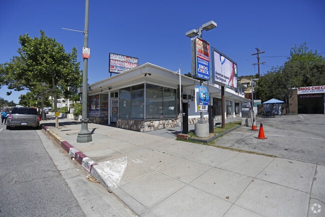
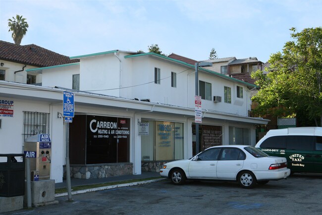
Property Record
2219 Colorado Blvd, Los Angeles, CA 90041

NEARBY LISTINGS FOR SALE OR LEASE
-
-
-
-
-
-
-
No Photo
-
-
-
-
-
-
-
-
-
-
-
-
-
-
View all Los Angeles listings for sale on LoopNet.com
Property Detail
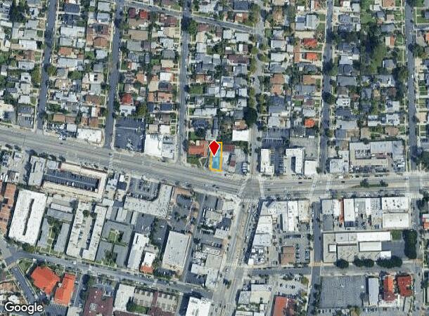
2219 Colorado Blvd
Los Angeles-Long Beach-Glendale, CA
Eagle Rock Central Tract
5671-013-003
EAGLE ROCK CENTRAL TRACT LOT 4
Retailwithmorethanonenonretailuse
Los Angeles
X
California
06037C1375F
4
2024
0.13 AC
2025
Glendale
181000
Los Angeles
4,750 SF
DEMOGRAPHICS near 2219 Colorado Blvd
1 Mile
3 Mile
5 Mile
2024 Total Population
21,880
228,677
548,321
2029 Population
21,189
220,558
529,658
Pop Growth 2024-2029
(3.16%)
(3.55%)
(3.40%)
Average Age
42
42
41
2024 Total Households
7,830
86,434
210,321
HH Growth 2024-2029
(3.42%)
(3.81%)
(3.62%)
Median Household Inc
$103,085
$82,510
$87,373
Avg Household Size
2.60
2.50
2.50
2024 Avg HH Vehicles
2.00
2.00
2.00
Median Home Value
$989,767
$925,106
$946,811
Median Year Built
1949
1960
1957
Nearby Places
Map Layers
Map Styles
 Street
 Aerial
- Restaurants
- Banks
- Shops
- Fitness
- Groceries
PUBLIC TRANSPORTATION
COMMUTER RAIL
Glendale (Antelope Valley Line - Southern California Regional Rail Authority (Metrolink), Ventura County Line - Southern California Regional Rail Authority (Metrolink))
DRIVE
WALK
Distance
Glendale (Antelope Valley Line - Southern California Regional Rail Authority (Metrolink), Ventura County Line - Southern California Regional Rail Authority (Metrolink))
11 min
4.6 mi
Union Station (91 Line - Southern California Regional Rail Authority (Metrolink), Antelope Valley Line - Southern California Regional Rail Authority (Metrolink), Orange County Line - Southern California Regional Rail Authority (Metrolink), Riverside Line - Southern California Regional Rail Authority (Metrolink), San Bernardino Line - Southern California Regional Rail Authority (Metrolink), Ventura County Line - Southern California Regional Rail Authority (Metrolink))
DRIVE
WALK
Distance
Union Station (91 Line - Southern California Regional Rail Authority (Metrolink), Antelope Valley Line - Southern California Regional Rail Authority (Metrolink), Orange County Line - Southern California Regional Rail Authority (Metrolink), Riverside Line - Southern California Regional Rail Authority (Metrolink), San Bernardino Line - Southern California Regional Rail Authority (Metrolink), Ventura County Line - Southern California Regional Rail Authority (Metrolink))
17 min
9.3 mi
AIRPORT
Bob Hope
DRIVE
WALK
Distance
Bob Hope
20 min
12.0 mi
Los Angeles International
DRIVE
WALK
Distance
Los Angeles International
34 min
26.7 mi
Long Beach (Daugherty Field)
DRIVE
WALK
Distance
Long Beach (Daugherty Field)
37 min
31.2 mi
SALE & LEASE HISTORY
LISTING DATE
SALE/LEASE

Oct 18, 2018
For Sale
Apr 05, 2018
For Sale
Nearby Properties
Address
Land Use
TOTAL SIZE
Lot Size
Zoning
Address
Land Use
TOTAL SIZE
Lot Size
Zoning
272,288 SF
24.26 AC
GLC3-C2-R4
Address
Land Use
TOTAL SIZE
Lot Size
Zoning
590,292 SF
8.21 AC
GLC3*
Address
Land Use
TOTAL SIZE
Lot Size
Zoning
477,885 SF
2.52 AC
GLC3*
Address
Land Use
TOTAL SIZE
Lot Size
Zoning
920,082 SF
2.51 AC
GLC2-R4*
Address
Land Use
TOTAL SIZE
Lot Size
Zoning
251,317 SF
114.56 AC
LAR1
Address
Land Use
TOTAL SIZE
Lot Size
Zoning
985,517 SF
4.08 AC
GLC3
Address
Land Use
TOTAL SIZE
Lot Size
Zoning
349,519 SF
2.16 AC
GLM1*
Address
Land Use
TOTAL SIZE
Lot Size
Zoning
245,031 SF
2.21 AC
GLM2
Address
Land Use
TOTAL SIZE
Lot Size
Zoning
235,936 SF
1.58 AC
GLC2*
Address
Land Use
TOTAL SIZE
Lot Size
Zoning
457,694 SF
1.42 AC
GLC3*
Address
Land Use
TOTAL SIZE
Lot Size
Zoning
265,301 SF
0.17 AC
GLC3*
Address
Land Use
TOTAL SIZE
Lot Size
Zoning
122,988 SF
3.32 AC
GLC3*
Address
Land Use
TOTAL SIZE
Lot Size
Zoning
766,497 SF
2.10 AC
GLC2*
Address
Land Use
TOTAL SIZE
Lot Size
Zoning
220,624 SF
1.50 AC
GLC3-C2*
Address
Land Use
TOTAL SIZE
Lot Size
Zoning
638,414 SF
2.53 AC
GLC3-C2*
Address
Land Use
TOTAL SIZE
Lot Size
Zoning
214,087 SF
1.65 AC
GLC3*
Address
Land Use
TOTAL SIZE
Lot Size
Zoning
223,599 SF
1.43 AC
GLC3*
Address
Land Use
TOTAL SIZE
Lot Size
Zoning
189,663 SF
1.36 AC
GLC2*
Address
Land Use
TOTAL SIZE
Lot Size
Zoning
779,800 SF
5.39 AC
GLC2-C3*
Address
Land Use
TOTAL SIZE
Lot Size
Zoning
212,943 SF
1.41 AC
GLC3-R4*
Address
Land Use
TOTAL SIZE
Lot Size
Zoning
280,778 SF
2.30 AC
GLC3*
Address
Land Use
TOTAL SIZE
Lot Size
Zoning
302,119 SF
1.41 AC
GLC2
Address
Land Use
TOTAL SIZE
Lot Size
Zoning
53,760 SF
4.60 AC
LAM1
Address
Land Use
TOTAL SIZE
Lot Size
Zoning
260,091 SF
1.02 AC
GLC2*
Address
Land Use
TOTAL SIZE
Lot Size
Zoning
284,476 SF
1.76 AC
Address
Land Use
TOTAL SIZE
Lot Size
Zoning
178,932 SF
0.88 AC
GLC3*
Address
Land Use
TOTAL SIZE
Lot Size
Zoning
1,119,154 SF
LAC4
Address
Land Use
TOTAL SIZE
Lot Size
Zoning
58,941 SF
1.35 AC
GLC3*
Address
Land Use
TOTAL SIZE
Lot Size
Zoning
145,740 SF
0.76 AC
GLC3YY
Address
Land Use
TOTAL SIZE
Lot Size
Zoning
329,802 SF
1.05 AC
GLC3*
The World's #1 Commercial Real Estate Marketplace
Connect with us
© 2025 CoStar Group
The information above has been obtained from sources believed reliable. While we do not doubt its accuracy we have not verified it and make no guarantee, warranty or representation about it. It is your responsibility to independently confirm its accuracy and completeness. Any projections, opinions, assumptions, or estimates used are for example only and do not represent the current or future performance of the property. The value of this transaction to you depends on tax and other factors which should be evaluated by your tax, financial, and legal advisors. You and your advisors should conduct a careful, independent investigation of the property to determine to your satisfaction the suitability of the property for your needs.