Property Record
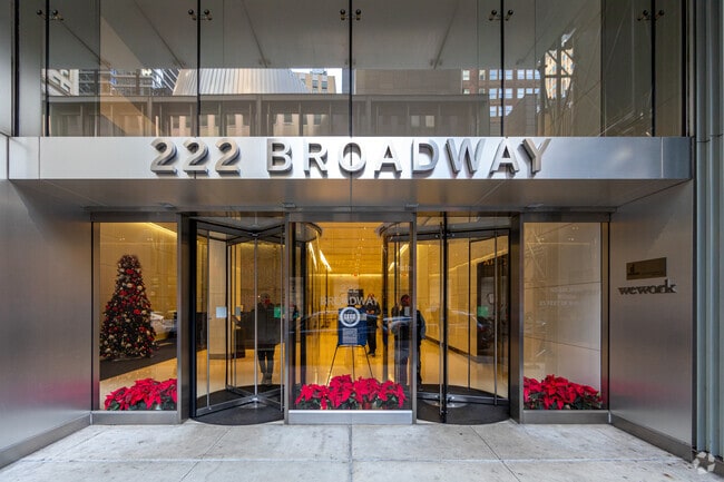
222 Broadway, New York, NY 10038


NEARBY LISTINGS FOR SALE OR LEASE
Property Detail
222 Broadway
0089-0012
Manhattan
Officebuilding
New York
X
12
3604970184F
0.77 AC
2024
Insurance District
2025
New York City
001501
New York-Jersey City-White Plains, NY-NJ
756,138 SF
DEMOGRAPHICS near 222 Broadway
1 Mile
3 Mile
5 Mile
2024 Total Population
117,247
980,122
2,388,876
2029 Population
108,482
930,554
2,260,852
Pop Growth 2024-2029
(7.48%)
(5.06%)
(5.36%)
Average Age
39
38
38
2024 Total Households
53,801
461,587
1,062,109
HH Growth 2024-2029
(7.70%)
(5.45%)
(5.72%)
Median Household Inc
$127,880
$112,474
$96,343
Avg Household Size
2.00
2.00
2.10
2024 Avg HH Vehicles
.00
.00
.00
Median Home Value
$1,060,995
$953,495
$924,728
Median Year Built
1958
1957
1954
Nearby Places
Map Layers
Map Styles
 Street
 Aerial
- Restaurants
- Banks
- Shops
- Fitness
- Groceries
PUBLIC TRANSPORTATION
TRANSIT/SUBWAY
Broadway-Nassau Street (A - New York MTA Subway (The Subway), C - New York MTA Subway (The Subway))
DRIVE
WALK
Distance
Broadway-Nassau Street (A - New York MTA Subway (The Subway), C - New York MTA Subway (The Subway))
1 min
1 min
0.1 mi
Fulton Street (4,5 Line) (4 - New York MTA Subway (The Subway), 5 - New York MTA Subway (The Subway))
DRIVE
WALK
Distance
Fulton Street (4,5 Line) (4 - New York MTA Subway (The Subway), 5 - New York MTA Subway (The Subway))
0 min
1 min
0.1 mi
Fulton Street (J,M,Z Line) (J - New York MTA Subway (The Subway), M - New York MTA Subway (The Subway), Z - New York MTA Subway (The Subway))
DRIVE
WALK
Distance
Fulton Street (J,M,Z Line) (J - New York MTA Subway (The Subway), M - New York MTA Subway (The Subway), Z - New York MTA Subway (The Subway))
1 min
1 min
0.1 mi
World Trade Center (E - New York MTA Subway (The Subway))
DRIVE
WALK
Distance
World Trade Center (E - New York MTA Subway (The Subway))
0 min
2 min
0.1 mi
Cortlandt St (Broadway Local - N - MTA New York City Transit, Broadway Local - R - MTA New York City Transit, Broadway Local - W - MTA New York City Transit)
DRIVE
WALK
Distance
Cortlandt St (Broadway Local - N - MTA New York City Transit, Broadway Local - R - MTA New York City Transit, Broadway Local - W - MTA New York City Transit)
0 min
3 min
0.2 mi
COMMUTER RAIL
Christopher St (Hoboken-33rd Street - Port Authority Trans-Hudson (PATH), Journal Square-33rd Street - Port Authority Trans-Hudson (PATH))
DRIVE
WALK
Distance
Christopher St (Hoboken-33rd Street - Port Authority Trans-Hudson (PATH), Journal Square-33rd Street - Port Authority Trans-Hudson (PATH))
6 min
1.7 mi
Exchange Place (Hoboken-World Trade Center - Port Authority Trans-Hudson (PATH), Newark Penn Station-World Trade Center - Port Authority Trans-Hudson (PATH))
DRIVE
WALK
Distance
Exchange Place (Hoboken-World Trade Center - Port Authority Trans-Hudson (PATH), Newark Penn Station-World Trade Center - Port Authority Trans-Hudson (PATH))
12 min
4.5 mi
AIRPORT
LaGuardia
DRIVE
WALK
Distance
LaGuardia
22 min
11.5 mi
Newark Liberty International
DRIVE
WALK
Distance
Newark Liberty International
20 min
12.7 mi
John F Kennedy International
DRIVE
WALK
Distance
John F Kennedy International
32 min
19.7 mi
Freight Ports
NY - Red Hook Container Terminal
DRIVE
WALK
Distance
NY - Red Hook Container Terminal
8 min
3.4 mi
SALE & LEASE HISTORY
LISTING DATE
SALE/LEASE

Sep 24, 2016
For Lease
Oct 16, 2019
For Lease
Oct 02, 2023
For Lease
May 26, 2021
For Lease
May 16, 2017
For Lease
Mar 06, 2024
For Lease
Jan 08, 2020
For Lease
Aug 09, 2018
For Lease
Apr 27, 2020
For Lease
Apr 09, 2019
For Lease
Nearby Properties
Address
Land Use
TOTAL SIZE
Lot Size
Zoning
Address
Land Use
TOTAL SIZE
Lot Size
Zoning
8,462,176 SF
61.41 AC
R7-2
Address
Land Use
TOTAL SIZE
Lot Size
Zoning
1,445,092 SF
3.10 AC
C6-4
Address
Land Use
TOTAL SIZE
Lot Size
Zoning
2,161,994 SF
3.79 AC
M1-5
Address
Land Use
TOTAL SIZE
Lot Size
Zoning
2,354,289 SF
3.96 AC
C6-4
Address
Land Use
TOTAL SIZE
Lot Size
Zoning
2,812,739 SF
2.10 AC
C5-3
Address
Land Use
TOTAL SIZE
Lot Size
Zoning
1,048,620 SF
5.67 AC
C6-4
Address
Land Use
TOTAL SIZE
Lot Size
Zoning
1,946,157 SF
1.49 AC
C6-4
Address
Land Use
TOTAL SIZE
Lot Size
Zoning
2,535,958 SF
2.94 AC
C6-4
Address
Land Use
TOTAL SIZE
Lot Size
Zoning
2.38 AC
Address
Land Use
TOTAL SIZE
Lot Size
Zoning
1,751,641 SF
1.84 AC
C6-4
Address
Land Use
TOTAL SIZE
Lot Size
Zoning
6,877 SF
27.74 AC
UD
Address
Land Use
TOTAL SIZE
Lot Size
Zoning
1,805,894 SF
1.42 AC
C6-4
Address
Land Use
TOTAL SIZE
Lot Size
Zoning
1.75 AC
Address
Land Use
TOTAL SIZE
Lot Size
Zoning
2,157,862 SF
2.23 AC
BPC
Address
Land Use
TOTAL SIZE
Lot Size
Zoning
1,009,855 SF
4.90 AC
C6-3
Address
Land Use
TOTAL SIZE
Lot Size
Zoning
2,255,659 SF
4.58 AC
BPC
Address
Land Use
TOTAL SIZE
Lot Size
Zoning
2,124,441 SF
17.29 AC
R8
Address
Land Use
TOTAL SIZE
Lot Size
Zoning
Address
Land Use
TOTAL SIZE
Lot Size
Zoning
1,009,855 SF
3.25 AC
C6-3
Address
Land Use
TOTAL SIZE
Lot Size
Zoning
6.42 AC
Address
Land Use
TOTAL SIZE
Lot Size
Zoning
2,233,692 SF
1.90 AC
BPC
Address
Land Use
TOTAL SIZE
Lot Size
Zoning
1,233,394 SF
1.78 AC
C5-3
Address
Land Use
TOTAL SIZE
Lot Size
Zoning
2.21 AC
Address
Land Use
TOTAL SIZE
Lot Size
Zoning
1,104,505 SF
2.32 AC
C4-7
Address
Land Use
TOTAL SIZE
Lot Size
Zoning
1,560,607 SF
2.69 AC
C6-6
Address
Land Use
TOTAL SIZE
Lot Size
Zoning
1,636,000 SF
1.09 AC
C6-4
Address
Land Use
TOTAL SIZE
Lot Size
Zoning
1,178,655 SF
4.57 AC
Address
Land Use
TOTAL SIZE
Lot Size
Zoning
1,281,169 SF
C6-4
Address
Land Use
TOTAL SIZE
Lot Size
Zoning
832,321 SF
4.57 AC
Address
Land Use
TOTAL SIZE
Lot Size
Zoning
1,909,502 SF
2.37 AC
BPC
The World's #1 Commercial Real Estate Marketplace
Connect with us
© 2025 CoStar Group
The information above has been obtained from sources believed reliable. While we do not doubt its accuracy we have not verified it and make no guarantee, warranty or representation about it. It is your responsibility to independently confirm its accuracy and completeness. Any projections, opinions, assumptions, or estimates used are for example only and do not represent the current or future performance of the property. The value of this transaction to you depends on tax and other factors which should be evaluated by your tax, financial, and legal advisors. You and your advisors should conduct a careful, independent investigation of the property to determine to your satisfaction the suitability of the property for your needs.